 |
|
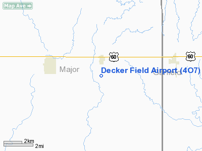
Location & QuickFacts
| FAA Information Effective: | 2008-09-25 |
| Airport Identifier: | 4O7 |
| Airport Status: | Operational |
| Longitude/Latitude: | 098-10-42.4000W/36-22-19.4000N
-98.178444/36.372056 (Estimated) |
| Elevation: | 1330 ft / 405.38 m (Estimated) |
| Land: | 240 acres |
| From nearest city: | 1 nautical miles S of Meno, OK |
| Location: | Major County, OK |
| Magnetic Variation: | 07E (1985) |
Owner & Manager
| Ownership: | Privately owned |
| Owner: | Ronnie L Decker |
| Address: | Rt 2 Box 97
Meno, OK 73760 |
| Phone number: | 580-776-2544 |
| Manager: | Ronnie L Decker |
| Address: | Rt 2 Box 97
Meno, OK 73760 |
| Phone number: | 580-776-2544 |
Airport Operations and Facilities
| Airport Use: | Open to public |
| Wind indicator: | Yes |
| Segmented Circle: | No |
| Control Tower: | No |
| Landing fee charge: | No |
| Sectional chart: | Wichita |
| Region: | ASW - Southwest |
| Boundary ARTCC: | ZKC - Kansas City |
| Tie-in FSS: | MLC - Mc Alester |
| FSS on Airport: | No |
| FSS Toll Free: | 1-800-WX-BRIEF |
| NOTAMs Facility: | MLC (NOTAM-d service avaliable) |
Airport Communications
Airport Services
| Airframe Repair: | MAJOR |
| Power Plant Repair: | MAJOR |
Runway Information
Runway 03/21
| Dimension: | 2215 x 75 ft / 675.1 x 22.9 m |
| Surface: | TURF, Fair Condition |
| |
Runway 03 |
Runway 21 |
| Traffic Pattern: | Left | Left |
| Obstruction: | , 50:1 slope to clear | 15 ft road, 265.0 ft from runway, 17:1 slope to clear |
|
Radio Navigation Aids
| ID |
Type |
Name |
Ch |
Freq |
Var |
Dist |
| FAU | NDB | Fairview | | 246.00 | 07E | 15.4 nm |
| JWG | NDB | Watonga | | 359.00 | 07E | 32.9 nm |
| AVK | NDB | Alva | | 203.00 | 08E | 34.1 nm |
| LCY | NDB | Logan County | | 326.00 | 07E | 48.7 nm |
| MDF | NDB | Mooreland/dcmsnd | | 284.00 | 08E | 49.5 nm |
| ODG | VOR/DME | Woodring | 027X | 109.00 | 08E | 18.9 nm |
| END | VORTAC | Vance | 101X | 115.40 | 09E | 12.7 nm |
| IFI | VORTAC | Kingfisher | 094X | 114.70 | 09E | 35.1 nm |
| ANY | VORTAC | Anthony | 076X | 112.90 | 07E | 47.3 nm |
Remarks
- RY 21 HAS 50 FT PLINE 900 FT FM THR.
Images and information placed above are from
http://www.airport-data.com/airport/4O7/
We thank them for the data!
| General Info
|
| Country |
United States
|
| State |
OKLAHOMA
|
| FAA ID |
4O7
|
| Latitude |
36-22-14.121N
|
| Longitude |
098-10-43.241W
|
| Elevation |
1330 feet
|
| Near City |
MENO
|
We don't guarantee the information is fresh and accurate. The data may
be wrong or outdated.
For more up-to-date information please refer to other sources.
|
|


