 |
|
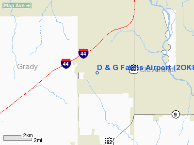
Location & QuickFacts
| FAA Information Effective: | 2008-09-25 |
| Airport Identifier: | 2OK8 |
| Airport Status: | Operational |
| Longitude/Latitude: | 097-38-46.1390W/35-13-30.2320N
-97.646150/35.225064 (Estimated) |
| Elevation: | 1300 ft / 396.24 m (Estimated) |
| Land: | 0 acres |
| From nearest city: | 3 nautical miles SW of Newcastle, OK |
| Location: | Mc Clain County, OK |
| Magnetic Variation: | 07E (1985) |
Owner & Manager
| Ownership: | Privately owned |
| Owner: | Roy A. Dunning |
| Address: | 2838 Sw 16th
Newcastle, OK 73065 |
| Phone number: | 405-387-4628 |
| Manager: | Roy A. Dunning |
| Address: | 2838 Sw 16th
Newcastle, OK 73065 |
| Phone number: | 405-387-4628 |
Airport Operations and Facilities
| Airport Use: | Private |
| Wind indicator: | Yes |
| Segmented Circle: | No |
| Control Tower: | No |
| Landing fee charge: | No |
| Sectional chart: | Dallas-ft Worth |
| Region: | ASW - Southwest |
| Boundary ARTCC: | ZFW - Fort Worth |
| Tie-in FSS: | MLC - Mc Alester |
| FSS on Airport: | No |
| FSS Toll Free: | 1-800-WX-BRIEF |
Airport Services
| Airframe Repair: | NONE |
| Power Plant Repair: | NONE |
Runway Information
Runway N/S
| Dimension: | 4000 x 200 ft / 1219.2 x 61.0 m |
| Surface: | TURF, |
| |
Runway N |
Runway S |
| Traffic Pattern: | Left | Left |
|
Radio Navigation Aids
| ID |
Type |
Name |
Ch |
Freq |
Var |
Dist |
| FSI | FAN MARKER | Trail | | | 09E | 45.8 nm |
| OUN | NDB | Norman | | 260.00 | 07E | 8.8 nm |
| OK | NDB | Tuloo | | 406.00 | 07E | 14.9 nm |
| OLR | NDB | Chickasha | | 290.00 | 07E | 17.6 nm |
| RQO | NDB | El Reno | | 335.00 | 07E | 23.4 nm |
| PVJ | NDB | Pauls Valley | | 384.00 | 06E | 36.9 nm |
| LCY | NDB | Logan County | | 326.00 | 07E | 39.0 nm |
| OFZ | NDB | Trail | | 388.00 | 09E | 45.8 nm |
| SRE | NDB | Seminole | | 278.00 | 06E | 47.8 nm |
| GGU | NDB | Prague | | 314.00 | 06E | 48.7 nm |
| TIK | TACAN | Tinker | 105X | | 07E | 18.2 nm |
| PWA | VOR/DME | Wiley Post | 081X | 113.40 | 08E | 18.5 nm |
| IRW | VORTAC | Will Rogers | 088X | 114.10 | 07E | 8.2 nm |
| IFI | VORTAC | Kingfisher | 094X | 114.70 | 09E | 39.0 nm |
| OKC | VOT | Oklahoma Will Rgs W | | 108.80 | | 10.4 nm |
Images and information placed above are from
http://www.airport-data.com/airport/2OK8/
We thank them for the data!
| General Info
|
| Country |
United States
|
| State |
OKLAHOMA
|
| FAA ID |
2OK8
|
| Latitude |
35-13-30.232N
|
| Longitude |
097-38-46.139W
|
| Elevation |
1300 feet
|
| Near City |
NEWCASTLE
|
We don't guarantee the information is fresh and accurate. The data may
be wrong or outdated.
For more up-to-date information please refer to other sources.
|
|


