 |
|
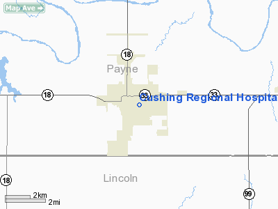
Cushing Rgnl Hospital Heliport |
Location & QuickFacts
| FAA Information Effective: | 2008-09-25 |
| Airport Identifier: | OK65 |
| Airport Status: | Operational |
| Longitude/Latitude: | 096-45-24.0900W/35-58-43.2310N
-96.756692/35.978675 (Estimated) |
| Elevation: | 914 ft / 278.59 m (Estimated) |
| Land: | 0 acres |
| From nearest city: | 0 nautical miles N of Cushing, OK |
| Location: | Payne County, OK |
| Magnetic Variation: | 05E (2000) |
Owner & Manager
| Ownership: | Privately owned |
| Owner: | Cushing Regional Hospital |
| Address: | 1027 E Cherry; Po Box 1409
Cushing, OK 74023 |
| Phone number: | 918-225-2915 |
| Manager: | Cushing Regional Hospital |
| Address: | 1027 E Cherry; Po Box 1409
Cushing, OK 74023 |
| Phone number: | 918-225-2915 |
Airport Operations and Facilities
| Airport Use: | Private
MEDICAL. |
| Wind indicator: | Yes |
| Segmented Circle: | No |
| Control Tower: | No |
| Lighting Schedule: | PHONE REQ
FOR STROBE LGT & HELIPAD LGTS CALL 918-225-2915. |
| Sectional chart: | Dallas-ft Worth |
| Region: | ASW - Southwest |
| Boundary ARTCC: | ZKC - Kansas City |
| Tie-in FSS: | MLC - Mc Alester |
| FSS on Airport: | No |
| FSS Toll Free: | 1-800-WX-BRIEF |
Runway Information
Helipad H1
| Dimension: | 20 x 20 ft / 6.1 x 6.1 m |
| Surface: | ASPH, |
| |
Runway H1 |
Runway |
| Traffic Pattern: | Left | Left |
|
Radio Navigation Aids
| ID |
Type |
Name |
Ch |
Freq |
Var |
Dist |
| CUH | NDB | Cushing | | 242.00 | 05E | 5.4 nm |
| CQB | NDB | Tilghman | | 396.00 | 06E | 15.7 nm |
| TZO | NDB | Bristow | | 251.00 | 05E | 20.5 nm |
| GGU | NDB | Prague | | 314.00 | 06E | 27.8 nm |
| OWP | NDB | William Pogue | | 362.00 | 06E | 31.5 nm |
| LCY | NDB | Logan County | | 326.00 | 07E | 33.1 nm |
| SRE | NDB | Seminole | | 278.00 | 06E | 42.7 nm |
| DW | NDB | Owaso | | 375.00 | 06E | 47.1 nm |
| TIK | TACAN | Tinker | 105X | | 07E | 44.6 nm |
| SWO | VOR/DME | Stillwater | 021X | 108.40 | 07E | 21.6 nm |
| GNP | VOR/DME | Glenpool | 043X | 110.60 | 06E | 38.5 nm |
| OKM | VOR/DME | Okmulgee | 096X | 114.90 | 08E | 46.7 nm |
| TUL | VORTAC | Tulsa | 091X | 114.40 | 08E | 48.8 nm |
| TUL | VOT | Tulsa Intl | | 109.00 | | 48.8 nm |
Remarks
- PRVDD VFR; A LGTD WIND CONE MAINTAINED; SAFETY BARRIER PLACED AROUND HELIPORT; SIGN WARNING OF HELICOPTER OPERATIONS INSTALLED; AND INGRESS/EGRESS ROUTES BE DESIGNATED TO AVOID FLYING OVER PUBLIC PARKING AREAS.
Images and information placed above are from
http://www.airport-data.com/airport/OK65/
We thank them for the data!
| General Info
|
| Country |
United States
|
| State |
OKLAHOMA
|
| FAA ID |
OK65
|
| Latitude |
35-58-43.231N
|
| Longitude |
096-45-24.090W
|
| Elevation |
914 feet
|
| Near City |
CUSHING
|
We don't guarantee the information is fresh and accurate. The data may
be wrong or outdated.
For more up-to-date information please refer to other sources.
|
|


