 |
|
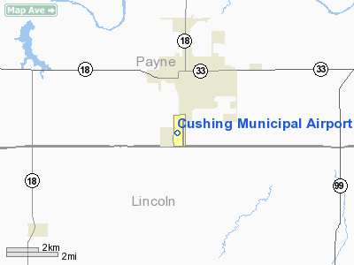
Location & QuickFacts
| FAA Information Effective: | 2008-09-25 |
| Airport Identifier: | CUH |
| Airport Status: | Operational |
| Longitude/Latitude: | 096-46-22.9900W/35-56-59.7300N
-96.773053/35.949925 (Estimated) |
| Elevation: | 916 ft / 279.20 m (Estimated) |
| Land: | 672 acres |
| From nearest city: | 2 nautical miles S of Cushing, OK |
| Location: | Payne County, OK |
| Magnetic Variation: | 05E (2005) |
Owner & Manager
| Ownership: | Publicly owned |
| Owner: | City Of Cushing |
| Address: | Po Box 311
Cushing, OK 74023 |
| Phone number: | 918-225-2394 |
| Manager: | Jim Clements |
| Address: | 11 West Airport Road
Cushing, OK 74023 |
| Phone number: | 918-225-6979 |
Airport Operations and Facilities
| Airport Use: | Open to public |
| Wind indicator: | Yes |
| Segmented Circle: | Yes |
| Control Tower: | No |
| Lighting Schedule: | DUSK-DAWN
MIRL RY 18/36 PRESET MED INTST; TO INCR INTST ACTVT - CTAF. PAPI RYS 18 & 36 OPER CONTINUOUSLY. |
| Beacon Color: | Clear-Green (lighted land airport) |
| Landing fee charge: | No |
| Sectional chart: | Dallas-ft Worth |
| Region: | ASW - Southwest |
| Boundary ARTCC: | ZKC - Kansas City |
| Tie-in FSS: | MLC - Mc Alester |
| FSS on Airport: | No |
| FSS Toll Free: | 1-800-WX-BRIEF |
| NOTAMs Facility: | CUH (NOTAM-d service avaliable) |
| Federal Agreements: | NGY3 |
Airport Communications
| CTAF: | 122.800 |
| Unicom: | 122.800 |
Airport Services
| Fuel available: | 100LLA
FUEL AVBL 24 HR WITH AUTOMATED CREDIT CARD SYSTEM. |
| Bottled Oxygen: | NONE |
| Bulk Oxygen: | NONE |
Runway Information
Runway 02/20
| Dimension: | 2860 x 80 ft / 871.7 x 24.4 m |
| Surface: | TURF, Good Condition
; RY 08/26 & RY 11/29 SOFT WHEN WET. |
| |
Runway 02 |
Runway 20 |
| Longitude: | 096-46-29.0900W | 096-46-13.0900W |
| Latitude: | 35-56-50.2300N | 35-57-14.2310N |
| Alignment: | 28 | 127 |
| Traffic Pattern: | Left | Left |
| Obstruction: | 40 ft trees, 900.0 ft from runway, 22:1 slope to clear | 35 ft pole, 1500.0 ft from runway, 150 ft left of centerline, 42:1 slope to clear |
|
Runway 08/26
| Dimension: | 2700 x 55 ft / 823.0 x 16.8 m |
| Surface: | TURF, Good Condition
; RY 08/26 & RY 11/29 SOFT WHEN WET. |
| |
Runway 08 |
Runway 26 |
| Longitude: | 096-46-54.0000W | 096-46-21.1620W |
| Latitude: | 35-57-02.2000N | 35-57-02.2000N |
| Alignment: | 90 | 127 |
| Traffic Pattern: | Left | Left |
| Obstruction: | 52 ft trees, 700.0 ft from runway, 13:1 slope to clear | , 50:1 slope to clear |
|
Runway 11/29
| Dimension: | 2500 x 75 ft / 762.0 x 22.9 m |
| Surface: | TURF, Good Condition
; RY 08/26 & RY 11/29 SOFT WHEN WET. |
| |
Runway 11 |
Runway 29 |
| Longitude: | 096-46-52.0900W | 096-46-25.5000W |
| Latitude: | 35-57-03.2290N | 35-56-49.5000N |
| Alignment: | 123 | 127 |
| Traffic Pattern: | Left | Left |
| Obstruction: | 52 ft trees, 650.0 ft from runway, 12:1 slope to clear | 60 ft tree, 1400.0 ft from runway, 23:1 slope to clear |
|
Runway 18/36
| Dimension: | 5201 x 100 ft / 1585.3 x 30.5 m |
| Surface: | CONC-TRTD, Good Condition
; RY 08/26 & RY 11/29 SOFT WHEN WET. |
| Surface Treatment: | Saw-cut or plastic Grooved |
| Pavement Class: | 4 /R/B/X/T |
| Weight Limit: | Single wheel: 30000 lbs. |
| Edge Lights: | Medium |
| |
Runway 18 |
Runway 36 |
| Longitude: | 096-46-09.4250W | 096-46-08.8950W |
| Latitude: | 35-57-26.1180N | 35-56-34.6880N |
| Elevation: | 916.00 ft | 879.00 ft |
| Alignment: | 127 | 127 |
| Traffic Pattern: | Left | Left |
| Markings: | Non-precision instrument, Fair Condition | Non-precision instrument, Fair Condition |
| VASI: | 4-light PAPI on left side | 4-light PAPI on left side |
| Obstruction: | 45 ft trees, 1117.0 ft from runway, 50 ft right of centerline, 20:1 slope to clear | 32 ft trees, 1150.0 ft from runway, 29:1 slope to clear
APCH SLOPE 16:1 FM DSPLCD THLD. |
| Decleard distances: | Take off run available 5201.00 ft
Take off distance available 5201.00 ft
Actual stop distance available 4986.00 ft
Landing distance available 4986.00 ft
| Take off run available 5201.00 ft
Take off distance available 5201.00 ft
Actual stop distance available 5201.00 ft
Landing distance available 4986.00 ft
|
|
Radio Navigation Aids
| ID |
Type |
Name |
Ch |
Freq |
Var |
Dist |
| CUH | NDB | Cushing | | 242.00 | 05E | 3.6 nm |
| CQB | NDB | Tilghman | | 396.00 | 06E | 13.9 nm |
| TZO | NDB | Bristow | | 251.00 | 05E | 20.1 nm |
| GGU | NDB | Prague | | 314.00 | 06E | 26.2 nm |
| LCY | NDB | Logan County | | 326.00 | 07E | 31.9 nm |
| OWP | NDB | William Pogue | | 362.00 | 06E | 32.9 nm |
| SRE | NDB | Seminole | | 278.00 | 06E | 41.0 nm |
| DW | NDB | Owaso | | 375.00 | 06E | 48.6 nm |
| HET | NDB | Henryetta | | 267.00 | 04E | 49.5 nm |
| OK | NDB | Tuloo | | 406.00 | 07E | 49.8 nm |
| TIK | TACAN | Tinker | 105X | | 07E | 42.8 nm |
| SWO | VOR/DME | Stillwater | 021X | 108.40 | 07E | 22.3 nm |
| GNP | VOR/DME | Glenpool | 043X | 110.60 | 06E | 39.2 nm |
| OKM | VOR/DME | Okmulgee | 096X | 114.90 | 08E | 46.8 nm |
| PWA | VOR/DME | Wiley Post | 081X | 113.40 | 08E | 49.5 nm |
Remarks
Images and information placed above are from
http://www.airport-data.com/airport/CUH/
We thank them for the data!
| General Info
|
| Country |
United States
|
| State |
OKLAHOMA
|
| FAA ID |
CUH
|
| Latitude |
35-56-59.730N
|
| Longitude |
096-46-22.990W
|
| Elevation |
914 feet
|
| Near City |
CUSHING
|
We don't guarantee the information is fresh and accurate. The data may
be wrong or outdated.
For more up-to-date information please refer to other sources.
|
|


