 |
|
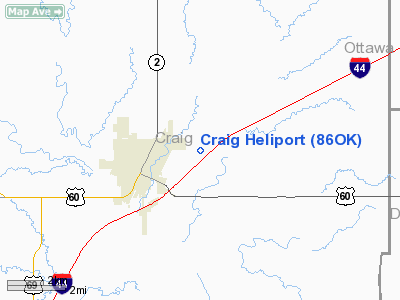
Location & QuickFacts
| FAA Information Effective: | 2008-09-25 |
| Airport Identifier: | 86OK |
| Airport Status: | Operational |
| Longitude/Latitude: | 095-07-00.8780W/36-39-00.2920N
-95.116911/36.650081 (Estimated) |
| Elevation: | 700 ft / 213.36 m (Estimated) |
| Land: | 0 acres |
| From nearest city: | 0 nautical miles N of Vinita, OK |
| Location: | Craig County, OK |
| Magnetic Variation: | 06E (1985) |
Owner & Manager
| Ownership: | Publicly owned |
| Owner: | Craig General Hospital |
| Address: | 735 N. Foreman
Vinita, OK 74301 |
| Phone number: | 918-256-7551 |
| Manager: | Terry Shambles |
| Address: |
|
| Phone number: | 918-256-0252 |
Airport Operations and Facilities
| Airport Use: | Private
MEDICAL |
| Segmented Circle: | No |
| Control Tower: | No |
| Sectional chart: | Kansas City |
| Region: | ASW - Southwest |
| Boundary ARTCC: | ZKC - Kansas City |
| Tie-in FSS: | MLC - Mc Alester |
| FSS Toll Free: | 1-800-WX-BRIEF |
Runway Information
Helipad H1
| Dimension: | 60 x 60 ft / 18.3 x 18.3 m |
| Surface: | TURF, |
| |
Runway H1 |
Runway |
| Traffic Pattern: | Left | Left |
|
Radio Navigation Aids
| ID |
Type |
Name |
Ch |
Freq |
Var |
Dist |
| CFV | NDB | Coffeyville | | 212.00 | 05E | 34.5 nm |
| SLG | NDB | Siloam Springs | | 284.00 | 04E | 41.1 nm |
| DW | NDB | Owaso | | 375.00 | 06E | 42.0 nm |
| TQH | NDB | Tahlequah | | 215.00 | 05E | 43.8 nm |
| PPF | NDB | Parsons | | 258.00 | 06E | 45.4 nm |
| EOS | VOR/DME | Neosho | 120X | 117.30 | 07E | 34.8 nm |
| BVO | VOR/DME | Bartlesville | 126X | 117.90 | 08E | 44.8 nm |
| OSW | VORTAC | Oswego | 123X | 117.60 | 08E | 30.8 nm |
| TUL | VORTAC | Tulsa | 091X | 114.40 | 08E | 42.4 nm |
| TUL | VOT | Tulsa Intl | | 109.00 | | 42.4 nm |
Remarks
- PRVDD LANDING AREA IS LGTD FOR NIGHT OPERATIONS.
Images and information placed above are from
http://www.airport-data.com/airport/86OK/
We thank them for the data!
| General Info
|
| Country |
United States
|
| State |
OKLAHOMA
|
| FAA ID |
86OK
|
| Latitude |
36-39-00.292N
|
| Longitude |
095-07-00.878W
|
| Elevation |
700 feet
|
| Near City |
VINITA
|
We don't guarantee the information is fresh and accurate. The data may
be wrong or outdated.
For more up-to-date information please refer to other sources.
|
|


