 |
|
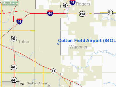
Location & QuickFacts
| FAA Information Effective: | 2008-09-25 |
| Airport Identifier: | 84OL |
| Airport Status: | Operational |
| Longitude/Latitude: | 095-45-55.9450W/36-06-37.3560N
-95.765540/36.110377 (Estimated) |
| Elevation: | 685 ft / 208.79 m (Estimated) |
| Land: | 25 acres |
| From nearest city: | 3 nautical miles NE of Broken Arrow, OK |
| Location: | Tulsa County, OK |
| Magnetic Variation: | 06E (1985) |
Owner & Manager
| Ownership: | Privately owned |
| Owner: | D.w. Cotton, Fr. |
| Address: | P.o. Box 4529
Tulsa, OK 74159 |
| Phone number: | 918-355-1555 |
| Manager: | James S. Dross |
| Address: | P.o. Box 691092
Tulsa, OK 74169 |
| Phone number: | 918-355-1555 |
Airport Operations and Facilities
| Airport Use: | Private |
| Wind indicator: | Yes |
| Segmented Circle: | No |
| Control Tower: | No |
| Landing fee charge: | No |
| Sectional chart: | Kansas City |
| Region: | ASW - Southwest |
| Traffic Pattern Alt: | 815 ft |
| Boundary ARTCC: | ZKC - Kansas City |
| Tie-in FSS: | MLC - Mc Alester |
| FSS on Airport: | No |
| FSS Toll Free: | 1-800-WX-BRIEF
FOR LOCAL CALL TO FSS DIAL 836-3505. |
Airport Services
| Fuel available: | 100LL |
| Airframe Repair: | NONE |
| Power Plant Repair: | NONE |
Runway Information
Runway 17/35
| Dimension: | 2570 x 30 ft / 783.3 x 9.1 m |
| Surface: | ASPH-TURF, Poor Condition
FIRST 500' OF EACH RWY END ASPH; REMAINING 1570' ROUGH/TREATED TURF. |
| |
Runway 17 |
Runway 35 |
| Traffic Pattern: | Right | Left |
| Obstruction: | , 50:1 slope to clear
+5' BRUSH AND +20' TREES AT THR. | 15 ft tree, 210.0 ft from runway, 90 ft left of centerline
ROAD AT 25'. |
|
Radio Navigation Aids
| ID |
Type |
Name |
Ch |
Freq |
Var |
Dist |
| DW | NDB | Owaso | | 375.00 | 06E | 13.0 nm |
| OWP | NDB | William Pogue | | 362.00 | 06E | 19.2 nm |
| TZO | NDB | Bristow | | 251.00 | 05E | 38.1 nm |
| TQH | NDB | Tahlequah | | 215.00 | 05E | 38.6 nm |
| MKO | NDB | Muskogee | | 306.00 | 06E | 38.8 nm |
| HET | NDB | Henryetta | | 267.00 | 04E | 44.1 nm |
| MEE | VOR | Davis | | 108.60 | 06E | 33.1 nm |
| GNP | VOR/DME | Glenpool | 043X | 110.60 | 06E | 15.1 nm |
| OKM | VOR/DME | Okmulgee | 096X | 114.90 | 08E | 25.6 nm |
| BVO | VOR/DME | Bartlesville | 126X | 117.90 | 08E | 45.2 nm |
| TUL | VORTAC | Tulsa | 091X | 114.40 | 08E | 5.3 nm |
| TUL | VOT | Tulsa Intl | | 109.00 | | 5.3 nm |
Images and information placed above are from
http://www.airport-data.com/airport/84OL/
We thank them for the data!
| General Info
|
| Country |
United States
|
| State |
OKLAHOMA
|
| FAA ID |
84OL
|
| Latitude |
36-06-37.356N
|
| Longitude |
095-45-55.945W
|
| Elevation |
685 feet
|
| Near City |
BROKEN ARROW
|
We don't guarantee the information is fresh and accurate. The data may
be wrong or outdated.
For more up-to-date information please refer to other sources.
|
|


