 |
|
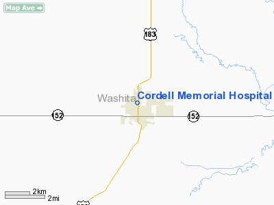
Cordell Memorial Hospital Heliport |
Location & QuickFacts
| FAA Information Effective: | 2008-09-25 |
| Airport Identifier: | 64OK |
| Airport Status: | Operational |
| Longitude/Latitude: | 098-59-18.2800W/35-18-03.1880N
-98.988411/35.300886 (Estimated) |
| Elevation: | 1564 ft / 476.71 m (Estimated) |
| Land: | 0 acres |
| From nearest city: | 0 nautical miles N of Cordell, OK |
| Location: | Washita County, OK |
| Magnetic Variation: | 08E (1985) |
Owner & Manager
| Ownership: | Publicly owned |
| Owner: | City Of Cordell |
| Address: | 101 East Main St.
Cordell, OK 73632 |
| Phone number: | 580-832-3825 |
| Manager: | Charlie Brown |
| Address: | 101 East Main St.
Cordell, OK 73632 |
| Phone number: | 580-832-3825 |
Airport Operations and Facilities
| Airport Use: | Private
MEDICAL. |
| Segmented Circle: | No |
| Control Tower: | No |
| Sectional chart: | Dallas-ft Worth |
| Region: | ASW - Southwest |
| Boundary ARTCC: | ZFW - Fort Worth |
| Tie-in FSS: | MLC - Mc Alester |
| FSS Toll Free: | 1-800-WX-BRIEF |
Runway Information
Helipad H1
| Dimension: | 20 x 20 ft / 6.1 x 6.1 m |
| Surface: | CONC, |
| |
Runway H1 |
Runway |
| Traffic Pattern: | Left | Left |
|
Radio Navigation Aids
| ID |
Type |
Name |
Ch |
Freq |
Var |
Dist |
| FSI | FAN MARKER | Trail | | | 09E | 42.5 nm |
| BZ | NDB | Fossi | | 393.00 | 08E | 13.8 nm |
| CLK | NDB | Clinton | | 320.00 | 07E | 14.6 nm |
| OJA | NDB | Weatherford | | 272.00 | 07E | 20.8 nm |
| EZY | NDB | Elk City | | 241.00 | 08E | 21.4 nm |
| OFZ | NDB | Trail | | 388.00 | 09E | 42.5 nm |
| JWG | NDB | Watonga | | 359.00 | 07E | 43.5 nm |
| RQO | NDB | El Reno | | 335.00 | 07E | 49.2 nm |
| BFV | VORTAC | Burns Flat | 037X | 110.00 | 08E | 11.4 nm |
| HBR | VORTAC | Hobart | 055X | 111.80 | 10E | 26.4 nm |
| SYO | VORTAC | Sayre | 099X | 115.20 | 10E | 31.8 nm |
| LTS | VORTAC | Altus | 035X | 109.80 | 08E | 40.8 nm |
Remarks
- PROVIDED PEDESTRIAN ACCESS TO THE AREA IS RESTRICTED.
Images and information placed above are from
http://www.airport-data.com/airport/64OK/
We thank them for the data!
| General Info
|
| Country |
United States
|
| State |
OKLAHOMA
|
| FAA ID |
64OK
|
| Latitude |
35-18-03.188N
|
| Longitude |
098-59-18.280W
|
| Elevation |
1564 feet
|
| Near City |
CORDELL
|
We don't guarantee the information is fresh and accurate. The data may
be wrong or outdated.
For more up-to-date information please refer to other sources.
|
|


