 |
|
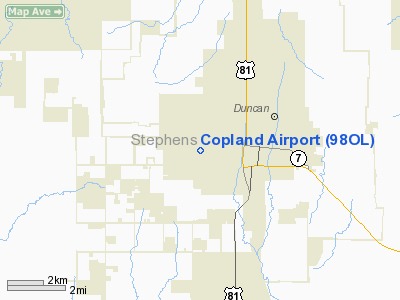
Location & QuickFacts
| FAA Information Effective: | 2008-09-25 |
| Airport Identifier: | 98OL |
| Airport Status: | Operational |
| Longitude/Latitude: | 097-59-41.1270W/34-30-00.2890N
-97.994757/34.500080 (Estimated) |
| Elevation: | 1120 ft / 341.38 m (Estimated) |
| Land: | 40 acres |
| From nearest city: | 1 nautical miles W of Duncan, OK |
| Location: | Stephens County, OK |
| Magnetic Variation: | 07E (1985) |
Owner & Manager
| Ownership: | Privately owned |
| Owner: | George V. Copland |
| Address: | 3601 W. Beech Ave.
Duncan, OK 73533 |
| Phone number: | 580-255-8349 |
| Manager: | George V. Copland |
| Address: | 3601 W. Beech Ave.
Duncan, OK 73533 |
| Phone number: | 580-255-8349
HOME PHONE. |
Airport Operations and Facilities
| Airport Use: | Private |
| Wind indicator: | Yes |
| Segmented Circle: | Yes |
| Control Tower: | No |
| Landing fee charge: | No |
| Sectional chart: | Dallas-ft Worth |
| Region: | ASW - Southwest |
| Boundary ARTCC: | ZFW - Fort Worth |
| Tie-in FSS: | MLC - Mc Alester |
| FSS on Airport: | No |
| FSS Toll Free: | 1-800-WX-BRIEF |
Airport Services
| Airframe Repair: | NONE |
| Power Plant Repair: | NONE |
Runway Information
Runway 17/35
| Dimension: | 2020 x 50 ft / 615.7 x 15.2 m |
| Surface: | TURF, Good Condition
SOFT WHEN WET. |
| |
Runway 17 |
Runway 35 |
| Traffic Pattern: | Left | Left |
| Obstruction: | 21 ft tree, 83.0 ft from runway, 65 ft right of centerline, 3:1 slope to clear | 15 ft bldg, 100.0 ft from runway, 25 ft left of centerline, 6:1 slope to clear |
|
Radio Navigation Aids
| ID |
Type |
Name |
Ch |
Freq |
Var |
Dist |
| FSI | FAN MARKER | Trail | | | 09E | 26.3 nm |
| PFL | NDB | Post | | 308.00 | 08E | 21.3 nm |
| OFZ | NDB | Trail | | 388.00 | 09E | 26.3 nm |
| OLR | NDB | Chickasha | | 290.00 | 07E | 36.3 nm |
| PVJ | NDB | Pauls Valley | | 384.00 | 06E | 40.0 nm |
| AUV | NDB | Arbuckle | | 284.00 | 07E | 48.0 nm |
| SKB | NDB | Scotland | | 344.00 | 08E | 49.2 nm |
| SHP | TACAN | Sheppard | 045X | | 10E | 39.6 nm |
| DUC | VOR/DME | Duncan | 047X | 111.00 | 09E | 8.0 nm |
| LAW | VOR/DME | Lawton | 031X | 109.40 | 09E | 20.7 nm |
| SPS | VORTAC | Wichita Falls | 074X | 112.70 | 10E | 42.8 nm |
| ADM | VORTAC | Ardmore | 114X | 116.70 | 06E | 44.5 nm |
Images and information placed above are from
http://www.airport-data.com/airport/98OL/
We thank them for the data!
| General Info
|
| Country |
United States
|
| State |
OKLAHOMA
|
| FAA ID |
98OL
|
| Latitude |
34-30-00.289N
|
| Longitude |
097-59-41.127W
|
| Elevation |
1120 feet
|
| Near City |
DUNCAN
|
We don't guarantee the information is fresh and accurate. The data may
be wrong or outdated.
For more up-to-date information please refer to other sources.
|
|


