 |
|
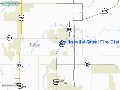
Collinsville Rural Fire District Heliport |
Location & QuickFacts
| FAA Information Effective: | 2008-09-25 |
| Airport Identifier: | OK45 |
| Airport Status: | Operational |
| Longitude/Latitude: | 095-50-24.9560W/36-21-15.3380N
-95.840266/36.354261 (Estimated) |
| Elevation: | 650 ft / 198.12 m (Estimated) |
| Land: | 0 acres |
| From nearest city: | 0 nautical miles N of Collinsville, OK |
| Location: | Tulsa County, OK |
| Magnetic Variation: | 06E (1985) |
Owner & Manager
| Ownership: | Publicly owned |
| Owner: | Collinsville Rural Fire Dist. |
| Address: | P.o. Box 293
Collinsville, OK 74021 |
| Phone number: | 918-371-4854 |
| Manager: | Collinsville Rural Fire Dist. |
| Address: | P.o. Box 293
Collinsville, OK 74021 |
| Phone number: | 918-371-4854 |
Airport Operations and Facilities
| Airport Use: | Private
MEDICAL. |
| Wind indicator: | Yes |
| Segmented Circle: | No |
| Control Tower: | No |
| Lighting Schedule: | PHONE REQ
FOR PERIMETER LGTS CALL 918-584-0471. |
| Sectional chart: | Kansas City |
| Region: | ASW - Southwest |
| Boundary ARTCC: | ZKC - Kansas City |
| Tie-in FSS: | MLC - Mc Alester |
| FSS on Airport: | No |
| FSS Toll Free: | 1-800-WX-BRIEF |
Runway Information
Helipad H1
| Dimension: | 30 x 30 ft / 9.1 x 9.1 m |
| Surface: | CONC, |
| |
Runway H1 |
Runway |
| Traffic Pattern: | Left | Left |
| Markings: | Basic, Good Condition | , |
|
Radio Navigation Aids
| ID |
Type |
Name |
Ch |
Freq |
Var |
Dist |
| DW | NDB | Owaso | | 375.00 | 06E | 3.3 nm |
| OWP | NDB | William Pogue | | 362.00 | 06E | 18.7 nm |
| TZO | NDB | Bristow | | 251.00 | 05E | 45.2 nm |
| CFV | NDB | Coffeyville | | 212.00 | 05E | 46.3 nm |
| TQH | NDB | Tahlequah | | 215.00 | 05E | 48.0 nm |
| MEE | VOR | Davis | | 108.60 | 06E | 47.5 nm |
| GNP | VOR/DME | Glenpool | 043X | 110.60 | 06E | 26.8 nm |
| BVO | VOR/DME | Bartlesville | 126X | 117.90 | 08E | 30.1 nm |
| OKM | VOR/DME | Okmulgee | 096X | 114.90 | 08E | 39.8 nm |
| TUL | VORTAC | Tulsa | 091X | 114.40 | 08E | 9.8 nm |
| TUL | VOT | Tulsa Intl | | 109.00 | | 9.8 nm |
Remarks
- PRVDD OVERHEAD TELEPHONE WIRES 75' E OF PAD BURIED; LGT POLES & WIRES APPROX 400' E OF PAD LGTD & MKD; PLINES 350' W & NW ARE LGTD & MKD; APCHS ARE CONDUCTED FM ANY DIRECTION EXCEPT 210 DEGS OR 030 DEGS; & HELIPAD CONSTRUCTION, LGTG & MKDG COMPLY WITH AC 150/5390-1B.
Images and information placed above are from
http://www.airport-data.com/airport/OK45/
We thank them for the data!
| General Info
|
| Country |
United States
|
| State |
OKLAHOMA
|
| FAA ID |
OK45
|
| Latitude |
36-21-15.338N
|
| Longitude |
095-50-24.956W
|
| Elevation |
650 feet
|
| Near City |
COLLINSVILLE
|
We don't guarantee the information is fresh and accurate. The data may
be wrong or outdated.
For more up-to-date information please refer to other sources.
|
|


