 |
|
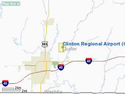
Location & QuickFacts
| FAA Information Effective: | 2008-09-25 |
| Airport Identifier: | CLK |
| Airport Status: | Operational |
| Longitude/Latitude: | 098-55-57.6760W/35-32-17.7150N
-98.932688/35.538254 (Estimated) |
| Elevation: | 1615 ft / 492.25 m (Surveyed) |
| Land: | 480 acres |
| From nearest city: | 3 nautical miles NE of Clinton, OK |
| Location: | Custer County, OK |
| Magnetic Variation: | 07E (2000) |
Owner & Manager
| Ownership: | Publicly owned |
| Owner: | City Of Clinton |
| Address: | Box 1177
Clinton, OK 73601 |
| Phone number: | 580-323-0217 |
| Manager: | Tracy Yoder |
| Address: | Rt 1 Box 3530
Clinton, OK 73601 |
| Phone number: | 580-323-5782 |
Airport Operations and Facilities
| Airport Use: | Open to public |
| Wind indicator: | Yes
TETRAHEDRON PRIMARY WIND INDICATOR. |
| Segmented Circle: | Yes |
| Control Tower: | No |
| Lighting Schedule: | DUSK-DAWN
MIRL RY 17/35 & TWY LGTS PRESET MED INTST; TO INCR INTST & ACTVT VASI RY 35 - CTAF. |
| Beacon Color: | Clear-Green (lighted land airport) |
| Landing fee charge: | No |
| Sectional chart: | Dallas-ft Worth |
| Region: | ASW - Southwest |
| Boundary ARTCC: | ZFW - Fort Worth |
| Tie-in FSS: | MLC - Mc Alester |
| FSS on Airport: | No |
| FSS Toll Free: | 1-800-WX-BRIEF |
| NOTAMs Facility: | CLK (NOTAM-d service avaliable) |
| Federal Agreements: | NGY |
Airport Communications
| CTAF: | 122.800 |
| Unicom: | 122.800 |
Airport Services
| Fuel available: | 100LL |
| Bottled Oxygen: | NONE |
| Bulk Oxygen: | NONE |
Runway Information
Runway 13/31
| Dimension: | 1430 x 245 ft / 435.9 x 74.7 m |
| Surface: | TURF, Fair Condition
RY ROUGH. |
| |
Runway 13 |
Runway 31 |
| Longitude: | 098-56-10.3000W | 098-55-58.3000W |
| Latitude: | 35-32-35.2000N | 35-32-25.2000N |
| Alignment: | 127 | 127 |
| Traffic Pattern: | Left | Left |
|
Runway 17/35
| Dimension: | 4300 x 75 ft / 1310.6 x 22.9 m |
| Surface: | ASPH, Fair Condition
RY ROUGH. |
| Pavement Class: | 3 /F/C/Y/T |
| Weight Limit: | Single wheel: 7000 lbs. |
| Edge Lights: | Medium |
| |
Runway 17 |
Runway 35 |
| Longitude: | 098-55-55.8690W | 098-55-55.1200W |
| Latitude: | 35-32-34.8650N | 35-31-52.3410N |
| Elevation: | 1604.00 ft | 1592.00 ft |
| Alignment: | 127 | 127 |
| Traffic Pattern: | Left | Left |
| Markings: | Non-precision instrument, Good Condition | Non-precision instrument, Good Condition |
| Crossing Height: | 0.00 ft | 24.00 ft |
| VASI: | | 4-box on left side |
| Visual Glide Angle: | 0.00° | 3.00° |
| Runway End Identifier: | No | No |
| Obstruction: | 20 ft tree, 600.0 ft from runway, 80 ft left of centerline, 20:1 slope to clear | , 50:1 slope to clear |
|
Radio Navigation Aids
| ID |
Type |
Name |
Ch |
Freq |
Var |
Dist |
| CLK | NDB | Clinton | | 320.00 | 07E | 0.1 nm |
| OJA | NDB | Weatherford | | 272.00 | 07E | 12.8 nm |
| BZ | NDB | Fossi | | 393.00 | 08E | 14.2 nm |
| EZY | NDB | Elk City | | 241.00 | 08E | 23.8 nm |
| JWG | NDB | Watonga | | 359.00 | 07E | 31.5 nm |
| RQO | NDB | El Reno | | 335.00 | 07E | 45.3 nm |
| BFV | VORTAC | Burns Flat | 037X | 110.00 | 08E | 22.5 nm |
| SYO | VORTAC | Sayre | 099X | 115.20 | 10E | 36.3 nm |
| HBR | VORTAC | Hobart | 055X | 111.80 | 10E | 40.9 nm |
| IFI | VORTAC | Kingfisher | 094X | 114.70 | 09E | 48.1 nm |
Remarks
Images and information placed above are from
http://www.airport-data.com/airport/CLK/
We thank them for the data!
| General Info
|
| Country |
United States
|
| State |
OKLAHOMA
|
| FAA ID |
CLK
|
| Latitude |
35-32-17.715N
|
| Longitude |
098-55-57.676W
|
| Elevation |
1615 feet
|
| Near City |
CLINTON
|
We don't guarantee the information is fresh and accurate. The data may
be wrong or outdated.
For more up-to-date information please refer to other sources.
|
|


