 |
|
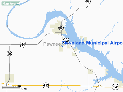
Location & QuickFacts
| FAA Information Effective: | 2008-09-25 |
| Airport Identifier: | 95F |
| Airport Status: | Operational |
| Longitude/Latitude: | 096-27-48.0600W/36-17-01.5600N
-96.463350/36.283767 (Estimated) |
| Elevation: | 912 ft / 277.98 m (Estimated) |
| Land: | 172 acres |
| From nearest city: | 2 nautical miles S of Cleveland, OK |
| Location: | Pawnee County, OK |
| Magnetic Variation: | 06E (1985) |
Owner & Manager
| Ownership: | Publicly owned |
| Owner: | City Of Cleveland |
| Address: | P. O. Drawer 190, 201 N. Broadway
Cleveland, OK 74020 |
| Phone number: | 918-358-3506 |
| Manager: | Ed Callison
CITY MANAGER |
| Address: | P. O. Drawer 190, 201 N. Broadway
Cleveland, OK 74020 |
| Phone number: | 918-358-3506 |
Airport Operations and Facilities
| Airport Use: | Open to public |
| Wind indicator: | Yes |
| Control Tower: | No |
| Lighting Schedule: | DUSK-DAWN |
| Beacon Color: | Clear-Green (lighted land airport)
ROTG BCN OTS INDEFLY. |
| Landing fee charge: | No |
| Sectional chart: | Kansas City |
| Region: | ASW - Southwest |
| Boundary ARTCC: | ZKC - Kansas City |
| Tie-in FSS: | MLC - Mc Alester |
| FSS on Airport: | No |
| FSS Toll Free: | 1-800-WX-BRIEF |
| NOTAMs Facility: | MLC (NOTAM-d service avaliable) |
| Federal Agreements: | NY1 |
Airport Communications
Airport Services
| Airframe Repair: | MINOR |
| Power Plant Repair: | MINOR |
| Bottled Oxygen: | NONE |
Runway Information
Runway 18/36
| Dimension: | 4000 x 60 ft / 1219.2 x 18.3 m |
| Surface: | ASPH, Fair Condition |
| Weight Limit: | Single wheel: 4000 lbs. |
| Edge Lights: | Medium |
| |
Runway 18 |
Runway 36 |
| Longitude: | 096-27-44.9500W | 096-27-51.1800W |
| Latitude: | 36-17-21.1700N | 36-16-41.9400N |
| Elevation: | 912.00 ft | 900.00 ft |
| Alignment: | 127 | 7 |
| Traffic Pattern: | Left | Left |
| Markings: | Basic, Good Condition | Basic, Good Condition |
| VASI: | 2-box on left side
VASI OTS INDEFLY. | 2-box on left side
VASI OTS INDEFLY. |
| Visual Glide Angle: | 2.75° | 2.75° |
| Obstruction: | 30 ft trees, 750.0 ft from runway, 18:1 slope to clear
+15 FT ROAD 10 FT FM RY THLD. | 30 ft trees, 348.0 ft from runway, 4:1 slope to clear |
|
Radio Navigation Aids
| ID |
Type |
Name |
Ch |
Freq |
Var |
Dist |
| OWP | NDB | William Pogue | | 362.00 | 06E | 16.4 nm |
| CUH | NDB | Cushing | | 242.00 | 05E | 28.1 nm |
| DW | NDB | Owaso | | 375.00 | 06E | 28.5 nm |
| TZO | NDB | Bristow | | 251.00 | 05E | 31.0 nm |
| CQB | NDB | Tilghman | | 396.00 | 06E | 37.9 nm |
| PN | NDB | Ponca | | 515.00 | 05E | 44.8 nm |
| GGU | NDB | Prague | | 314.00 | 06E | 47.8 nm |
| SWO | VOR/DME | Stillwater | 021X | 108.40 | 07E | 30.2 nm |
| GNP | VOR/DME | Glenpool | 043X | 110.60 | 06E | 32.4 nm |
| BVO | VOR/DME | Bartlesville | 126X | 117.90 | 08E | 39.5 nm |
| OKM | VOR/DME | Okmulgee | 096X | 114.90 | 08E | 45.9 nm |
| TUL | VORTAC | Tulsa | 091X | 114.40 | 08E | 33.2 nm |
| PER | VORTAC | Pioneer | 079X | 113.20 | 06E | 43.7 nm |
| TUL | VOT | Tulsa Intl | | 109.00 | | 33.2 nm |
Remarks
- GOLFERS INVOF ARPT.
- PAEW ADJ RY 18/36.
Images and information placed above are from
http://www.airport-data.com/airport/95F/
We thank them for the data!
| General Info
|
| Country |
United States
|
| State |
OKLAHOMA
|
| FAA ID |
95F
|
| Latitude |
36-17-00.251N
|
| Longitude |
096-27-51.078W
|
| Elevation |
980 feet
|
| Near City |
CLEVELAND
|
We don't guarantee the information is fresh and accurate. The data may
be wrong or outdated.
For more up-to-date information please refer to other sources.
|
|


