 |
|
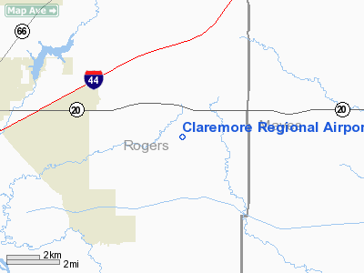
Location & QuickFacts
| FAA Information Effective: | 2008-09-25 |
| Airport Identifier: | GCM |
| Airport Status: | Operational |
| Longitude/Latitude: | 095-28-46.6000W/36-17-33.8000N
-95.479611/36.292722 (Estimated) |
| Elevation: | 733 ft / 223.42 m (Surveyed) |
| Land: | 526 acres |
| From nearest city: | 7 nautical miles E of Claremore, OK |
| Location: | Rogers County, OK |
| Magnetic Variation: | 05E (1990) |
Owner & Manager
| Ownership: | Publicly owned |
| Owner: | City Of Claremore |
| Address: | Po Box 249
Claremore, OK 74018 |
| Phone number: | 918-341-2365 |
| Manager: | Aaron Barth |
| Address: | 19502 E. Rogers Post Road
Claremore, OK 74019 |
| Phone number: | 918-343-0931 |
Airport Operations and Facilities
| Airport Use: | Open to public |
| Wind indicator: | Yes |
| Segmented Circle: | Yes |
| Control Tower: | No |
| Lighting Schedule: | DUSK-DAWN
ACTVT MIRL RY 17/35 - CTAF. |
| Beacon Color: | Clear-Green (lighted land airport) |
| Sectional chart: | Kansas City |
| Region: | ASW - Southwest |
| Boundary ARTCC: | ZKC - Kansas City |
| Tie-in FSS: | MLC - Mc Alester |
| FSS on Airport: | No |
| FSS Toll Free: | 1-800-WX-BRIEF |
| NOTAMs Facility: | GCM (NOTAM-d service avaliable) |
| Federal Agreements: | NGY |
Airport Communications
| CTAF: | 122.700 |
| Unicom: | 122.700 |
Airport Services
| Fuel available: | 100LLA
24 HR. AUTOMATIC FUEL SERVICE SYSTEM. |
| Airframe Repair: | MAJOR |
| Power Plant Repair: | MAJOR |
| Bottled Oxygen: | HIGH/LOW |
Runway Information
Runway 17/35
| Dimension: | 5200 x 75 ft / 1585.0 x 22.9 m |
| Surface: | ASPH, Fair Condition |
| Surface Treatment: | Porous Friction Course |
| Pavement Class: | 3 /F/C/Y/T |
| Weight Limit: | Single wheel: 30000 lbs.
Dual wheel: 58500 lbs.
Dual tandem wheel: 119500 lbs. |
| Edge Lights: | Medium |
| |
Runway 17 |
Runway 35 |
| Longitude: | 095-28-46.5796W | 095-28-46.7042W |
| Latitude: | 36-17-59.4661N | 36-17-08.0451N |
| Elevation: | 697.00 ft | 733.00 ft |
| Alignment: | 127 | 127 |
| Traffic Pattern: | Left | Left |
| Markings: | Non-precision instrument, Fair Condition | Non-precision instrument, Fair Condition |
| Crossing Height: | 35.00 ft | 26.00 ft |
| VASI: | 4-light PAPI on left side | 4-light PAPI on left side |
| Visual Glide Angle: | 3.00° | 3.00° |
| Runway End Identifier: | Yes | Yes |
| Obstruction: | 35 ft trees, 1080.0 ft from runway, 25:1 slope to clear | 12 ft hill, 435.0 ft from runway, 19:1 slope to clear |
|
Radio Navigation Aids
| ID |
Type |
Name |
Ch |
Freq |
Var |
Dist |
| DW | NDB | Owaso | | 375.00 | 06E | 19.2 nm |
| TQH | NDB | Tahlequah | | 215.00 | 05E | 31.8 nm |
| OWP | NDB | William Pogue | | 362.00 | 06E | 33.5 nm |
| MKO | NDB | Muskogee | | 306.00 | 06E | 43.0 nm |
| CFV | NDB | Coffeyville | | 212.00 | 05E | 48.3 nm |
| SLG | NDB | Siloam Springs | | 284.00 | 04E | 48.4 nm |
| MEE | VOR | Davis | | 108.60 | 06E | 38.2 nm |
| GNP | VOR/DME | Glenpool | 043X | 110.60 | 06E | 32.6 nm |
| OKM | VOR/DME | Okmulgee | 096X | 114.90 | 08E | 40.6 nm |
| BVO | VOR/DME | Bartlesville | 126X | 117.90 | 08E | 41.7 nm |
| TUL | VORTAC | Tulsa | 091X | 114.40 | 08E | 16.0 nm |
| TUL | VOT | Tulsa Intl | | 109.00 | | 16.0 nm |
Images and information placed above are from
http://www.airport-data.com/airport/GCM/
We thank them for the data!
| General Info
|
| Country |
United States
|
| State |
OKLAHOMA
|
| FAA ID |
GCM
|
| Latitude |
36-17-39.900N
|
| Longitude |
095-28-46.800W
|
| Elevation |
725 feet
|
| Near City |
CLAREMORE
|
We don't guarantee the information is fresh and accurate. The data may
be wrong or outdated.
For more up-to-date information please refer to other sources.
|
|


