 |
|
Location & QuickFacts
| FAA Information Effective: | 2008-09-25 |
| Airport Identifier: | 7OK7 |
| Airport Status: | Operational |
| Longitude/Latitude: | 095-57-11.9780W/36-02-34.3440N
-95.953327/36.042873 (Estimated) |
| Elevation: | 624 ft / 190.20 m (Estimated) |
| Land: | 0 acres |
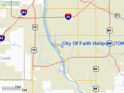
| From nearest city: | 0 nautical miles N of Tulsa, OK |
| Location: | Tulsa County, OK |
| Magnetic Variation: | 06E (1985) |
Owner & Manager
| Ownership: | Privately owned |
| Owner: | Oral Roberts University |
| Address: | 7777 South Lewis Ave
Tulsa, OK 74136 |
| Phone number: | 918-493-8097 |
| Manager: | Mike Bernard |
| Address: | 8181 South Lewis Ave.
Tulsa, OK 74136 |
| Phone number: | 918-493-8866 |
Airport Operations and Facilities
| Airport Use: | Private |
| Wind indicator: | Yes |
| Segmented Circle: | No |
| Control Tower: | No |
| Landing fee charge: | No |
| Sectional chart: | Kansas City |
| Region: | ASW - Southwest |
| Boundary ARTCC: | ZKC - Kansas City |
| Tie-in FSS: | MLC - Mc Alester |
| FSS on Airport: | No |
| FSS Toll Free: | 1-800-WX-BRIEF |
Runway Information
Helipad H1
| Dimension: | 50 x 50 ft / 15.2 x 15.2 m |
| Surface: | CONC, |
| |
Runway H1 |
Runway |
| Traffic Pattern: | Left | Left |
|
Radio Navigation Aids
| ID |
Type |
Name |
Ch |
Freq |
Var |
Dist |
| OWP | NDB | William Pogue | | 362.00 | 06E | 12.5 nm |
| DW | NDB | Owaso | | 375.00 | 06E | 16.3 nm |
| TZO | NDB | Bristow | | 251.00 | 05E | 28.2 nm |
| HET | NDB | Henryetta | | 267.00 | 04E | 38.5 nm |
| CUH | NDB | Cushing | | 242.00 | 05E | 41.0 nm |
| MKO | NDB | Muskogee | | 306.00 | 06E | 42.2 nm |
| CQB | NDB | Tilghman | | 396.00 | 06E | 46.3 nm |
| TQH | NDB | Tahlequah | | 215.00 | 05E | 46.6 nm |
| GGU | NDB | Prague | | 314.00 | 06E | 48.9 nm |
| MEE | VOR | Davis | | 108.60 | 06E | 36.5 nm |
| GNP | VOR/DME | Glenpool | 043X | 110.60 | 06E | 7.4 nm |
| OKM | VOR/DME | Okmulgee | 096X | 114.90 | 08E | 21.5 nm |
| BVO | VOR/DME | Bartlesville | 126X | 117.90 | 08E | 47.7 nm |
| TUL | VORTAC | Tulsa | 091X | 114.40 | 08E | 12.2 nm |
| TUL | VOT | Tulsa Intl | | 109.00 | | 12.2 nm |
Remarks
- NO LNDG IF TLWD CMPT EXCEEDS 9 KNOTS; NO PSNL/VEHICLES DURG LNDG/TKOF OPNS; OPNS VFR; NO NGT OPNS TIL LNDG/OBSTN LGTS INSTLD; OPNS IAW FARS/AIR TAXI CERT HOLDERS MAN; DTRMN OF WIND DRCTN/VLCTY MUST BE PRVDD; HEL REP MUST CTC TUL FAA FS ADO FOR SAFETY CHECK.
Images and information placed above are from
http://www.airport-data.com/airport/7OK7/
We thank them for the data!
| General Info
|
| Country |
United States
|
| State |
OKLAHOMA
|
| FAA ID |
7OK7
|
| Latitude |
36-02-34.344N
|
| Longitude |
095-57-11.978W
|
| Elevation |
624 feet
|
| Near City |
TULSA
|
We don't guarantee the information is fresh and accurate. The data may
be wrong or outdated.
For more up-to-date information please refer to other sources.
|
|


