 |
|
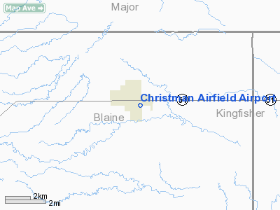
Christman Airfield Airport |
Location & QuickFacts
| FAA Information Effective: | 2008-09-25 |
| Airport Identifier: | O65 |
| Airport Status: | Operational |
| Longitude/Latitude: | 098-18-31.2570W/36-06-45.1320N
-98.308682/36.112537 (Estimated) |
| Elevation: | 1205 ft / 367.28 m (Estimated) |
| Land: | 75 acres |
| From nearest city: | 1 nautical miles SE of Okeene, OK |
| Location: | Blaine County, OK |
| Magnetic Variation: | 07E (1985) |
Owner & Manager
| Ownership: | Publicly owned |
| Owner: | City Of Okeene |
| Address: | City Hall Po Box 800
Okeene, OK 73763 |
| Phone number: | 580-822-3035 |
| Manager: | John Ramey
CITY MANAGER. |
| Address: | City Hall, Po Box 800
Okeene, OK 73763 |
| Phone number: | 580-822-3035 |
Airport Operations and Facilities
| Airport Use: | Open to public |
| Wind indicator: | Yes |
| Segmented Circle: | No |
| Control Tower: | No |
| Landing fee charge: | No |
| Sectional chart: | Wichita |
| Region: | ASW - Southwest |
| Boundary ARTCC: | ZKC - Kansas City |
| Tie-in FSS: | MLC - Mc Alester |
| FSS on Airport: | No |
| FSS Toll Free: | 1-800-WX-BRIEF |
| NOTAMs Facility: | MLC (NOTAM-d service avaliable) |
| Federal Agreements: | N1 |
Airport Communications
Airport Services
| Airframe Repair: | NONE |
| Power Plant Repair: | NONE |
| Bottled Oxygen: | NONE |
| Bulk Oxygen: | NONE |
Runway Information
Runway 17/35
| Dimension: | 3000 x 60 ft / 914.4 x 18.3 m |
| Surface: | ASPH, Fair Condition |
| Pavement Class: | 3 /F/C/Y/U |
| Weight Limit: | Single wheel: 12000 lbs. |
| |
Runway 17 |
Runway 35 |
| Longitude: | 098-18-31.3500W | 098-18-31.3100W |
| Latitude: | 36-06-52.1000N | 36-06-22.4300N |
| Elevation: | 1208.00 ft | 1196.00 ft |
| Alignment: | 127 | 127 |
| Traffic Pattern: | Left | Left |
| Markings: | Basic, Good Condition | Basic, Good Condition |
| Obstruction: | 35 ft pline, 540.0 ft from runway, 9:1 slope to clear | , 50:1 slope to clear |
|
Radio Navigation Aids
| ID |
Type |
Name |
Ch |
Freq |
Var |
Dist |
| FAU | NDB | Fairview | | 246.00 | 07E | 13.2 nm |
| JWG | NDB | Watonga | | 359.00 | 07E | 16.1 nm |
| OJA | NDB | Weatherford | | 272.00 | 07E | 39.2 nm |
| RQO | NDB | El Reno | | 335.00 | 07E | 40.8 nm |
| AVK | NDB | Alva | | 203.00 | 08E | 43.7 nm |
| CLK | NDB | Clinton | | 320.00 | 07E | 46.0 nm |
| LCY | NDB | Logan County | | 326.00 | 07E | 46.3 nm |
| MDF | NDB | Mooreland/dcmsnd | | 284.00 | 08E | 48.4 nm |
| ODG | VOR/DME | Woodring | 027X | 109.00 | 08E | 29.7 nm |
| PWA | VOR/DME | Wiley Post | 081X | 113.40 | 08E | 47.5 nm |
| END | VORTAC | Vance | 101X | 115.40 | 09E | 23.5 nm |
| IFI | VORTAC | Kingfisher | 094X | 114.70 | 09E | 23.7 nm |
Images and information placed above are from
http://www.airport-data.com/airport/O65/
We thank them for the data!
| General Info
|
| Country |
United States
|
| State |
OKLAHOMA
|
| FAA ID |
O65
|
| Latitude |
36-06-45.132N
|
| Longitude |
098-18-31.257W
|
| Elevation |
1205 feet
|
| Near City |
OKEENE
|
We don't guarantee the information is fresh and accurate. The data may
be wrong or outdated.
For more up-to-date information please refer to other sources.
|
|


