 |
|
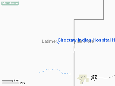
Choctaw Indian Hospital Heliport |
Location & QuickFacts
| FAA Information Effective: | 2008-09-25 |
| Airport Identifier: | OK35 |
| Airport Status: | Operational |
| Longitude/Latitude: | 095-05-38.8890W/34-48-50.0230N
-95.094136/34.813895 (Estimated) |
| Elevation: | 890 ft / 271.27 m (Estimated) |
| Land: | 0 acres |
| From nearest city: | 3 nautical miles N of Talihina, OK |
| Location: | Latimer County, OK |
| Magnetic Variation: | 06E (1985) |
Owner & Manager
| Ownership: | Privately owned |
| Owner: | Choctaw Indian Hospital |
| Address: |
Talihina, OK 74571 |
| Phone number: | 918-567-2211 |
| Manager: | Carl Ardese |
| Address: | Route 2
Talihina, OK 74571 |
| Phone number: | 918-567-2211 |
Airport Operations and Facilities
| Airport Use: | Private
MEDICAL |
| Wind indicator: | Yes |
| Segmented Circle: | No |
| Control Tower: | No |
| Lighting Schedule: | PHONE REQ
FOR PERIMETER LGTS CALL 918-567-2211. |
| Sectional chart: | Dallas-ft Worth |
| Region: | ASW - Southwest |
| Boundary ARTCC: | ZKC - Kansas City |
| Tie-in FSS: | MLC - Mc Alester |
| FSS Toll Free: | 1-800-WX-BRIEF |
Runway Information
Helipad H1
| Dimension: | 50 x 48 ft / 15.2 x 14.6 m |
| Surface: | CONC, |
| |
Runway H1 |
Runway |
| Traffic Pattern: | Left | Left |
|
Radio Navigation Aids
| ID |
Type |
Name |
Ch |
Freq |
Var |
Dist |
| IQS | NDB | Sallisaw | | 520.00 | 05E | 38.1 nm |
| AEE | NDB | Antlers | | 391.00 | 05E | 46.5 nm |
| MEZ | NDB | Mena | | 242.00 | 04E | 46.5 nm |
| MKO | NDB | Muskogee | | 306.00 | 06E | 47.9 nm |
| PGO | VORTAC | Rich Mountain | 082X | 113.50 | 04E | 25.3 nm |
| MLC | VORTAC | Mc Alester | 057X | 112.00 | 08E | 34.0 nm |
Images and information placed above are from
http://www.airport-data.com/airport/OK35/
We thank them for the data!
| General Info
|
| Country |
United States
|
| State |
OKLAHOMA
|
| FAA ID |
OK35
|
| Latitude |
34-48-50.023N
|
| Longitude |
095-05-38.889W
|
| Elevation |
890 feet
|
| Near City |
TALIHINA
|
We don't guarantee the information is fresh and accurate. The data may
be wrong or outdated.
For more up-to-date information please refer to other sources.
|
|


