 |
|
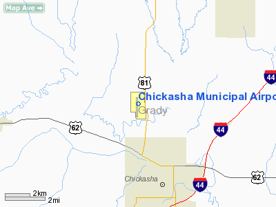
Location & QuickFacts
| FAA Information Effective: | 2008-09-25 |
| Airport Identifier: | CHK |
| Airport Status: | Operational |
| Longitude/Latitude: | 097-58-03.7000W/35-05-50.5000N
-97.967694/35.097361 (Estimated) |
| Elevation: | 1152 ft / 351.13 m (Surveyed) |
| Land: | 720 acres |
| From nearest city: | 3 nautical miles NW of Chickasha, OK |
| Location: | Grady County, OK |
| Magnetic Variation: | 08E (1980) |
Owner & Manager
| Ownership: | Publicly owned |
| Owner: | City Of Chickasha |
| Address: | City Hall 117 N 4th Street
Chickasha, OK 73018 |
| Phone number: | 405-222-6028 |
| Manager: | Steve Chapman
ON SITE CTC: CLINT FERGESON, 405-222-6006. |
| Address: | City Hall 117 N 4th Street
Chickasha, OK 73018 |
| Phone number: | 405-222-6000 |
Airport Operations and Facilities
| Airport Use: | Open to public |
| Wind indicator: | Yes |
| Segmented Circle: | Yes |
| Control Tower: | No |
| Lighting Schedule: | DUSK-DAWN
MIRL RY 17/35 PRESET LOW INTST; TO INCR INTST ACTVT - CTAF. |
| Beacon Color: | Clear-Green (lighted land airport) |
| Landing fee charge: | No |
| Sectional chart: | Dallas-ft Worth |
| Region: | ASW - Southwest |
| Traffic Pattern Alt: | 800 ft |
| Boundary ARTCC: | ZFW - Fort Worth |
| Tie-in FSS: | MLC - Mc Alester |
| FSS on Airport: | No |
| FSS Toll Free: | 1-800-WX-BRIEF |
| NOTAMs Facility: | CHK (NOTAM-d service avaliable) |
| Federal Agreements: | NGPRY |
Airport Communications
| CTAF: | 123.000 |
| Unicom: | 123.000 |
Airport Services
| Fuel available: | 100LLA
FUEL AVBL 24 HRS SELF SERVE WITH CREDIT CARD. |
| Airframe Repair: | MAJOR |
| Power Plant Repair: | MAJOR |
| Bulk Oxygen: | NONE |
Runway Information
Runway 02/20
| Dimension: | 2525 x 100 ft / 769.6 x 30.5 m |
| Surface: | TURF, Good Condition |
| |
Runway 02 |
Runway 20 |
| Longitude: | 097-58-04.2990W | 097-57-47.7490W |
| Latitude: | 35-05-38.3900N | 35-05-59.3390N |
| Alignment: | 33 | 127 |
| Traffic Pattern: | Left | Left |
| Obstruction: | , 50:1 slope to clear | 65 ft trees, 1200.0 ft from runway, 18:1 slope to clear |
|
Runway 17/35
| Dimension: | 5101 x 100 ft / 1554.8 x 30.5 m |
| Surface: | CONC, Good Condition |
| Pavement Class: | 4 /R/B/X/T |
| Weight Limit: | Single wheel: 40000 lbs.
Dual wheel: 52000 lbs. |
| Edge Lights: | Medium |
| |
Runway 17 |
Runway 35 |
| Longitude: | 097-58-09.1582W | 097-58-09.1489W |
| Latitude: | 35-06-12.3096N | 35-05-21.8636N |
| Elevation: | 1150.00 ft | 1130.00 ft |
| Alignment: | 127 | 0 |
| Traffic Pattern: | Left | Left |
| Markings: | Non-precision instrument, Good Condition | Non-precision instrument, Good Condition |
| Crossing Height: | 44.00 ft | 44.00 ft |
| VASI: | 4-light PAPI on left side
PAPI OTS INDEFLY. | 4-light PAPI on left side |
| Visual Glide Angle: | 3.00° | 3.00° |
| Obstruction: | , 50:1 slope to clear | 55 ft trees, 700.0 ft from runway, 9:1 slope to clear |
|
Runway 18/36
| Dimension: | 2840 x 145 ft / 865.6 x 44.2 m |
| Surface: | TURF, Good Condition |
| |
Runway 18 |
Runway 36 |
| Longitude: | 097-58-00.7150W | 097-58-00.7150W |
| Latitude: | 35-06-12.0600N | 35-05-43.9710N |
| Alignment: | 127 | 0 |
| Traffic Pattern: | Left | Left |
| Obstruction: | 4 ft fence, 50.0 ft from runway, 12:1 slope to clear | 35 ft bldg, 1005.0 ft from runway, 50 ft right of centerline, 28:1 slope to clear |
|
Radio Navigation Aids
| ID |
Type |
Name |
Ch |
Freq |
Var |
Dist |
| FSI | FAN MARKER | Trail | | | 09E | 28.6 nm |
| OLR | NDB | Chickasha | | 290.00 | 07E | 0.5 nm |
| RQO | NDB | El Reno | | 335.00 | 07E | 23.0 nm |
| OUN | NDB | Norman | | 260.00 | 07E | 26.1 nm |
| OFZ | NDB | Trail | | 388.00 | 09E | 28.6 nm |
| OK | NDB | Tuloo | | 406.00 | 07E | 28.7 nm |
| PFL | NDB | Post | | 308.00 | 08E | 36.4 nm |
| PVJ | NDB | Pauls Valley | | 384.00 | 06E | 43.0 nm |
| OJA | NDB | Weatherford | | 272.00 | 07E | 43.2 nm |
| TIK | TACAN | Tinker | 105X | | 07E | 35.3 nm |
| PWA | VOR/DME | Wiley Post | 081X | 113.40 | 08E | 30.5 nm |
| LAW | VOR/DME | Lawton | 031X | 109.40 | 09E | 42.3 nm |
| DUC | VOR/DME | Duncan | 047X | 111.00 | 09E | 42.9 nm |
| IRW | VORTAC | Will Rogers | 088X | 114.10 | 07E | 23.6 nm |
| IFI | VORTAC | Kingfisher | 094X | 114.70 | 09E | 42.6 nm |
| OKC | VOT | Oklahoma Will Rgs W | | 108.80 | | 25.4 nm |
Remarks
- CONSTRUCTED PRIOR TO AIRSPACE REQUIREMENT
Images and information placed above are from
http://www.airport-data.com/airport/CHK/
We thank them for the data!
| General Info
|
| Country |
United States
|
| State |
OKLAHOMA
|
| FAA ID |
CHK
|
| Latitude |
35-05-46.129N
|
| Longitude |
097-57-58.261W
|
| Elevation |
1150 feet
|
| Near City |
CHICKASHA
|
We don't guarantee the information is fresh and accurate. The data may
be wrong or outdated.
For more up-to-date information please refer to other sources.
|
|


