 |
|
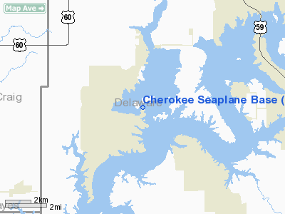
Cherokee Seaplane Base Airport |
Location & QuickFacts
| FAA Information Effective: | 2008-09-25 |
| Airport Identifier: | 4O6 |
| Airport Status: | Operational |
| Longitude/Latitude: | 094-55-00.8500W/36-35-00.2810N
-94.916903/36.583411 (Estimated) |
| Elevation: | 739 ft / 225.25 m (Surveyed) |
| Land: | 12 acres |
| From nearest city: | 7 nautical miles SW of Afton, OK |
| Location: | Delaware County, OK |
| Magnetic Variation: | 05E (1985) |
Owner & Manager
| Ownership: | Privately owned |
| Owner: | R. A. Billingsley |
| Address: | 30318 S. 4540 Rd.
Afton, OK 74331 |
| Phone number: | 918-782-2911 |
| Manager: | R. A. Billingsley |
| Address: | 30318 S. 4540 Rd.
Afton, OK 74331 |
| Phone number: | 918-782-2911 |
Airport Operations and Facilities
| Airport Use: | Open to public |
| Wind indicator: | Yes |
| Segmented Circle: | No |
| Control Tower: | No |
| Landing fee charge: | No |
| Sectional chart: | Kansas City |
| Region: | ASW - Southwest |
| Traffic Pattern Alt: | 500 ft |
| Boundary ARTCC: | ZKC - Kansas City |
| Tie-in FSS: | MLC - Mc Alester |
| FSS on Airport: | No |
| FSS Toll Free: | 1-800-WX-BRIEF |
| NOTAMs Facility: | MLC (NOTAM-d service avaliable) |
Airport Communications
Runway Information
Runway ALL/WAY
| Dimension: | 10000 x 800 ft / 3048.0 x 243.8 m |
| Surface: | WATER, |
| |
Runway ALL |
Runway WAY |
| Traffic Pattern: | Left | Left |
|
Runway NE/SW
| Dimension: | 4000 x 200 ft / 1219.2 x 61.0 m |
| Surface: | WATER, |
| |
Runway NE |
Runway SW |
| Traffic Pattern: | Left | Left |
|
Radio Navigation Aids
| ID |
Type |
Name |
Ch |
Freq |
Var |
Dist |
| SLG | NDB | Siloam Springs | | 284.00 | 04E | 31.5 nm |
| TQH | NDB | Tahlequah | | 215.00 | 05E | 39.7 nm |
| CFV | NDB | Coffeyville | | 212.00 | 05E | 43.9 nm |
| DW | NDB | Owaso | | 375.00 | 06E | 49.2 nm |
| EOS | VOR/DME | Neosho | 120X | 117.30 | 07E | 27.9 nm |
| DAK | VOR/DME | Drake | 025X | 108.80 | 07E | 47.6 nm |
| OSW | VORTAC | Oswego | 123X | 117.60 | 08E | 37.2 nm |
| RZC | VORTAC | Razorback | 111X | 116.40 | 04E | 43.5 nm |
| TUL | VORTAC | Tulsa | 091X | 114.40 | 08E | 48.2 nm |
| TUL | VOT | Tulsa Intl | | 109.00 | | 48.1 nm |
Images and information placed above are from
http://www.airport-data.com/airport/4O6/
We thank them for the data!
| General Info
|
| Country |
United States
|
| State |
OKLAHOMA
|
| FAA ID |
4O6
|
| Latitude |
36-35-00.281N
|
| Longitude |
094-55-00.850W
|
| Elevation |
739 feet
|
| Near City |
AFTON
|
We don't guarantee the information is fresh and accurate. The data may
be wrong or outdated.
For more up-to-date information please refer to other sources.
|
|


