 |
|
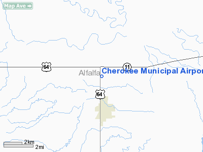
Location & QuickFacts
| FAA Information Effective: | 2008-09-25 |
| Airport Identifier: | 4O5 |
| Airport Status: | Operational |
| Longitude/Latitude: | 098-21-30.4700W/36-47-16.9400N
-98.358464/36.788039 (Estimated) |
| Elevation: | 1177 ft / 358.75 m (Estimated) |
| Land: | 60 acres |
| From nearest city: | 3 nautical miles N of Cherokee, OK |
| Location: | Alfalfa County, OK |
| Magnetic Variation: | 07E (1985) |
Owner & Manager
| Ownership: | Publicly owned |
| Owner: | City Of Cherokee |
| Address: | 121 N Grand
Cherokee, OK 73728 |
| Phone number: | 580-596-3052 |
| Manager: | Steven Vetter
CITY MANAGER. |
| Address: | 121 N Grand
Cherokee, OK 73728 |
| Phone number: | 580-596-3052 |
Airport Operations and Facilities
| Airport Use: | Open to public |
| Wind indicator: | Yes |
| Segmented Circle: | No |
| Control Tower: | No |
| Lighting Schedule: | DUSK-DAWN |
| Beacon Color: | Clear-Green (lighted land airport) |
| Landing fee charge: | No |
| Sectional chart: | Wichita |
| Region: | ASW - Southwest |
| Boundary ARTCC: | ZKC - Kansas City |
| Tie-in FSS: | MLC - Mc Alester |
| FSS on Airport: | No |
| FSS Toll Free: | 1-800-WX-BRIEF |
| NOTAMs Facility: | MLC (NOTAM-d service avaliable) |
| Federal Agreements: | NGY |
Airport Communications
Airport Services
| Airframe Repair: | NONE |
| Power Plant Repair: | NONE |
| Bottled Oxygen: | NONE |
| Bulk Oxygen: | NONE |
Runway Information
Runway 17/35
| Dimension: | 3570 x 50 ft / 1088.1 x 15.2 m |
| Surface: | ASPH, Fair Condition |
| Weight Limit: | Single wheel: 4000 lbs. |
| Edge Lights: | Medium |
| |
Runway 17 |
Runway 35 |
| Longitude: | 098-21-30.1800W | 098-21-30.7600W |
| Latitude: | 36-47-34.5900N | 36-46-59.2900N |
| Elevation: | 0.00 ft | 1177.00 ft |
| Alignment: | 127 | 1 |
| Traffic Pattern: | Left | Left |
| Markings: | Basic, Fair Condition | Basic, Fair Condition |
| Crossing Height: | 9.00 ft | 0.00 ft |
| Displaced threshold: | 0.00 ft | 180.00 ft |
| VASI: | system of panels on left side that may or may not be lighted | |
| Visual Glide Angle: | 4.00° | 0.00° |
| Obstruction: | 4 ft fence, 260.0 ft from runway, 15:1 slope to clear | , 50:1 slope to clear
APCH RATIO 50:1 TO DSPLCD THLD.
15 FT ROAD 130 FT FM THLD. |
|
Radio Navigation Aids
| ID |
Type |
Name |
Ch |
Freq |
Var |
Dist |
| AVK | NDB | Alva | | 203.00 | 08E | 15.1 nm |
| FAU | NDB | Fairview | | 246.00 | 07E | 30.8 nm |
| MDF | NDB | Mooreland/dcmsnd | | 284.00 | 08E | 44.1 nm |
| ODG | VOR/DME | Woodring | 027X | 109.00 | 08E | 37.1 nm |
| ANY | VORTAC | Anthony | 076X | 112.90 | 07E | 24.0 nm |
| END | VORTAC | Vance | 101X | 115.40 | 09E | 34.0 nm |
Images and information placed above are from
http://www.airport-data.com/airport/4O5/
We thank them for the data!
| General Info
|
| Country |
United States
|
| State |
OKLAHOMA
|
| FAA ID |
4O5
|
| Latitude |
36-47-15.860N
|
| Longitude |
098-21-30.760W
|
| Elevation |
1177 feet
|
| Near City |
CHEROKEE
|
We don't guarantee the information is fresh and accurate. The data may
be wrong or outdated.
For more up-to-date information please refer to other sources.
|
|


