 |
|
Location & QuickFacts
| FAA Information Effective: | 2008-09-25 |
| Airport Identifier: | 63OK |
| Airport Status: | Operational |
| Longitude/Latitude: | 097-53-31.1800W/35-42-30.1700N
-97.891994/35.708381 (Estimated) |
| Elevation: | 980 ft / 298.70 m (Estimated) |
| Land: | 0 acres |
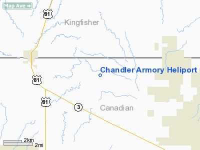
| From nearest city: | 0 nautical miles NW of Chandler, OK |
| Location: | Lincoln County, OK |
| Magnetic Variation: | 07E (1985) |
Owner & Manager
| Ownership: | Publicly owned |
| Owner: | Oklahoma Military Dept. |
| Address: | 3501 Military Circle, Ne
Oklahoma City, OK 73111 |
| Phone number: | 405-228-5294 |
| Manager: | Maj Clifton Barger |
| Address: | 3501 Military Circle
Oklahoma City, OK 73111 |
| Phone number: | 405-228-5294 |
Airport Operations and Facilities
| Airport Use: | Private |
| Segmented Circle: | No |
| Control Tower: | No |
| Sectional chart: | Dallas-ft Worth |
| Region: | ASW - Southwest |
| Boundary ARTCC: | ZFW - Fort Worth |
| Tie-in FSS: | MLC - Mc Alester |
| FSS Toll Free: | 1-800-WX-BRIEF |
Runway Information
Helipad H1
| Dimension: | 100 x 100 ft / 30.5 x 30.5 m |
| Surface: | TURF, |
| |
Runway H1 |
Runway |
| Traffic Pattern: | Left | Left |
|
Radio Navigation Aids
| ID |
Type |
Name |
Ch |
Freq |
Var |
Dist |
| RQO | NDB | El Reno | | 335.00 | 07E | 14.9 nm |
| OK | NDB | Tuloo | | 406.00 | 07E | 20.0 nm |
| LCY | NDB | Logan County | | 326.00 | 07E | 24.6 nm |
| JWG | NDB | Watonga | | 359.00 | 07E | 27.6 nm |
| OUN | NDB | Norman | | 260.00 | 07E | 34.5 nm |
| OLR | NDB | Chickasha | | 290.00 | 07E | 36.5 nm |
| OJA | NDB | Weatherford | | 272.00 | 07E | 39.5 nm |
| FAU | NDB | Fairview | | 246.00 | 07E | 44.9 nm |
| TIK | TACAN | Tinker | 105X | | 07E | 29.9 nm |
| PWA | VOR/DME | Wiley Post | 081X | 113.40 | 08E | 15.9 nm |
| ODG | VOR/DME | Woodring | 027X | 109.00 | 08E | 40.3 nm |
| IFI | VORTAC | Kingfisher | 094X | 114.70 | 09E | 8.0 nm |
| IRW | VORTAC | Will Rogers | 088X | 114.10 | 07E | 25.2 nm |
| END | VORTAC | Vance | 101X | 115.40 | 09E | 38.3 nm |
| OKC | VOT | Oklahoma Will Rgs W | | 108.80 | | 23.7 nm |
Images and information placed above are from
http://www.airport-data.com/airport/63OK/
We thank them for the data!
| General Info
|
| Country |
United States
|
| State |
OKLAHOMA
|
| FAA ID |
63OK
|
| Latitude |
35-42-30.170N
|
| Longitude |
097-53-31.180W
|
| Elevation |
980 feet
|
| Near City |
CHANDLER
|
We don't guarantee the information is fresh and accurate. The data may
be wrong or outdated.
For more up-to-date information please refer to other sources.
|
|


