 |
|
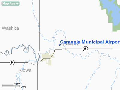
Location & QuickFacts
| FAA Information Effective: | 2008-09-25 |
| Airport Identifier: | 86F |
| Airport Status: | Operational |
| Longitude/Latitude: | 098-34-30.7200W/35-07-25.0400N
-98.575200/35.123622 (Estimated) |
| Elevation: | 1354 ft / 412.70 m (Estimated) |
| Land: | 70 acres |
| From nearest city: | 2 nautical miles NE of Carnegie, OK |
| Location: | Caddo County, OK |
| Magnetic Variation: | 07E (1985) |
Owner & Manager
| Ownership: | Publicly owned |
| Owner: | City Of Carnegie |
| Address: | City Hall Po Box 1075
Carnegie, OK 73015 |
| Phone number: | 580-654-1004 |
| Manager: | Debbie Clinton
TOWN CLERK. |
| Address: | City Hall Po Box 1075
Carnegie, OK 73015 |
| Phone number: | 580-654-1004 |
Airport Operations and Facilities
| Airport Use: | Open to public |
| Wind indicator: | Yes |
| Segmented Circle: | No |
| Control Tower: | No |
| Lighting Schedule: | DUSK-DAWN |
| Landing fee charge: | No |
| Sectional chart: | Dallas-ft Worth |
| Region: | ASW - Southwest |
| Boundary ARTCC: | ZFW - Fort Worth |
| Tie-in FSS: | MLC - Mc Alester |
| FSS on Airport: | No |
| FSS Toll Free: | 1-800-WX-BRIEF |
| NOTAMs Facility: | MLC (NOTAM-d service avaliable) |
| Federal Agreements: | NGY |
Airport Communications
Airport Services
| Airframe Repair: | NONE |
| Power Plant Repair: | NONE |
| Bottled Oxygen: | NONE |
| Bulk Oxygen: | NONE |
Runway Information
Runway 17/35
| Dimension: | 3000 x 50 ft / 914.4 x 15.2 m |
| Surface: | ASPH, Fair Condition |
| Pavement Class: | 3 /F/C/Y/T |
| Weight Limit: | Single wheel: 11000 lbs. |
| Edge Lights: | Low |
| |
Runway 17 |
Runway 35 |
| Traffic Pattern: | Left | Left |
| Markings: | Basic, Good Condition | Basic, Good Condition |
| Obstruction: | , 50:1 slope to clear | 35 ft pline, 1225.0 ft from runway, 29:1 slope to clear |
|
Radio Navigation Aids
| ID |
Type |
Name |
Ch |
Freq |
Var |
Dist |
| FSI | FAN MARKER | Trail | | | 09E | 22.3 nm |
| OFZ | NDB | Trail | | 388.00 | 09E | 22.3 nm |
| OJA | NDB | Weatherford | | 272.00 | 07E | 24.9 nm |
| OLR | NDB | Chickasha | | 290.00 | 07E | 29.7 nm |
| CLK | NDB | Clinton | | 320.00 | 07E | 30.6 nm |
| PFL | NDB | Post | | 308.00 | 08E | 32.1 nm |
| RQO | NDB | El Reno | | 335.00 | 07E | 35.0 nm |
| BZ | NDB | Fossi | | 393.00 | 08E | 36.5 nm |
| EZY | NDB | Elk City | | 241.00 | 08E | 44.3 nm |
| JWG | NDB | Watonga | | 359.00 | 07E | 45.0 nm |
| LAW | VOR/DME | Lawton | 031X | 109.40 | 09E | 38.6 nm |
| HBR | VORTAC | Hobart | 055X | 111.80 | 10E | 28.6 nm |
| BFV | VORTAC | Burns Flat | 037X | 110.00 | 08E | 31.7 nm |
| LTS | VORTAC | Altus | 035X | 109.80 | 08E | 44.1 nm |
| IRW | VORTAC | Will Rogers | 088X | 114.10 | 07E | 49.5 nm |
| IFI | VORTAC | Kingfisher | 094X | 114.70 | 09E | 49.6 nm |
Images and information placed above are from
http://www.airport-data.com/airport/86F/
We thank them for the data!
| General Info
|
| Country |
United States
|
| State |
OKLAHOMA
|
| FAA ID |
86F
|
| Latitude |
35-07-25.040N
|
| Longitude |
098-34-30.720W
|
| Elevation |
1354 feet
|
| Near City |
CARNEGIE
|
We don't guarantee the information is fresh and accurate. The data may
be wrong or outdated.
For more up-to-date information please refer to other sources.
|
|


