 |
|
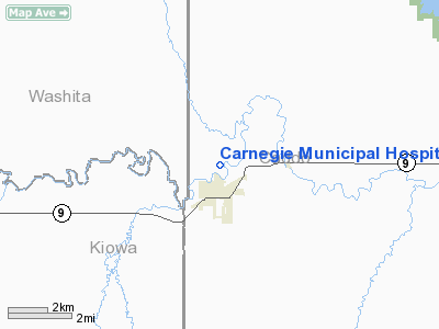
Carnegie Muni Hospital Heliport |
Location & QuickFacts
| FAA Information Effective: | 2008-09-25 |
| Airport Identifier: | OL07 |
| Airport Status: | Operational |
| Longitude/Latitude: | 098-36-01.2240W/35-07-00.2110N
-98.600340/35.116725 (Estimated) |
| Elevation: | 1234 ft / 376.12 m (Estimated) |
| Land: | 0 acres |
| From nearest city: | 0 nautical miles N of Carnegie, OK |
| Location: | Caddo County, OK |
| Magnetic Variation: | 08E (1985) |
Owner & Manager
| Ownership: | Publicly owned |
| Owner: | Carnegie Municipal Hospital |
| Address: | 102 North Broadway
Carnegie, OK 73015 |
| Phone number: | 580-654-1050 |
| Manager: | Shane Dunning,admin |
| Address: | Po Box 97
Carnegie, OK 73015 |
| Phone number: | 580-654-1050 |
Airport Operations and Facilities
| Airport Use: | Private
MEDICAL |
| Segmented Circle: | No |
| Control Tower: | No |
| Lighting Schedule: | DUSK-DAWN |
| Sectional chart: | Dallas-ft Worth |
| Region: | ASW - Southwest |
| Boundary ARTCC: | ZFW - Fort Worth |
| Tie-in FSS: | MLC - Mc Alester |
| FSS Toll Free: | 1-800-WX-BRIEF |
Runway Information
Helipad H1
| Dimension: | 75 x 75 ft / 22.9 x 22.9 m |
| Surface: | ASPH, |
| |
Runway H1 |
Runway |
| Traffic Pattern: | Left | Left |
|
Radio Navigation Aids
| ID |
Type |
Name |
Ch |
Freq |
Var |
Dist |
| FSI | FAN MARKER | Trail | | | 09E | 22.4 nm |
| OFZ | NDB | Trail | | 388.00 | 09E | 22.4 nm |
| OJA | NDB | Weatherford | | 272.00 | 07E | 25.1 nm |
| CLK | NDB | Clinton | | 320.00 | 07E | 30.2 nm |
| OLR | NDB | Chickasha | | 290.00 | 07E | 30.9 nm |
| PFL | NDB | Post | | 308.00 | 08E | 32.0 nm |
| BZ | NDB | Fossi | | 393.00 | 08E | 35.7 nm |
| RQO | NDB | El Reno | | 335.00 | 07E | 36.3 nm |
| EZY | NDB | Elk City | | 241.00 | 08E | 43.3 nm |
| JWG | NDB | Watonga | | 359.00 | 07E | 45.6 nm |
| LAW | VOR/DME | Lawton | 031X | 109.40 | 09E | 38.4 nm |
| HBR | VORTAC | Hobart | 055X | 111.80 | 10E | 27.3 nm |
| BFV | VORTAC | Burns Flat | 037X | 110.00 | 08E | 30.6 nm |
| LTS | VORTAC | Altus | 035X | 109.80 | 08E | 42.9 nm |
Remarks
- PRVDD INGRESS/EGRESS FM/TO THE EAST; AND OWNER/OPERATOR OF HELIPORT MUST COORDINATE W/CARNIGIE ARPT TO ESTABLISH PROCEDURES THAT FLIGHT OPERATIONS AT HELIPORT DO NOT CONFLICT W/CARNIGIE ARPT TFC PTN OPNS.
Images and information placed above are from
http://www.airport-data.com/airport/OL07/
We thank them for the data!
| General Info
|
| Country |
United States
|
| State |
OKLAHOMA
|
| FAA ID |
OL07
|
| Latitude |
35-07-00.211N
|
| Longitude |
098-36-01.224W
|
| Elevation |
1234 feet
|
| Near City |
CARNEGIE
|
We don't guarantee the information is fresh and accurate. The data may
be wrong or outdated.
For more up-to-date information please refer to other sources.
|
|


