 |
|
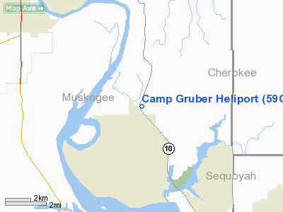
Location & QuickFacts
| FAA Information Effective: | 2008-09-25 |
| Airport Identifier: | 59OK |
| Airport Status: | Operational |
| Longitude/Latitude: | 095-12-19.8610W/35-40-25.3500N
-95.205517/35.673708 (Estimated) |
| Elevation: | 586 ft / 178.61 m (Estimated) |
| Land: | 0 acres |
| From nearest city: | 1 nautical miles N of Braggs, OK |
| Location: | Muskogee County, OK |
| Magnetic Variation: | 07E (1985) |
Owner & Manager
| Ownership: | Publicly owned |
| Owner: | Oklahoma Military Dept. |
| Address: | 3501 Military Circle, Ne
Oklahoma City, OK 73111 |
| Phone number: | 405-228-5294 |
| Manager: | Maj Cliffon Barger |
| Address: | 3501 Military Circle
Oklahoma City, OK 73111 |
| Phone number: | 405-228-5294 |
Airport Operations and Facilities
| Airport Use: | Private |
| Wind indicator: | Yes |
| Segmented Circle: | No |
| Control Tower: | No |
| Sectional chart: | Dallas-ft Worth |
| Region: | ASW - Southwest |
| Boundary ARTCC: | ZFW - Fort Worth |
| Tie-in FSS: | MLC - Mc Alester |
| FSS Toll Free: | 1-800-WX-BRIEF |
Runway Information
Helipad H1
| Dimension: | 50 x 50 ft / 15.2 x 15.2 m |
| Surface: | CONC, |
| |
Runway H1 |
Runway |
| Traffic Pattern: | Left | Left |
|
Radio Navigation Aids
| ID |
Type |
Name |
Ch |
Freq |
Var |
Dist |
| MKO | NDB | Muskogee | | 306.00 | 06E | 6.2 nm |
| TQH | NDB | Tahlequah | | 215.00 | 05E | 18.0 nm |
| IQS | NDB | Sallisaw | | 520.00 | 05E | 26.0 nm |
| HET | NDB | Henryetta | | 267.00 | 04E | 42.7 nm |
| SLG | NDB | Siloam Springs | | 284.00 | 04E | 46.7 nm |
| MEE | VOR | Davis | | 108.60 | 06E | 7.9 nm |
| OKM | VOR/DME | Okmulgee | 096X | 114.90 | 08E | 32.3 nm |
| GNP | VOR/DME | Glenpool | 043X | 110.60 | 06E | 40.1 nm |
| TUL | VORTAC | Tulsa | 091X | 114.40 | 08E | 42.3 nm |
| FSM | VORTAC | Fort Smith | 041X | 110.40 | 07E | 48.8 nm |
| TUL | VOT | Tulsa Intl | | 109.00 | | 42.3 nm |
Images and information placed above are from
http://www.airport-data.com/airport/59OK/
We thank them for the data!
| General Info
|
| Country |
United States
|
| State |
OKLAHOMA
|
| FAA ID |
59OK
|
| Latitude |
35-40-25.350N
|
| Longitude |
095-12-19.861W
|
| Elevation |
586 feet
|
| Near City |
BRAGGS
|
We don't guarantee the information is fresh and accurate. The data may
be wrong or outdated.
For more up-to-date information please refer to other sources.
|
|


