 |
|
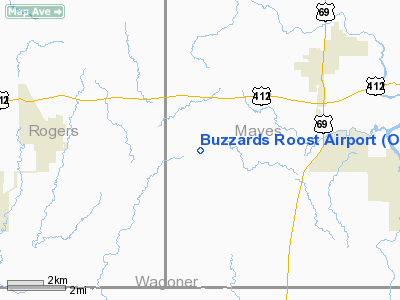
Location & QuickFacts
| FAA Information Effective: | 2008-09-25 |
| Airport Identifier: | O18 |
| Airport Status: | Operational |
| Longitude/Latitude: | 095-25-03.8950W/36-08-38.3530N
-95.417749/36.143987 (Estimated) |
| Elevation: | 661 ft / 201.47 m (Surveyed) |
| Land: | 80 acres |
| From nearest city: | 4 nautical miles E of Inola, OK |
| Location: | Mayes County, OK |
| Magnetic Variation: | 06E (1985) |
Owner & Manager
| Ownership: | Privately owned |
| Owner: | Beth Harkcom |
| Address: | 8629 W. 600 Rd.
Inola, OK 74036 |
| Phone number: | 918-543-2935 |
| Manager: | Beth Harkcom |
| Address: | 8629 W. 600 Rd.
Inola, OK 74036 |
| Phone number: | 918-543-2935 |
Airport Operations and Facilities
| Airport Use: | Open to public |
| Wind indicator: | Yes |
| Segmented Circle: | No |
| Control Tower: | No |
| Landing fee charge: | No |
| Sectional chart: | Kansas City |
| Region: | ASW - Southwest |
| Boundary ARTCC: | ZME - Memphis |
| Tie-in FSS: | MLC - Mc Alester |
| FSS on Airport: | No |
| FSS Toll Free: | 1-800-WX-BRIEF |
| NOTAMs Facility: | MLC (NOTAM-d service avaliable) |
Airport Communications
Airport Services
Runway Information
Runway 17/35
| Dimension: | 2555 x 80 ft / 778.8 x 24.4 m |
| Surface: | TURF, Fair Condition |
| |
Runway 17 |
Runway 35 |
| Traffic Pattern: | Right | Right |
| Obstruction: | 15 ft road, 20.0 ft from runway, 1:1 slope to clear | 4 ft fence, 0.0 ft from runway |
|
Radio Navigation Aids
| ID |
Type |
Name |
Ch |
Freq |
Var |
Dist |
| TQH | NDB | Tahlequah | | 215.00 | 05E | 23.9 nm |
| DW | NDB | Owaso | | 375.00 | 06E | 24.3 nm |
| MKO | NDB | Muskogee | | 306.00 | 06E | 33.6 nm |
| OWP | NDB | William Pogue | | 362.00 | 06E | 35.8 nm |
| SLG | NDB | Siloam Springs | | 284.00 | 04E | 45.2 nm |
| MEE | VOR | Davis | | 108.60 | 06E | 29.0 nm |
| GNP | VOR/DME | Glenpool | 043X | 110.60 | 06E | 29.9 nm |
| OKM | VOR/DME | Okmulgee | 096X | 114.90 | 08E | 34.8 nm |
| TUL | VORTAC | Tulsa | 091X | 114.40 | 08E | 18.2 nm |
| TUL | VOT | Tulsa Intl | | 109.00 | | 18.2 nm |
Images and information placed above are from
http://www.airport-data.com/airport/O18/
We thank them for the data!
| General Info
|
| Country |
United States
|
| State |
OKLAHOMA
|
| FAA ID |
O18
|
| Latitude |
36-08-38.353N
|
| Longitude |
095-25-03.895W
|
| Elevation |
661 feet
|
| Near City |
INOLA
|
We don't guarantee the information is fresh and accurate. The data may
be wrong or outdated.
For more up-to-date information please refer to other sources.
|
|


