 |
|
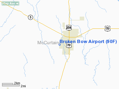
Location & QuickFacts
| FAA Information Effective: | 2008-09-25 |
| Airport Identifier: | 90F |
| Airport Status: | Operational |
| Longitude/Latitude: | 094-45-30.7760W/34-00-50.3950N
-94.758549/34.013999 (Estimated) |
| Elevation: | 404 ft / 123.14 m (Estimated) |
| Land: | 60 acres |
| From nearest city: | 2 nautical miles SW of Broken Bow, OK |
| Location: | Mc Curtain County, OK |
| Magnetic Variation: | 05E (1985) |
Owner & Manager
| Ownership: | Publicly owned |
| Owner: | City Of Broken Bow |
| Address: | City Hall, 210 N. Broadway
Broken Bow, OK 74728 |
| Phone number: | 580-584-2282 |
| Manager: | John Dean
CITY MANAGER. |
| Address: | City Hall, 210 N. Broadway
Broken Bow, OK 74728 |
| Phone number: | 580-584-2885 |
Airport Operations and Facilities
| Airport Use: | Open to public |
| Wind indicator: | Yes |
| Segmented Circle: | Yes |
| Control Tower: | No |
| Lighting Schedule: | DUSK-DAWN |
| Beacon Color: | Clear-Green (lighted land airport) |
| Landing fee charge: | No |
| Sectional chart: | Memphis |
| Region: | ASW - Southwest |
| Boundary ARTCC: | ZFW - Fort Worth |
| Tie-in FSS: | MLC - Mc Alester |
| FSS on Airport: | No |
| FSS Toll Free: | 1-800-WX-BRIEF |
| NOTAMs Facility: | MLC (NOTAM-d service avaliable) |
| Federal Agreements: | GY |
Airport Communications
Airport Services
| Bottled Oxygen: | NONE |
| Bulk Oxygen: | NONE |
Runway Information
Runway 17/35
| Dimension: | 3200 x 50 ft / 975.4 x 15.2 m |
| Surface: | ASPH, Fair Condition |
| Pavement Class: | 3 /F/C/Z/U |
| Weight Limit: | Single wheel: 17000 lbs. |
| Edge Lights: | Medium |
| |
Runway 17 |
Runway 35 |
| Traffic Pattern: | Left | Left |
| Markings: | Basic, Good Condition | Basic, Good Condition |
| Crossing Height: | 26.00 ft | 26.00 ft |
| VASI: | 2-light PAPI on left side | 2-light PAPI on left side |
| Visual Glide Angle: | 2.00° | 2.00° |
| Obstruction: | 70 ft trees, 600.0 ft from runway, 200 ft right of centerline, 5:1 slope to clear | 75 ft trees, 300.0 ft from runway, 1:1 slope to clear |
|
Radio Navigation Aids
| ID |
Type |
Name |
Ch |
Freq |
Var |
Dist |
| IBO | NDB | Idabel | | 271.00 | 03E | 7.7 nm |
| DEQ | NDB | De Queen | | 281.00 | 04E | 18.0 nm |
| HHW | NDB | Hugo | | 323.00 | 05E | 38.9 nm |
| MEZ | NDB | Mena | | 242.00 | 04E | 42.1 nm |
| AEE | NDB | Antlers | | 391.00 | 05E | 45.7 nm |
| PRX | VOR/DME | Paris | 083X | 113.60 | 07E | 44.6 nm |
| PGO | VORTAC | Rich Mountain | 082X | 113.50 | 04E | 40.7 nm |
| TXK | VORTAC | Texarkana | 110X | 116.30 | 07E | 45.6 nm |
Remarks
- HIGH SPEED; LOW ALTITUDE MILITARY ACTIVITY INVOF BROKEN BOW LAKE.
- ULTRALIGHTS ON AND IN VICINITY OF AIRPORT.
Images and information placed above are from
http://www.airport-data.com/airport/90F/
We thank them for the data!
| General Info
|
| Country |
United States
|
| State |
OKLAHOMA
|
| FAA ID |
90F
|
| Latitude |
34-00-50.395N
|
| Longitude |
094-45-30.776W
|
| Elevation |
404 feet
|
| Near City |
BROKEN BOW
|
We don't guarantee the information is fresh and accurate. The data may
be wrong or outdated.
For more up-to-date information please refer to other sources.
|
|


