 |
|
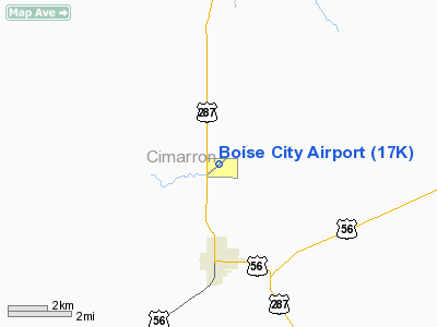
| Boise City Airport |
| IATA: none – ICAO: none – FAA LID: 17K |
| Summary |
| Airport type |
Public |
| Owner/Operator |
City of Boise City |
| Serves |
Boise City, Oklahoma |
| Location |
3 miles (4.8 km) N of Boise City, Oklahoma |
| Elevation AMSL |
4,178 ft / 1,273 m |
| Coordinates |
36°46′27.48″N 102°30′37.57″W / 36.7743°N 102.5104361°W / 36.7743; -102.5104361 |
| Runways |
| Direction |
Length |
Surface |
| ft |
m |
| 04/24 |
4,210 |
1,283 |
Asphalt |
| Source: Federal Aviation Administration |
Boise City Airport (FAA LID: 17K) is a general aviation airport located 3 miles (4.8 km) north of Boise City, Oklahoma, USA.
Facilities
Boise City Airport covers 107 acres (0.43 km) and has one runway:
- Runway 04/22: 4,210 x 60 ft (18 m). Surface: Asphalt
The above content comes from Wikipedia and is published under free licenses – click here to read more.
Location & QuickFacts
| FAA Information Effective: | 2008-09-25 |
| Airport Identifier: | 17K |
| Airport Status: | Operational |
| Longitude/Latitude: | 102-30-37.5710W/36-46-27.4810N
-102.510436/36.774300 (Estimated) |
| Elevation: | 4178 ft / 1273.45 m (Surveyed) |
| Land: | 107 acres |
| From nearest city: | 3 nautical miles N of Boise City, OK |
| Location: | Cimarron County, OK |
| Magnetic Variation: | 09E (1995) |
Owner & Manager
| Ownership: | Publicly owned |
| Owner: | City Of Boise City |
| Address: | City Hall, P.o. Box 129
Boise City, OK 73933 |
| Phone number: | 580-544-2271 |
| Manager: | Rod Avery City Mgr |
| Address: | City Hall, P.o. Box 129
Boise City, OK 73933 |
| Phone number: | 580-544-2271 |
Airport Operations and Facilities
| Airport Use: | Open to public |
| Wind indicator: | Yes |
| Segmented Circle: | Yes |
| Control Tower: | No |
| Lighting Schedule: | DUSK-DAWN
ACTVT MIRL RY 04/22 - CTAF. |
| Beacon Color: | Clear-Green (lighted land airport) |
| Landing fee charge: | No |
| Sectional chart: | Wichita |
| Region: | ASW - Southwest |
| Boundary ARTCC: | ZAB - Albuquerque |
| Tie-in FSS: | MLC - Mc Alester |
| FSS on Airport: | No |
| FSS Toll Free: | 1-800-WX-BRIEF |
| NOTAMs Facility: | MLC (NOTAM-d service avaliable) |
| Federal Agreements: | NGY |
Airport Communications
Airport Services
| Airframe Repair: | MINOR |
| Power Plant Repair: | MINOR |
| Bottled Oxygen: | NONE |
| Bulk Oxygen: | NONE |
Runway Information
Runway 04/22
| Dimension: | 4210 x 60 ft / 1283.2 x 18.3 m |
| Surface: | ASPH, Good Condition |
| Weight Limit: | Single wheel: 4000 lbs. |
| Edge Lights: | Medium |
| |
Runway 04 |
Runway 22 |
| Longitude: | 102-30-57.2270W | 102-30-17.8850W |
| Latitude: | 36-46-13.9640N | 36-46-41.0120N |
| Elevation: | 4169.00 ft | 4162.00 ft |
| Alignment: | 49 | 127 |
| Traffic Pattern: | Left | Left |
| Markings: | Non-precision instrument, Good Condition | Basic, Good Condition |
| Obstruction: | 28 ft trees, 515.0 ft from runway, 35 ft right of centerline, 11:1 slope to clear | , 50:1 slope to clear |
|
Radio Navigation Aids
| ID |
Type |
Name |
Ch |
Freq |
Var |
Dist |
| BCY | NDB | Thorp | | 212.00 | 10E | 1.6 nm |
| EHA | NDB | Elkhart | | 377.00 | 10E | 33.0 nm |
| CAO | NDB | Clayton | | 332.00 | 09E | 36.7 nm |
| GUY | NDB | Guymon | | 275.00 | 09E | 48.6 nm |
| DHT | VORTAC | Dalhart | 057X | 112.00 | 12E | 41.1 nm |
Remarks
- 3 INCH DROP OFF ALONG EDGE OF RY ENTIRE LENGTH.
Images and information placed above are from
http://www.airport-data.com/airport/17K/
We thank them for the data!
| General Info
|
| Country |
United States
|
| State |
OKLAHOMA
|
| FAA ID |
17K
|
| Latitude |
36-46-27.481N
|
| Longitude |
102-30-37.571W
|
| Elevation |
4178 feet
|
| Near City |
BOISE CITY
|
We don't guarantee the information is fresh and accurate. The data may
be wrong or outdated.
For more up-to-date information please refer to other sources.
|
|


