 |
|
Location & QuickFacts
| FAA Information Effective: | 2008-09-25 |
| Airport Identifier: | 15OK |
| Airport Status: | Operational |
| Longitude/Latitude: | 095-18-39.0000W/35-42-14.0000N
-95.310833/35.703889 (Estimated) |
| Elevation: | 531 ft / 161.85 m (Estimated) |
| Land: | 0 acres |
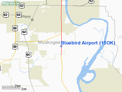
| From nearest city: | 5 nautical miles SE of Muskogee, OK |
| Location: | Muskogee County, OK |
| Magnetic Variation: | () |
Owner & Manager
| Ownership: | Privately owned |
| Owner: | William G. Swartz |
| Address: | 4031 S. 42nd St. East
Muskogee, OK 74403 |
| Phone number: | 918-682-6002 |
| Manager: | William G. Swartz |
| Address: | 4031 S. 42nd St. East
Muskogee, OK 74403 |
| Phone number: | 918-682-6002 |
Airport Operations and Facilities
| Airport Use: | Private |
| Wind indicator: | Yes |
| Control Tower: | No |
| Sectional chart: | Dallas-ft Worth |
| Region: | ASW - Southwest |
| Boundary ARTCC: | ZFW - Fort Worth |
| Tie-in FSS: | MLC - Mc Alester |
| FSS Toll Free: | 1-800-WX-BRIEF |
Airport Communications
Runway Information
Runway 18/36
| Dimension: | 1350 x 50 ft / 411.5 x 15.2 m |
| Surface: | TURF, |
| |
Runway 18 |
Runway 36 |
| Traffic Pattern: | Left | Right |
|
Radio Navigation Aids
| ID |
Type |
Name |
Ch |
Freq |
Var |
Dist |
| MKO | NDB | Muskogee | | 306.00 | 06E | 6.7 nm |
| TQH | NDB | Tahlequah | | 215.00 | 05E | 20.0 nm |
| IQS | NDB | Sallisaw | | 520.00 | 05E | 31.2 nm |
| HET | NDB | Henryetta | | 267.00 | 04E | 38.8 nm |
| DW | NDB | Owaso | | 375.00 | 06E | 45.5 nm |
| SLG | NDB | Siloam Springs | | 284.00 | 04E | 49.5 nm |
| OWP | NDB | William Pogue | | 362.00 | 06E | 49.8 nm |
| MEE | VOR | Davis | | 108.60 | 06E | 3.7 nm |
| OKM | VOR/DME | Okmulgee | 096X | 114.90 | 08E | 27.1 nm |
| GNP | VOR/DME | Glenpool | 043X | 110.60 | 06E | 34.6 nm |
| TUL | VORTAC | Tulsa | 091X | 114.40 | 08E | 37.6 nm |
| TUL | VOT | Tulsa Intl | | 109.00 | | 37.6 nm |
Remarks
- ALL TFC REMAIN E OF RY.
- PLINE .9NM S OF RY.
- ALL TFC MONITOR AND ANNOUNCE INTENTIONS ON FREQ 122.8.
- PRVDD VFR OPNS, RIGHT TFC RY 36 & LOA WITH DAVIS FIELD.
Images and information placed above are from
http://www.airport-data.com/airport/15OK/
We thank them for the data!
| General Info
|
| Country |
United States
|
| State |
OKLAHOMA
|
| FAA ID |
15OK
|
| Latitude |
36-25-16.119N
|
| Longitude |
097-50-44.205W
|
| Elevation |
1236 feet
|
| Near City |
ENID
|
We don't guarantee the information is fresh and accurate. The data may
be wrong or outdated.
For more up-to-date information please refer to other sources.
|
|


