 |
|
Location & QuickFacts
| FAA Information Effective: | 2008-09-25 |
| Airport Identifier: | OK22 |
| Airport Status: | Operational |
| Longitude/Latitude: | 096-49-55.8000W/35-24-10.7000N
-96.832167/35.402972 (Estimated) |
| Elevation: | 1030 ft / 313.94 m (Estimated) |
| Land: | 12 acres |
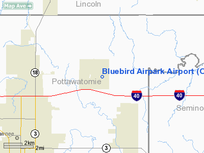
| From nearest city: | 7 nautical miles NE of Shawnee, OK |
| Location: | Pottawatomie County, OK |
| Magnetic Variation: | 05E (2000) |
Owner & Manager
| Ownership: | Privately owned |
| Owner: | Doyle G. & Betty J. Herrington |
| Address: | 46505 Garretts Lake Road
Shawnee, OK 74804 |
| Phone number: | 405-275-5386 |
| Manager: | Doyle G. & Betty J. Herrington |
| Address: | 46505 Garretts Lake Road
Shawnee, OK 74804 |
| Phone number: | 405-275-5386 |
Airport Operations and Facilities
| Airport Use: | Private |
| Wind indicator: | Yes |
| Segmented Circle: | No |
| Control Tower: | No |
| Sectional chart: | Dallas-ft Worth |
| Region: | ASW - Southwest |
| Boundary ARTCC: | ZFW - Fort Worth |
| Tie-in FSS: | MLC - Mc Alester |
| FSS Toll Free: | 1-800-WX-BRIEF |
Airport Communications
Runway Information
Runway 17/35
| Dimension: | 1700 x 100 ft / 518.2 x 30.5 m |
| Surface: | TURF, Good Condition |
| |
Runway 17 |
Runway 35 |
| Traffic Pattern: | Left | Left |
|
Radio Navigation Aids
| ID |
Type |
Name |
Ch |
Freq |
Var |
Dist |
| GGU | NDB | Prague | | 314.00 | 06E | 8.8 nm |
| SRE | NDB | Seminole | | 278.00 | 06E | 11.0 nm |
| CQB | NDB | Tilghman | | 396.00 | 06E | 19.2 nm |
| HDL | NDB | Holdenville | | 411.00 | 06E | 28.1 nm |
| CUH | NDB | Cushing | | 242.00 | 05E | 29.4 nm |
| TZO | NDB | Bristow | | 251.00 | 05E | 29.7 nm |
| OUN | NDB | Norman | | 260.00 | 07E | 32.6 nm |
| OK | NDB | Tuloo | | 406.00 | 07E | 38.1 nm |
| LCY | NDB | Logan County | | 326.00 | 07E | 39.0 nm |
| HET | NDB | Henryetta | | 267.00 | 04E | 40.1 nm |
| PVJ | NDB | Pauls Valley | | 384.00 | 06E | 45.7 nm |
| TIK | TACAN | Tinker | 105X | | 07E | 26.9 nm |
| ADH | VOR/DME | Ada | 125X | 117.80 | 06E | 37.0 nm |
| PWA | VOR/DME | Wiley Post | 081X | 113.40 | 08E | 40.7 nm |
| IRW | VORTAC | Will Rogers | 088X | 114.10 | 07E | 38.2 nm |
| OKC | VOT | Oklahoma Will Rgs W | | 108.80 | | 37.6 nm |
Images and information placed above are from
http://www.airport-data.com/airport/OK22/
We thank them for the data!
| General Info
|
| Country |
United States
|
| State |
OKLAHOMA
|
| FAA ID |
OK22
|
| Latitude |
35-24-10.700N
|
| Longitude |
096-49-55.800W
|
| Elevation |
1030 feet
|
| Near City |
SHAWNEE
|
We don't guarantee the information is fresh and accurate. The data may
be wrong or outdated.
For more up-to-date information please refer to other sources.
|
|


