 |
|
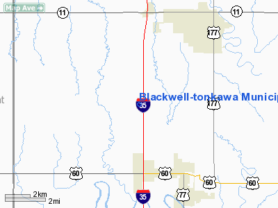
Blackwell-tonkawa Muni Airport |
Location & QuickFacts
| FAA Information Effective: | 2008-09-25 |
| Airport Identifier: | 4O3 |
| Airport Status: | Operational |
| Longitude/Latitude: | 097-20-58.5000W/36-44-42.4000N
-97.349583/36.745111 (Estimated) |
| Elevation: | 1030 ft / 313.94 m (Surveyed) |
| Land: | 209 acres |
| From nearest city: | 5 nautical miles SW of Blackwell, OK |
| Location: | Kay County, OK |
| Magnetic Variation: | 06E (1995) |
Owner & Manager
| Ownership: | Publicly owned |
| Owner: | Cities Of Blackwell/tonkawa |
| Address: | 16705 W. Hubbard Road
Blackwell, OK 74631 |
| Phone number: | 580-363-4242 |
| Manager: | Jim Holdeman |
| Address: | 16705 W. Hubbard Rd
Blackwell, OK 74631 |
| Phone number: | 580-363-4242 |
Airport Operations and Facilities
| Airport Use: | Open to public |
| Wind indicator: | Yes |
| Segmented Circle: | Yes |
| Control Tower: | No |
| Lighting Schedule: | DUSK-DAWN |
| Beacon Color: | Clear-Green (lighted land airport) |
| Sectional chart: | Wichita |
| Region: | ASW - Southwest |
| Boundary ARTCC: | ZKC - Kansas City |
| Tie-in FSS: | MLC - Mc Alester |
| FSS on Airport: | No |
| FSS Toll Free: | 1-800-WX-BRIEF |
| NOTAMs Facility: | MLC (NOTAM-d service avaliable) |
| Federal Agreements: | NGY |
Airport Communications
| CTAF: | 122.800 |
| Unicom: | 122.800 |
Airport Services
| Fuel available: | 100LL |
| Airframe Repair: | MINOR |
| Power Plant Repair: | MINOR |
| Bottled Oxygen: | NONE |
| Bulk Oxygen: | NONE |
Runway Information
Runway 17/35
| Dimension: | 3501 x 60 ft / 1067.1 x 18.3 m |
| Surface: | ASPH, Good Condition |
| Pavement Class: | 4 /F/B/Y/T |
| Weight Limit: | Single wheel: 30000 lbs.
Dual wheel: 48000 lbs.
Dual tandem wheel: 98000 lbs. |
| Edge Lights: | Medium |
| |
Runway 17 |
Runway 35 |
| Longitude: | 097-20-58.5732W | 097-20-58.4479W |
| Latitude: | 36-44-59.7087N | 36-44-25.0967N |
| Elevation: | 1030.00 ft | 1009.00 ft |
| Alignment: | 127 | 127 |
| Traffic Pattern: | Left | Left |
| Markings: | Non-precision instrument, Fair Condition | Non-precision instrument, Fair Condition |
| Crossing Height: | 26.00 ft | 26.00 ft |
| VASI: | 2-box on left side | 2-box on left side |
| Visual Glide Angle: | 3.00° | 3.00° |
|
Radio Navigation Aids
| ID |
Type |
Name |
Ch |
Freq |
Var |
Dist |
| PN | NDB | Ponca | | 515.00 | 05E | 12.9 nm |
| EGT | NDB | Wellington | | 414.00 | 07E | 34.8 nm |
| ODG | VOR/DME | Woodring | 027X | 109.00 | 08E | 30.8 nm |
| SWO | VOR/DME | Stillwater | 021X | 108.40 | 07E | 33.9 nm |
| PER | VORTAC | Pioneer | 079X | 113.20 | 06E | 9.1 nm |
| END | VORTAC | Vance | 101X | 115.40 | 09E | 36.5 nm |
| ANY | VORTAC | Anthony | 076X | 112.90 | 07E | 46.6 nm |
Images and information placed above are from
http://www.airport-data.com/airport/4O3/
We thank them for the data!
| General Info
|
| Country |
United States
|
| State |
OKLAHOMA
|
| FAA ID |
4O3
|
| Latitude |
36-44-42.417N
|
| Longitude |
097-20-58.559W
|
| Elevation |
1029 feet
|
| Near City |
BLACKWELL
|
We don't guarantee the information is fresh and accurate. The data may
be wrong or outdated.
For more up-to-date information please refer to other sources.
|
|


