 |
|
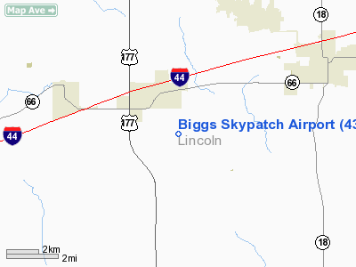
Location & QuickFacts
| FAA Information Effective: | 2008-09-25 |
| Airport Identifier: | 43OK |
| Airport Status: | Operational |
| Longitude/Latitude: | 096-59-01.0980W/35-40-00.2270N
-96.983638/35.666730 (Estimated) |
| Elevation: | 1000 ft / 304.80 m (Estimated) |
| Land: | 42 acres |
| From nearest city: | 4 nautical miles SE of Wellston, OK |
| Location: | Lincoln County, OK |
| Magnetic Variation: | 07E (1985) |
Owner & Manager
| Ownership: | Privately owned |
| Owner: | Glen A. Biggs |
| Address: | Rt 3, Box 86
Wellston, OK 74881 |
| Phone number: | 405-258-2965 |
| Manager: | Glen A. Biggs |
| Address: | Rt 3, Box 86
Wellston, OK 74881 |
| Phone number: | 405-258-2965 |
Airport Operations and Facilities
| Airport Use: | Private |
| Wind indicator: | Yes |
| Segmented Circle: | No |
| Control Tower: | No |
| Sectional chart: | Dallas-ft Worth |
| Region: | ASW - Southwest |
| Boundary ARTCC: | ZKC - Kansas City |
| Tie-in FSS: | MLC - Mc Alester |
| FSS on Airport: | No |
| FSS Toll Free: | 1-800-WX-BRIEF |
Runway Information
Runway N/S
| Dimension: | 4200 x 60 ft / 1280.2 x 18.3 m |
| Surface: | TURF, |
| |
Runway N |
Runway S |
| Traffic Pattern: | Left | Left |
|
Radio Navigation Aids
| ID |
Type |
Name |
Ch |
Freq |
Var |
Dist |
| CQB | NDB | Tilghman | | 396.00 | 06E | 8.7 nm |
| GGU | NDB | Prague | | 314.00 | 06E | 15.8 nm |
| CUH | NDB | Cushing | | 242.00 | 05E | 16.8 nm |
| LCY | NDB | Logan County | | 326.00 | 07E | 23.7 nm |
| TZO | NDB | Bristow | | 251.00 | 05E | 28.0 nm |
| SRE | NDB | Seminole | | 278.00 | 06E | 28.1 nm |
| OK | NDB | Tuloo | | 406.00 | 07E | 32.6 nm |
| OUN | NDB | Norman | | 260.00 | 07E | 34.6 nm |
| HDL | NDB | Holdenville | | 411.00 | 06E | 44.7 nm |
| HET | NDB | Henryetta | | 267.00 | 04E | 50.0 nm |
| TIK | TACAN | Tinker | 105X | | 07E | 23.8 nm |
| PWA | VOR/DME | Wiley Post | 081X | 113.40 | 08E | 33.4 nm |
| SWO | VOR/DME | Stillwater | 021X | 108.40 | 07E | 33.8 nm |
| IRW | VORTAC | Will Rogers | 088X | 114.10 | 07E | 35.8 nm |
| OKC | VOT | Oklahoma Will Rgs W | | 108.80 | | 34.3 nm |
Remarks
- DAY USE ONLY; PLINES BE OBSTRUCTION MARKED; PROVIDED TRAFFIC PATTERNS FLOWN EAST OF N/S RWY.
Images and information placed above are from
http://www.airport-data.com/airport/43OK/
We thank them for the data!
| General Info
|
| Country |
United States
|
| State |
OKLAHOMA
|
| FAA ID |
43OK
|
| Latitude |
35-40-00.227N
|
| Longitude |
096-59-01.098W
|
| Elevation |
1000 feet
|
| Near City |
WELLSTON
|
We don't guarantee the information is fresh and accurate. The data may
be wrong or outdated.
For more up-to-date information please refer to other sources.
|
|


