 |
|
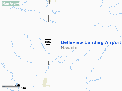
Belleview Landing Airport |
Location & QuickFacts
| FAA Information Effective: | 2008-09-25 |
| Airport Identifier: | 45OK |
| Airport Status: | Operational |
| Longitude/Latitude: | 095-36-10.9180W/36-54-45.2990N
-95.603033/36.912583 (Estimated) |
| Elevation: | 775 ft / 236.22 m (Estimated) |
| Land: | 120 acres |
| From nearest city: | 5 nautical miles S of South Coffeyville, OK |
| Location: | Nowata County, OK |
| Magnetic Variation: | 06E (1985) |
Owner & Manager
| Ownership: | Privately owned |
| Owner: | Frederick J & Linda J Powell |
| Address: | Rt 1, Box 374
South Coffeyville, OK 74072 |
| Phone number: | 918-255-6447 |
| Manager: | Frederick J & Linda J Powell |
| Address: | Rt 1, Box 374
South Coffeyville, OK 74072 |
| Phone number: | 918-255-6447 |
Airport Operations and Facilities
| Airport Use: | Private |
| Wind indicator: | Yes |
| Segmented Circle: | No |
| Control Tower: | No |
| Landing fee charge: | No |
| Sectional chart: | Kansas City |
| Region: | ASW - Southwest |
| Boundary ARTCC: | ZKC - Kansas City |
| Tie-in FSS: | MLC - Mc Alester |
| FSS on Airport: | No |
| FSS Toll Free: | 1-800-WX-BRIEF |
Runway Information
Runway 01/19
| Dimension: | 2000 x 50 ft / 609.6 x 15.2 m |
| Surface: | TURF, |
| |
Runway 01 |
Runway 19 |
| Traffic Pattern: | Left | Left |
| Obstruction: | | 4 ft fence |
|
Radio Navigation Aids
| ID |
Type |
Name |
Ch |
Freq |
Var |
Dist |
| CFV | NDB | Coffeyville | | 212.00 | 05E | 11.0 nm |
| PPF | NDB | Parsons | | 258.00 | 06E | 26.0 nm |
| DW | NDB | Owaso | | 375.00 | 06E | 38.7 nm |
| BVO | VOR/DME | Bartlesville | 126X | 117.90 | 08E | 20.5 nm |
| CNU | VOR/DME | Chanute | 029X | 109.20 | 05E | 42.9 nm |
| OSW | VORTAC | Oswego | 123X | 117.60 | 08E | 24.2 nm |
| TUL | VORTAC | Tulsa | 091X | 114.40 | 08E | 44.0 nm |
| TUL | VOT | Tulsa Intl | | 109.00 | | 44.0 nm |
Images and information placed above are from
http://www.airport-data.com/airport/45OK/
We thank them for the data!
| General Info
|
| Country |
United States
|
| State |
OKLAHOMA
|
| FAA ID |
45OK
|
| Latitude |
36-54-45.299N
|
| Longitude |
095-36-10.918W
|
| Elevation |
775 feet
|
| Near City |
SOUTH COFFEYVILLE
|
We don't guarantee the information is fresh and accurate. The data may
be wrong or outdated.
For more up-to-date information please refer to other sources.
|
|


