 |
|
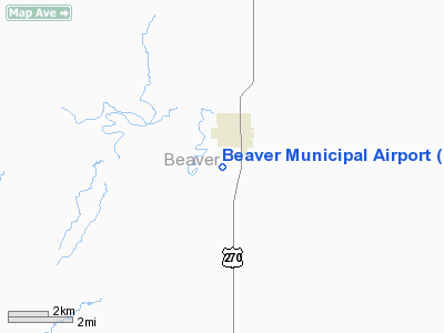
| Beaver Municipal Airport |
| IATA: none – ICAO: none – FAA LID: K44 |
| Summary |
| Airport type |
Public |
| Owner |
City of Beaver |
| Serves |
Beaver, Oklahoma |
| Elevation AMSL |
2,491 ft / 759 m |
| Coordinates |
36°47′56″N 100°31′48″W / 36.79889°N 100.53°W / 36.79889; -100.53 |
| Runways |
| Direction |
Length |
Surface |
| ft |
m |
| 17/35 |
3,030 |
924 |
Asphalt/Gravel |
| 4/22 |
3,025 |
922 |
Turf |
| Statistics (2005) |
| Aircraft operations |
1,500 |
| Source: Federal Aviation Administration |
Beaver Municipal Airport (FAA LID: K44) is a city-owned, public-use airport located one mile (2 km) southwest of the central business district of Beaver, a city in Beaver County, Oklahoma, United States.
Facilities and aircraft
Beaver Municipal Airport covers an area of 252 acres (102 ha) and contains two runways. Runway 17/35 has an asphalt/gravel surface measuring 3,030 by 43 feet (924 x 13 m). Runway 4/22 has a turf surface measuring 3,025 by 95 feet (922 by 29 m). For the 12-month period ending May 24, 2005, the airport had 1,500 general aviation aircraft operations, an average of 125 per month.
The above content comes from Wikipedia and is published under free licenses – click here to read more.
Location & QuickFacts
| FAA Information Effective: | 2008-09-25 |
| Airport Identifier: | K44 |
| Airport Status: | Operational |
| Longitude/Latitude: | 100-31-47.5350W/36-47-56.0930N
-100.529871/36.798915 (Estimated) |
| Elevation: | 2491 ft / 759.26 m (Surveyed) |
| Land: | 252 acres |
| From nearest city: | 1 nautical miles SW of Beaver, OK |
| Location: | Beaver County, OK |
| Magnetic Variation: | 09E (1985) |
Owner & Manager
| Ownership: | Publicly owned |
| Owner: | City Of Beaver |
| Address: | Po Box 698
Beaver, OK 73932 |
| Phone number: | 580-625-3331 |
| Manager: | Don Jenkins, City Mgr |
| Address: | 202 Ave N
Beaver, OK 73932 |
| Phone number: | 580-625-4256 |
Airport Operations and Facilities
| Airport Use: | Open to public |
| Wind indicator: | Yes |
| Segmented Circle: | Yes |
| Control Tower: | No |
| Lighting Schedule: | DUSK-DAWN |
| Beacon Color: | Clear-Green (lighted land airport) |
| Landing fee charge: | No |
| Sectional chart: | Wichita |
| Region: | ASW - Southwest |
| Boundary ARTCC: | ZKC - Kansas City |
| Tie-in FSS: | MLC - Mc Alester |
| FSS on Airport: | No |
| FSS Toll Free: | 1-800-WX-BRIEF |
| NOTAMs Facility: | MLC (NOTAM-d service avaliable) |
| Federal Agreements: | NY1 |
Airport Communications
Airport Services
| Airframe Repair: | NONE |
| Power Plant Repair: | NONE |
| Bottled Oxygen: | NONE |
| Bulk Oxygen: | NONE |
Runway Information
Runway 04/22
| Dimension: | 3025 x 95 ft / 922.0 x 29.0 m |
| Surface: | TURF, Fair Condition
RY SURFACE ROUGH. |
| |
Runway 04 |
Runway 22 |
| Alignment: | 45 | 127 |
| Traffic Pattern: | Left | Left |
| Obstruction: | , 50:1 slope to clear | 30 ft pline, 900.0 ft from runway, 30:1 slope to clear |
|
Runway 17/35
| Dimension: | 3030 x 43 ft / 923.5 x 13.1 m |
| Surface: | ASPH-GRVL, Poor Condition
RY SURFACE ROUGH. |
| Weight Limit: | Single wheel: 4000 lbs. |
| |
Runway 17 |
Runway 35 |
| Longitude: | 100-31-34.2500W | 100-31-33.3365W |
| Latitude: | 36-48-10.9200N | 36-47-40.9660N |
| Elevation: | 2457.00 ft | 2467.00 ft |
| Alignment: | 127 | 127 |
| Traffic Pattern: | Left | Left |
| Obstruction: | 147 ft tower, 2800.0 ft from runway, 225 ft left of centerline, 17:1 slope to clear | 10 ft road, 220.0 ft from runway, 2:1 slope to clear |
|
Radio Navigation Aids
| ID |
Type |
Name |
Ch |
Freq |
Var |
Dist |
| PYX | NDB | Perryton | | 266.00 | 09E | 25.5 nm |
| MEJ | NDB | Meade | | 389.00 | 09E | 30.3 nm |
| BFK | NDB | Buffalo | | 215.00 | 08E | 43.9 nm |
| HQG | NDB | Hugoton | | 365.00 | 09E | 46.1 nm |
| GUY | NDB | Guymon | | 275.00 | 09E | 47.3 nm |
| LBL | VORTAC | Liberal | 070X | 112.30 | 11E | 25.8 nm |
| GAG | VORTAC | Gage | 103X | 115.60 | 10E | 41.6 nm |
Remarks
- RWY 04/22 SOFT WHEN WET.
- FOR TRANS CALL 580-625-3331.
Images and information placed above are from
http://www.airport-data.com/airport/K44/
We thank them for the data!
| General Info
|
| Country |
United States
|
| State |
OKLAHOMA
|
| FAA ID |
K44
|
| Latitude |
36.798914
36° 47' 56.09" N
|
| Longitude |
-100.529872
100° 31' 47.54" W
|
| Elevation |
2491 feet
759 meters
|
| Magnetic Variation |
007° E (01/06)
|
| Beacon |
Yes
|
| Operating Agency |
MUNICIPAL
|
| Daylight Saving Time |
Second Sunday in March at 0200 to first Sunday in November at 0200 local time (Exception Arizona and that portion of Indiana in the Eastern Time Zone)
|
We don't guarantee the information is fresh and accurate. The data may
be wrong or outdated.
For more up-to-date information please refer to other sources.
|
|


