 |
|
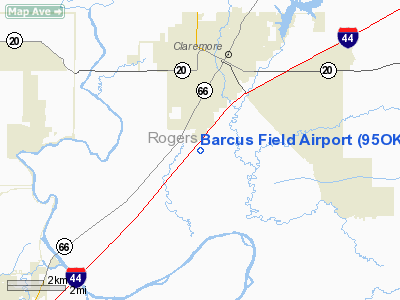
Location & QuickFacts
| FAA Information Effective: | 2008-09-25 |
| Airport Identifier: | 95OK |
| Airport Status: | Operational |
| Longitude/Latitude: | 095-37-50.5200W/36-16-03.3400N
-95.630700/36.267594 (Estimated) |
| Elevation: | 660 ft / 201.17 m (Estimated) |
| Land: | 66 acres |
| From nearest city: | 3 nautical miles N of Claremore, OK |
| Location: | Rogers County, OK |
| Magnetic Variation: | 05E (1995) |
Owner & Manager
| Ownership: | Privately owned |
| Owner: | Larry Melton |
| Address: | Po Box 1028, 23955 S. 4140 Rd
Claremore, OK 74018
PHYSICAL ADDRESS FOR AIRPORT |
| Phone number: | 918-344-3094 |
| Manager: | Larry Melton |
| Address: | Po Box 1028, 23955 S. 4140 Rd.
Claremore, OK 74018
PHYSICAL ADDRESS FOR AIRPORT |
| Phone number: | 918-344-3094 |
Airport Operations and Facilities
| Airport Use: | Private |
| Segmented Circle: | No |
| Control Tower: | No |
| Sectional chart: | Kansas City |
| Region: | ASW - Southwest |
| Boundary ARTCC: | ZKC - Kansas City |
| Tie-in FSS: | MLC - Mc Alester |
| FSS on Airport: | No |
| FSS Toll Free: | 1-800-WX-BRIEF |
Runway Information
Runway 17/35
| Dimension: | 2500 x 50 ft / 762.0 x 15.2 m |
| Surface: | TURF, |
| |
Runway 17 |
Runway 35 |
| Traffic Pattern: | Right | Left |
| Obstruction: | 17 ft road, 350.0 ft from runway | 15 ft road, 20.0 ft from runway |
|
Radio Navigation Aids
| ID |
Type |
Name |
Ch |
Freq |
Var |
Dist |
| DW | NDB | Owaso | | 375.00 | 06E | 12.1 nm |
| OWP | NDB | William Pogue | | 362.00 | 06E | 26.0 nm |
| TQH | NDB | Tahlequah | | 215.00 | 05E | 36.6 nm |
| MKO | NDB | Muskogee | | 306.00 | 06E | 43.8 nm |
| TZO | NDB | Bristow | | 251.00 | 05E | 48.8 nm |
| CFV | NDB | Coffeyville | | 212.00 | 05E | 49.7 nm |
| MEE | VOR | Davis | | 108.60 | 06E | 38.5 nm |
| GNP | VOR/DME | Glenpool | 043X | 110.60 | 06E | 26.5 nm |
| OKM | VOR/DME | Okmulgee | 096X | 114.90 | 08E | 36.4 nm |
| BVO | VOR/DME | Bartlesville | 126X | 117.90 | 08E | 38.9 nm |
| TUL | VORTAC | Tulsa | 091X | 114.40 | 08E | 8.8 nm |
| TUL | VOT | Tulsa Intl | | 109.00 | | 8.8 nm |
Remarks
- PRVDD ALL TFC PATTERNS RSTRD TO W SIDE OF FIELD; RY LNDG THLDS DSPLCD IF NECESSARY TO PROVIDE 20:1 CLEARANCE IN APCH AREAS.
Images and information placed above are from
http://www.airport-data.com/airport/95OK/
We thank them for the data!
| General Info
|
| Country |
United States
|
| State |
OKLAHOMA
|
| FAA ID |
95OK
|
| Latitude |
36-16-03.340N
|
| Longitude |
095-37-50.520W
|
| Elevation |
660 feet
|
| Near City |
CLAREMORE
|
We don't guarantee the information is fresh and accurate. The data may
be wrong or outdated.
For more up-to-date information please refer to other sources.
|
|


