 |
|
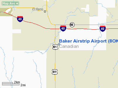
Location & QuickFacts
| FAA Information Effective: | 2008-09-25 |
| Airport Identifier: | 8OK2 |
| Airport Status: | Operational |
| Longitude/Latitude: | 097-55-43.9700W/35-28-30.1900N
-97.928881/35.475053 (Estimated) |
| Elevation: | 1370 ft / 417.58 m (Estimated) |
| Land: | 20 acres |
| From nearest city: | 3 nautical miles S of El Reno, OK |
| Location: | Canadian County, OK |
| Magnetic Variation: | 07E (1995) |
Owner & Manager
| Ownership: | Privately owned |
| Owner: | Glen & Kim Baker |
| Address: | Po Box 850718
Yukon, OK 73085 |
| Phone number: | 405-686-5559 |
| Manager: | Glen Baker |
| Address: | Po Box 850718
Yukon, OK 73085 |
| Phone number: | 405-686-5559 |
Airport Operations and Facilities
| Airport Use: | Private |
| Segmented Circle: | No |
| Control Tower: | No |
| Sectional chart: | Dallas-ft Worth |
| Region: | ASW - Southwest |
| Boundary ARTCC: | ZFW - Fort Worth |
| Tie-in FSS: | MLC - Mc Alester |
| FSS on Airport: | No |
| FSS Toll Free: | 1-800-WX-BRIEF |
Runway Information
Runway 17/35
| Dimension: | 2400 x 200 ft / 731.5 x 61.0 m |
| Surface: | TURF, |
| |
Runway 17 |
Runway 35 |
| Traffic Pattern: | Left | Left |
| Displaced threshold: | 0.00 ft | 300.00 ft
DSPLCD THLD MKD BY RED FLAG. |
| Obstruction: | | 3 ft fence, 10.0 ft from runway |
|
Radio Navigation Aids
| ID |
Type |
Name |
Ch |
Freq |
Var |
Dist |
| FSI | FAN MARKER | Trail | | | 09E | 47.8 nm |
| RQO | NDB | El Reno | | 335.00 | 07E | 3.9 nm |
| OK | NDB | Tuloo | | 406.00 | 07E | 15.8 nm |
| OLR | NDB | Chickasha | | 290.00 | 07E | 22.4 nm |
| OUN | NDB | Norman | | 260.00 | 07E | 26.3 nm |
| LCY | NDB | Logan County | | 326.00 | 07E | 33.5 nm |
| JWG | NDB | Watonga | | 359.00 | 07E | 33.6 nm |
| OJA | NDB | Weatherford | | 272.00 | 07E | 36.4 nm |
| OFZ | NDB | Trail | | 388.00 | 09E | 47.8 nm |
| CLK | NDB | Clinton | | 320.00 | 07E | 49.4 nm |
| TIK | TACAN | Tinker | 105X | | 07E | 27.0 nm |
| PWA | VOR/DME | Wiley Post | 081X | 113.40 | 08E | 14.2 nm |
| IRW | VORTAC | Will Rogers | 088X | 114.10 | 07E | 17.2 nm |
| IFI | VORTAC | Kingfisher | 094X | 114.70 | 09E | 20.2 nm |
| OKC | VOT | Oklahoma Will Rgs W | | 108.80 | | 16.8 nm |
Remarks
- PRVDD THE PROPER DSPLCD RY THLDS ARE MADE.
Images and information placed above are from
http://www.airport-data.com/airport/8OK2/
We thank them for the data!
| General Info
|
| Country |
United States
|
| State |
OKLAHOMA
|
| FAA ID |
8OK2
|
| Latitude |
35-28-30.190N
|
| Longitude |
097-55-43.970W
|
| Elevation |
1370 feet
|
| Near City |
EL RENO
|
We don't guarantee the information is fresh and accurate. The data may
be wrong or outdated.
For more up-to-date information please refer to other sources.
|
|


