 |
|
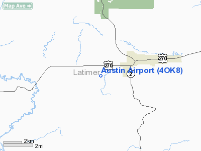
Location & QuickFacts
| FAA Information Effective: | 2008-09-25 |
| Airport Identifier: | 4OK8 |
| Airport Status: | Operational |
| Longitude/Latitude: | 095-21-31.9050W/34-54-11.3550N
-95.358863/34.903154 (Estimated) |
| Elevation: | 675 ft / 205.74 m (Estimated) |
| Land: | 0 acres |
| From nearest city: | 3 nautical miles SW of Wilburton, OK |
| Location: | Latimer County, OK |
| Magnetic Variation: | 06E (1985) |
Owner & Manager
| Ownership: | Privately owned |
| Owner: | Wayne L Austin |
| Address: | Rt 1 Box 385b
Wilburton, OK 74578 |
| Phone number: | 918-465-3756 |
| Manager: | Wayne L. Austin |
| Address: | Rt 1 Box 385b
Wilburton, OK 74578 |
| Phone number: | 918-465-3756 |
Airport Operations and Facilities
| Airport Use: | Private |
| Wind indicator: | Yes |
| Segmented Circle: | No |
| Control Tower: | No |
| Landing fee charge: | No |
| Sectional chart: | Dallas-ft Worth |
| Region: | ASW - Southwest |
| Boundary ARTCC: | ZFW - Fort Worth |
| Tie-in FSS: | MLC - Mc Alester |
| FSS on Airport: | No |
| FSS Toll Free: | 1-800-WX-BRIEF |
Airport Services
| Airframe Repair: | MINOR |
| Power Plant Repair: | MINOR |
Runway Information
Runway N/S
| Dimension: | 1600 x 25 ft / 487.7 x 7.6 m |
| Surface: | TURF, |
| |
Runway N |
Runway S |
| Traffic Pattern: | Left | Left |
| Obstruction: | , 600.0 ft from runway | 6 ft fence |
|
Radio Navigation Aids
| ID |
Type |
Name |
Ch |
Freq |
Var |
Dist |
| IQS | NDB | Sallisaw | | 520.00 | 05E | 40.7 nm |
| MKO | NDB | Muskogee | | 306.00 | 06E | 41.7 nm |
| HET | NDB | Henryetta | | 267.00 | 04E | 44.1 nm |
| AEE | NDB | Antlers | | 391.00 | 05E | 45.2 nm |
| MEE | VOR | Davis | | 108.60 | 06E | 45.7 nm |
| MLC | VORTAC | Mc Alester | 057X | 112.00 | 08E | 21.1 nm |
| PGO | VORTAC | Rich Mountain | 082X | 113.50 | 04E | 39.4 nm |
Remarks
- WATCH FOR LIVESTOCK ON FLD.
- CONDITIONS SATISFIED DUE/RWY ALIGNMENT.
Images and information placed above are from
http://www.airport-data.com/airport/4OK8/
We thank them for the data!
| General Info
|
| Country |
United States
|
| State |
OKLAHOMA
|
| FAA ID |
4OK8
|
| Latitude |
34-54-11.355N
|
| Longitude |
095-21-31.905W
|
| Elevation |
675 feet
|
| Near City |
WILBURTON
|
We don't guarantee the information is fresh and accurate. The data may
be wrong or outdated.
For more up-to-date information please refer to other sources.
|
|


