 |
|
Location & QuickFacts
| FAA Information Effective: | 2008-09-25 |
| Airport Identifier: | OK26 |
| Airport Status: | Operational |
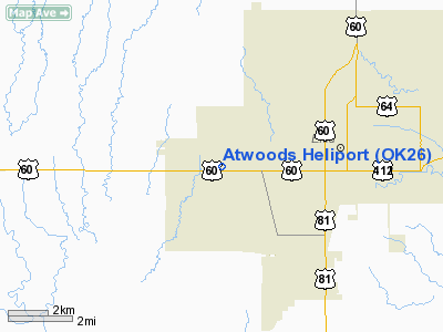
| Longitude/Latitude: | 097-56-52.0000W/36-23-34.0000N
-97.947778/36.392778 (Estimated) |
| Elevation: | 1296 ft / 395.02 m (Estimated) |
| Land: | 0 acres |
| From nearest city: | 3 nautical miles W of Enid, OK |
| Location: | Garfield County, OK |
| Magnetic Variation: | () |
Owner & Manager
| Ownership: | Privately owned |
| Owner: | Atwood Distributing Lp |
| Address: | 500 South Garland Rd
Enid, OK 73703 |
| Phone number: | 580-233-3702 |
| Manager: | Brian Atwood |
| Address: | 500 South Garland Rd
Enid, OK 73703 |
| Phone number: | 580-233-3702 |
Airport Operations and Facilities
| Airport Use: | Private |
| Control Tower: | No |
| Sectional chart: | Wichita |
| Region: | ASW - Southwest |
| Boundary ARTCC: | ZKC - Kansas City |
| Tie-in FSS: | MLC - Mc Alester |
| FSS Toll Free: | 1-800-WX-BRIEF |
Runway Information
Helipad H1
| Dimension: | 100 x 75 ft / 30.5 x 22.9 m |
| Surface: | CONC, |
| |
Runway H1 |
Runway |
| Traffic Pattern: | Left | Left |
|
Radio Navigation Aids
| ID |
Type |
Name |
Ch |
Freq |
Var |
Dist |
| FAU | NDB | Fairview | | 246.00 | 07E | 26.5 nm |
| JWG | NDB | Watonga | | 359.00 | 07E | 39.4 nm |
| LCY | NDB | Logan County | | 326.00 | 07E | 41.8 nm |
| AVK | NDB | Alva | | 203.00 | 08E | 41.9 nm |
| PN | NDB | Ponca | | 515.00 | 05E | 48.4 nm |
| ODG | VOR/DME | Woodring | 027X | 109.00 | 08E | 7.8 nm |
| SWO | VOR/DME | Stillwater | 021X | 108.40 | 07E | 43.2 nm |
| END | VORTAC | Vance | 101X | 115.40 | 09E | 3.2 nm |
| IFI | VORTAC | Kingfisher | 094X | 114.70 | 09E | 35.4 nm |
| PER | VORTAC | Pioneer | 079X | 113.20 | 06E | 43.6 nm |
| ANY | VORTAC | Anthony | 076X | 112.90 | 07E | 47.3 nm |
Remarks
- PRVDD ALL OPNL PROCEDURES ARE COORDINATED WITH THE ATCT CHIEF OF VANCE AFB.
Images and information placed above are from
http://www.airport-data.com/airport/OK26/
We thank them for the data!
|
|


