 |
|
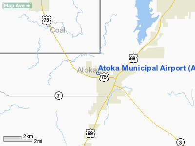
Location & QuickFacts
| FAA Information Effective: | 2008-09-25 |
| Airport Identifier: | AQR |
| Airport Status: | Operational |
| Longitude/Latitude: | 096-08-53.0150W/34-23-54.0200N
-96.148060/34.398339 (Estimated) |
| Elevation: | 590 ft / 179.83 m (Surveyed) |
| Land: | 490 acres |
| From nearest city: | 1 nautical miles NW of Atoka, OK |
| Location: | Atoka County, OK |
| Magnetic Variation: | 06E (1985) |
Owner & Manager
| Ownership: | Publicly owned |
| Owner: | City Of Atoka |
| Address: | 315 East A Street, City Hall
Atoka, OK 74525 |
| Phone number: | 580-889-3341 |
| Manager: | Don Walker
CITY MANAGER. |
| Address: | 315 East A Street, City Hall
Atoka, OK 74525 |
| Phone number: | 580-889-3341
OR 580-889-3250. |
Airport Operations and Facilities
| Airport Use: | Open to public |
| Wind indicator: | Yes |
| Segmented Circle: | Yes |
| Control Tower: | No |
| Lighting Schedule: | DUSK-DAWN |
| Beacon Color: | Clear-Green (lighted land airport) |
| Landing fee charge: | No |
| Sectional chart: | Dallas-ft Worth |
| Region: | ASW - Southwest |
| Boundary ARTCC: | ZFW - Fort Worth |
| Tie-in FSS: | MLC - Mc Alester |
| FSS on Airport: | No |
| FSS Toll Free: | 1-800-WX-BRIEF |
| NOTAMs Facility: | AQR (NOTAM-d service avaliable) |
| Federal Agreements: | N |
Airport Communications
Airport Services
| Fuel available: | 100LL
FUEL AVBL 24 HR WITH AUTOMATED CREDIT CARD SYSTEM. |
Runway Information
Runway 18/36
| Dimension: | 3015 x 40 ft / 919.0 x 12.2 m |
| Surface: | ASPH, Good Condition |
| Weight Limit: | Single wheel: 4000 lbs. |
| Edge Lights: | Medium |
| |
Runway 18 |
Runway 36 |
| Longitude: | 096-08-50.7400W | 096-08-55.2900W |
| Latitude: | 34-24-08.8100N | 34-23-39.2300N |
| Elevation: | 588.00 ft | 579.00 ft |
| Alignment: | 127 | 7 |
| Traffic Pattern: | Left | Left |
| Markings: | Basic, Fair Condition | Basic, Fair Condition |
| Displaced threshold: | 197.00 ft | 233.00 ft |
| Obstruction: | 120 ft trees, 1350.0 ft from runway, 9:1 slope to clear
APCH SLOPE 12:1 TO DSPLCD THLD.
+25 FT TREES WEST SIDE RY 18 END. | 36 ft trees, 450.0 ft from runway, 6:1 slope to clear
APCH SLOPE 18:1 TO DSPLCD THLD; FM +15 FT ROAD 259 FT FM DSPLCD THLD 0B.
15 FT HWY 35 FT FM RY END; +3 FT FENCE 6 FT FM RY END. |
|
Radio Navigation Aids
| ID |
Type |
Name |
Ch |
Freq |
Var |
Dist |
| AEE | NDB | Antlers | | 391.00 | 05E | 27.6 nm |
| DUA | NDB | Durant | | 359.00 | 05E | 30.1 nm |
| HHW | NDB | Hugo | | 323.00 | 05E | 37.1 nm |
| DNI | NDB | Denison | | 341.00 | 06E | 43.2 nm |
| HDL | NDB | Holdenville | | 411.00 | 06E | 43.3 nm |
| HJM | NDB | Rayburn | | 415.00 | 06E | 47.2 nm |
| URH | VOR/DME | Texoma | 090X | 114.30 | 05E | 29.9 nm |
| ADH | VOR/DME | Ada | 125X | 117.80 | 06E | 35.5 nm |
| MLC | VORTAC | Mc Alester | 057X | 112.00 | 08E | 32.6 nm |
Images and information placed above are from
http://www.airport-data.com/airport/AQR/
We thank them for the data!
| General Info
|
| Country |
United States
|
| State |
OKLAHOMA
|
| FAA ID |
AQR
|
| Latitude |
34-23-54.020N
|
| Longitude |
096-08-53.015W
|
| Elevation |
590 feet
|
| Near City |
ATOKA
|
We don't guarantee the information is fresh and accurate. The data may
be wrong or outdated.
For more up-to-date information please refer to other sources.
|
|


