 |
|
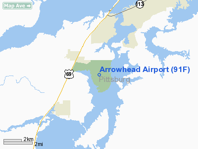
Location & QuickFacts
| FAA Information Effective: | 2008-09-25 |
| Airport Identifier: | 91F |
| Airport Status: | Operational |
| Longitude/Latitude: | 095-37-16.5100W/35-09-22.8600N
-95.621253/35.156350 (Estimated) |
| Elevation: | 851 ft / 259.38 m (Estimated) |
| Land: | 52 acres |
| From nearest city: | 3 nautical miles E of Canadian, OK |
| Location: | Pittsburg County, OK |
| Magnetic Variation: | 06E (1985) |
Owner & Manager
| Ownership: | Publicly owned |
| Owner: | Corps Of Engineers |
| Address: | Div Of Tourism & Rec., Lessee, Po Box 52002
Oklahoma City, OK 73105 |
| Phone number: | 405-521-3411 |
| Manager: | Roger Cunningham |
| Address: | Hc 67 Box 57
Canadian, OK 74425 |
| Phone number: | 918-339-2204 |
Airport Operations and Facilities
| Airport Use: | Open to public |
| Wind indicator: | Yes |
| Segmented Circle: | Yes |
| Control Tower: | No |
| Lighting Schedule: | DUSK-DAWN |
| Beacon Color: | Clear-Green (lighted land airport)
ROTG BCN OTS INDEFLY. |
| Landing fee charge: | No |
| Sectional chart: | Dallas-ft Worth |
| Region: | ASW - Southwest |
| Boundary ARTCC: | ZFW - Fort Worth |
| Tie-in FSS: | MLC - Mc Alester |
| FSS on Airport: | No |
| FSS Toll Free: | 1-800-WX-BRIEF |
| NOTAMs Facility: | MLC (NOTAM-d service avaliable) |
| Federal Agreements: | NGY |
Airport Communications
Airport Services
| Airframe Repair: | NONE |
| Power Plant Repair: | NONE |
| Bottled Oxygen: | NONE |
| Bulk Oxygen: | NONE |
Runway Information
Runway 15/33
| Dimension: | 3500 x 60 ft / 1066.8 x 18.3 m |
| Surface: | ASPH, |
| Pavement Class: | 5 /F/C/Y/T |
| Weight Limit: | Single wheel: 19000 lbs. |
| |
Runway 15 |
Runway 33 |
| Longitude: | 095-37-23.3500W | 095-37-09.6600W |
| Latitude: | 35-09-39.2300N | 35-09-06.4900N |
| Traffic Pattern: | Left | Left |
| Markings: | Basic, Good Condition | Basic, Good Condition |
| Displaced threshold: | 0.00 ft | 125.00 ft |
| Obstruction: | 55 ft trees, 412.0 ft from runway, 3:1 slope to clear | 20 ft pline, 500.0 ft from runway, 15:1 slope to clear |
|
Radio Navigation Aids
| ID |
Type |
Name |
Ch |
Freq |
Var |
Dist |
| HET | NDB | Henryetta | | 267.00 | 04E | 24.4 nm |
| MKO | NDB | Muskogee | | 306.00 | 06E | 31.0 nm |
| HDL | NDB | Holdenville | | 411.00 | 06E | 39.2 nm |
| IQS | NDB | Sallisaw | | 520.00 | 05E | 43.1 nm |
| MEE | VOR | Davis | | 108.60 | 06E | 32.9 nm |
| OKM | VOR/DME | Okmulgee | 096X | 114.90 | 08E | 34.4 nm |
| GNP | VOR/DME | Glenpool | 043X | 110.60 | 06E | 49.0 nm |
| MLC | VORTAC | Mc Alester | 057X | 112.00 | 08E | 20.1 nm |
Remarks
Images and information placed above are from
http://www.airport-data.com/airport/91F/
We thank them for the data!
| General Info
|
| Country |
United States
|
| State |
OKLAHOMA
|
| FAA ID |
91F
|
| Latitude |
35-09-15.352N
|
| Longitude |
095-37-12.950W
|
| Elevation |
851 feet
|
| Near City |
CANADIAN
|
We don't guarantee the information is fresh and accurate. The data may
be wrong or outdated.
For more up-to-date information please refer to other sources.
|
|


