 |
|
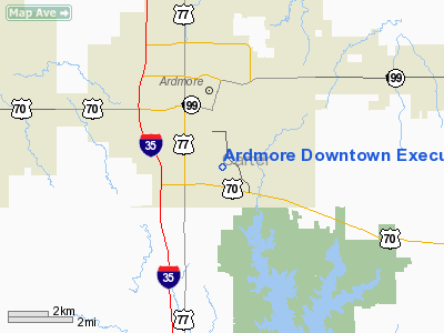
Ardmore Downtown Executive Airport |
| Ardmore Downtown Executive Airport |
| IATA: AHD – ICAO: none – FAA LID: 1F0 |
| Summary |
| Airport type |
Public |
| Owner |
City of Ardmore |
| Location |
Ardmore, Oklahoma |
| Elevation AMSL |
844 ft / 257 m |
| Coordinates |
34°08′49″N 097°07′22″W / 34.14694°N 97.12278°W / 34.14694; -97.12278 |
| Runways |
| Direction |
Length |
Surface |
| ft |
m |
| 17/35 |
5,000 |
1,524 |
Asphalt |
| Statistics (2005) |
| Aircraft operations |
11,200 |
| Based aircraft |
43 |
| Source: Federal Aviation Administration |
Ardmore Downtown Executive Airport (IATA: AHD, FAA LID: 1F0) is a city-owned public-use airport located one mile (2 km) southeast of the central business district of Ardmore, a city in Carter County, Oklahoma, United States.
Facilities and aircraft
Ardmore Downtown Executive Airport covers an area of 110 acres (45 ha) which contains one asphalt paved runway (17/35) measuring 5,000 x 75 ft (1,524 x 23 m). For the 12-month period ending July 5, 2005, the airport had 11,200 general aviation aircraft operations, an average of 30 per day. There are 43 aircraft based at this airport: 74% single-engine, 14% multi-engine, 5% jet, 5% helicopter and 2% ultralight.
The above content comes from Wikipedia and is published under free licenses – click here to read more.
Location & QuickFacts
| FAA Information Effective: | 2008-09-25 |
| Airport Identifier: | 1F0 |
| Airport Status: | Operational |
| Longitude/Latitude: | 097-07-21.5470W/34-08-49.1610N
-97.122652/34.146989 (Estimated) |
| Elevation: | 844 ft / 257.25 m (Surveyed) |
| Land: | 110 acres |
| From nearest city: | 1 nautical miles SE of Ardmore, OK |
| Location: | Carter County, OK |
| Magnetic Variation: | 07E (1985) |
Owner & Manager
| Ownership: | Publicly owned |
| Owner: | City Of Ardmore |
| Address: | Po Box 249
Ardmore, OK 73402 |
| Phone number: | 580-223-2933 |
| Manager: | Bruce Cypert |
| Address: | Box 249
Ardmore, OK 73402 |
| Phone number: | 580-221-2535 |
Airport Operations and Facilities
| Airport Use: | Open to public |
| Wind indicator: | Yes |
| Segmented Circle: | Yes |
| Control Tower: | No |
| Lighting Schedule: | DUSK-DAWN
ACTVT MIRL RY 17/35 & REIL RYS 17 & 35 - CTAF. |
| Beacon Color: | Clear-Green (lighted land airport)
ROTG BCN OTS INDEFLY. |
| Landing fee charge: | No |
| Sectional chart: | Dallas-ft Worth |
| Region: | ASW - Southwest |
| Traffic Pattern Alt: | 956 ft |
| Boundary ARTCC: | ZFW - Fort Worth |
| Tie-in FSS: | MLC - Mc Alester |
| FSS on Airport: | No |
| FSS Toll Free: | 1-800-WX-BRIEF |
| NOTAMs Facility: | 1F0 (NOTAM-d service avaliable) |
| Federal Agreements: | NGY |
Airport Communications
| CTAF: | 122.700 |
| Unicom: | 122.700 |
Airport Services
| Fuel available: | 100LLA
FUEL AVBL 24 HRS WITH CREDIT CARD. |
| Bottled Oxygen: | NONE |
Runway Information
Runway 17/35
| Dimension: | 5000 x 75 ft / 1524.0 x 22.9 m |
| Surface: | ASPH, Good Condition |
| Pavement Class: | 3 /F/B/X/T |
| Weight Limit: | Single wheel: 20000 lbs. |
| Edge Lights: | Medium |
| |
Runway 17 |
Runway 35 |
| Longitude: | 097-07-21.9720W | 097-07-21.1210W |
| Latitude: | 34-09-13.8890N | 34-08-24.4330N |
| Elevation: | 839.00 ft | 844.00 ft |
| Alignment: | 127 | 127 |
| Traffic Pattern: | Left | Right |
| Markings: | Non-precision instrument, Good Condition | Non-precision instrument, Good Condition |
| Crossing Height: | 30.00 ft | 30.00 ft |
| VASI: | 4-light PAPI on left side | 4-light PAPI on left side |
| Visual Glide Angle: | 4.00° | 3.00° |
| Runway End Identifier: | Yes | Yes |
| Obstruction: | 50 ft trees, 250.0 ft from runway, 150 ft right of centerline, 1:1 slope to clear | , 50:1 slope to clear
+10 FT HILL 0-200 FT FM RY END & 200 FT L. |
|
Radio Navigation Aids
| ID |
Type |
Name |
Ch |
Freq |
Var |
Dist |
| AUV | NDB | Arbuckle | | 284.00 | 07E | 0.2 nm |
| GLE | NDB | Gainesville | | 330.00 | 06E | 26.0 nm |
| DNI | NDB | Denison | | 341.00 | 06E | 29.8 nm |
| PVJ | NDB | Pauls Valley | | 384.00 | 06E | 34.6 nm |
| DUA | NDB | Durant | | 359.00 | 05E | 38.0 nm |
| GMZ | NDB | Grindstone Mountain | | 356.00 | 07E | 46.0 nm |
| URH | VOR/DME | Texoma | 090X | 114.30 | 05E | 38.4 nm |
| DUC | VOR/DME | Duncan | 047X | 111.00 | 09E | 42.0 nm |
| ADH | VOR/DME | Ada | 125X | 117.80 | 06E | 45.3 nm |
| ADM | VORTAC | Ardmore | 114X | 116.70 | 06E | 4.5 nm |
Remarks
- PRECIPITOUS TERRAIN AT SOUTH END OF TWY.
- GCO AVBL ON FREQ 121.725 THRU FLT SVCS.
- ULTRALIGHTS ON & INVOF ARPT.
Images and information placed above are from
http://www.airport-data.com/airport/1F0/
We thank them for the data!
| General Info
|
| Country |
United States
|
| State |
OKLAHOMA
|
| FAA ID |
1F0
|
| Latitude |
34-08-49.161N
|
| Longitude |
097-07-21.547W
|
| Elevation |
844 feet
|
| Near City |
ARDMORE
|
We don't guarantee the information is fresh and accurate. The data may
be wrong or outdated.
For more up-to-date information please refer to other sources.
|
|


