 |
|
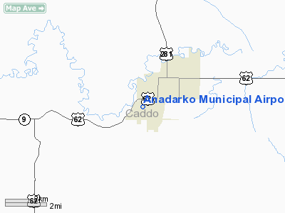
Location & QuickFacts
| FAA Information Effective: | 2008-09-25 |
| Airport Identifier: | F68 |
| Airport Status: | Operational |
| Longitude/Latitude: | 098-15-51.5000W/35-03-07.9000N
-98.264306/35.052194 (Estimated) |
| Elevation: | 1286 ft / 391.97 m (Surveyed) |
| Land: | 175 acres |
| From nearest city: | 2 nautical miles SW of Anadarko, OK |
| Location: | Caddo County, OK |
| Magnetic Variation: | 07E (1985) |
Owner & Manager
| Ownership: | Publicly owned |
| Owner: | City Of Anadarko |
| Address: | City Hall, Box 647
Anadarko, OK 73005 |
| Phone number: | 405-247-2481 |
| Manager: | Robert Mccoin
CITY PLANNING DIRECTOR. |
| Address: | City Hall Box 647
Anadarko, OK 73005 |
| Phone number: | 405-247-2481 |
Airport Operations and Facilities
| Airport Use: | Open to public |
| Wind indicator: | Yes |
| Segmented Circle: | Yes |
| Control Tower: | No |
| Lighting Schedule: | DUSK-DAWN |
| Beacon Color: | Clear-Green (lighted land airport) |
| Landing fee charge: | No |
| Sectional chart: | Dallas-ft Worth |
| Region: | ASW - Southwest |
| Boundary ARTCC: | ZFW - Fort Worth |
| Tie-in FSS: | MLC - Mc Alester |
| FSS on Airport: | No |
| FSS Toll Free: | 1-800-WX-BRIEF |
| NOTAMs Facility: | MLC (NOTAM-d service avaliable) |
Airport Communications
Airport Services
| Fuel available: | 100LL
FUEL AVBL BY PHONE REQ 405-247-2481 BTN 0800-1700. AFT HRS CALL POLICE 405-247-2411. |
| Airframe Repair: | NONE |
| Power Plant Repair: | NONE |
| Bottled Oxygen: | NONE |
| Bulk Oxygen: | NONE |
Runway Information
Runway 17/35
| Dimension: | 3100 x 50 ft / 944.9 x 15.2 m |
| Surface: | ASPH, Good Condition |
| Weight Limit: | Single wheel: 12500 lbs. |
| Edge Lights: | Low |
| |
Runway 17 |
Runway 35 |
| Longitude: | 098-15-51.0000W | 098-15-51.9900W |
| Latitude: | 35-03-23.2200N | 35-02-52.5700N |
| Traffic Pattern: | Left | Left |
| Markings: | Basic, Good Condition | Basic, Good Condition |
| Obstruction: | 15 ft road, 471.0 ft from runway, 18:1 slope to clear | 75 ft trees, 1332.0 ft from runway, 15:1 slope to clear |
|
Radio Navigation Aids
| ID |
Type |
Name |
Ch |
Freq |
Var |
Dist |
| FSI | FAN MARKER | Trail | | | 09E | 17.6 nm |
| OLR | NDB | Chickasha | | 290.00 | 07E | 14.7 nm |
| OFZ | NDB | Trail | | 388.00 | 09E | 17.6 nm |
| PFL | NDB | Post | | 308.00 | 08E | 27.5 nm |
| RQO | NDB | El Reno | | 335.00 | 07E | 28.5 nm |
| OJA | NDB | Weatherford | | 272.00 | 07E | 35.0 nm |
| OUN | NDB | Norman | | 260.00 | 07E | 40.8 nm |
| OK | NDB | Tuloo | | 406.00 | 07E | 41.0 nm |
| CLK | NDB | Clinton | | 320.00 | 07E | 44.0 nm |
| JWG | NDB | Watonga | | 359.00 | 07E | 49.3 nm |
| TIK | TACAN | Tinker | 105X | | 07E | 49.2 nm |
| LAW | VOR/DME | Lawton | 031X | 109.40 | 09E | 34.2 nm |
| PWA | VOR/DME | Wiley Post | 081X | 113.40 | 08E | 41.9 nm |
| DUC | VOR/DME | Duncan | 047X | 111.00 | 09E | 43.7 nm |
| IRW | VORTAC | Will Rogers | 088X | 114.10 | 07E | 37.1 nm |
| HBR | VORTAC | Hobart | 055X | 111.80 | 10E | 40.9 nm |
| IFI | VORTAC | Kingfisher | 094X | 114.70 | 09E | 47.0 nm |
| BFV | VORTAC | Burns Flat | 037X | 110.00 | 08E | 47.6 nm |
| OKC | VOT | Oklahoma Will Rgs W | | 108.80 | | 38.5 nm |
Remarks
- ULTRALIGHT ACTIVITY ON & INVOF ARPT.
- ESTAB PRIOR TO 1959.
Images and information placed above are from
http://www.airport-data.com/airport/F68/
We thank them for the data!
| General Info
|
| Country |
United States
|
| State |
OKLAHOMA
|
| FAA ID |
F68
|
| Latitude |
35-03-15.224N
|
| Longitude |
098-15-46.186W
|
| Elevation |
1286 feet
|
| Near City |
ANADARKO
|
We don't guarantee the information is fresh and accurate. The data may
be wrong or outdated.
For more up-to-date information please refer to other sources.
|
|


