 |
|
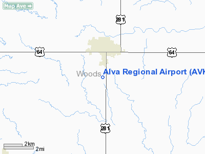
Location & QuickFacts
| FAA Information Effective: | 2008-09-25 |
| Airport Identifier: | AVK |
| Airport Status: | Operational |
| Longitude/Latitude: | 098-40-11.8060W/36-46-23.4120N
-98.669946/36.773170 (Estimated) |
| Elevation: | 1474 ft / 449.28 m (Surveyed) |
| Land: | 650 acres |
| From nearest city: | 2 nautical miles S of Alva, OK |
| Location: | Woods County, OK |
| Magnetic Variation: | 08E (1985) |
Owner & Manager
| Ownership: | Publicly owned |
| Owner: | City Of Alva |
| Address: | Municipal Bldg 415 4th St.
Alva, OK 73717 |
| Phone number: | 580-327-1340 |
| Manager: | Gerald Benson |
| Address: | 2875 College Blvd.
Alva, OK 73717 |
| Phone number: | 580-327-2898 |
Airport Operations and Facilities
| Airport Use: | Open to public |
| Wind indicator: | Yes |
| Segmented Circle: | Yes |
| Control Tower: | No |
| Lighting Schedule: | DUSK-DAWN |
| Beacon Color: | Clear-Green (lighted land airport) |
| Landing fee charge: | No |
| Sectional chart: | Wichita |
| Region: | ASW - Southwest |
| Boundary ARTCC: | ZKC - Kansas City |
| Tie-in FSS: | MLC - Mc Alester |
| FSS on Airport: | No |
| FSS Toll Free: | 1-800-WX-BRIEF |
| NOTAMs Facility: | AVK (NOTAM-d service avaliable) |
| Federal Agreements: | NGSY |
Airport Communications
| CTAF: | 122.800 |
| Unicom: | 122.800 |
Airport Services
| Fuel available: | 100LLA
24 HR. AUTOMATED CREDIT CARD SYSTEM. |
| Airframe Repair: | MINOR |
| Power Plant Repair: | MINOR |
| Bottled Oxygen: | NONE |
| Bulk Oxygen: | NONE |
Runway Information
Runway 08/26
| Dimension: | 1850 x 170 ft / 563.9 x 51.8 m |
| Surface: | TURF, Fair Condition
GOPHER HOLES IN RY. |
| |
Runway 08 |
Runway 26 |
| Longitude: | 098-40-31.3060W | 098-40-08.3060W |
| Latitude: | 36-46-10.1120N | 36-46-10.1120N |
| Elevation: | 1470.00 ft | 0.00 ft |
| Alignment: | 90 | 127 |
| Traffic Pattern: | Left | Left |
| Obstruction: | , 50:1 slope to clear | 35 ft pline, 880.0 ft from runway, 25:1 slope to clear |
|
Runway 17/35
| Dimension: | 4386 x 75 ft / 1336.9 x 22.9 m |
| Surface: | ASPH, Good Condition
GOPHER HOLES IN RY. |
| Pavement Class: | 4 /F/B/X/T |
| Weight Limit: | Single wheel: 15000 lbs. |
| Edge Lights: | Medium |
| |
Runway 17 |
Runway 35 |
| Longitude: | 098-40-08.4610W | 098-40-08.5850W |
| Latitude: | 36-46-50.6400N | 36-46-07.2730N |
| Elevation: | 1473.00 ft | 1468.00 ft |
| Alignment: | 127 | 127 |
| Traffic Pattern: | Left | Left |
| Markings: | Basic, Good Condition | Non-precision instrument, Good Condition |
| Crossing Height: | 52.00 ft | 0.00 ft |
| Displaced threshold: | 0.00 ft | 145.00 ft |
| VASI: | 2-light PAPI on left side | 2-light PAPI on left side |
| Visual Glide Angle: | 3.00° | 0.00° |
| Obstruction: | 30 ft bldg, 1185.0 ft from runway, 230 ft left of centerline, 32:1 slope to clear | , 50:1 slope to clear
APCH RATIO 50:1 FROM DSPLCD THR. |
|
Radio Navigation Aids
| ID |
Type |
Name |
Ch |
Freq |
Var |
Dist |
| AVK | NDB | Alva | | 203.00 | 08E | 0.4 nm |
| MDF | NDB | Mooreland/dcmsnd | | 284.00 | 08E | 30.6 nm |
| FAU | NDB | Fairview | | 246.00 | 07E | 30.8 nm |
| OWU | NDB | West Woodward | | 329.00 | 08E | 46.0 nm |
| BFK | NDB | Buffalo | | 215.00 | 08E | 46.0 nm |
| ODG | VOR/DME | Woodring | 027X | 109.00 | 08E | 48.9 nm |
| ANY | VORTAC | Anthony | 076X | 112.90 | 07E | 33.4 nm |
| END | VORTAC | Vance | 101X | 115.40 | 09E | 44.4 nm |
Images and information placed above are from
http://www.airport-data.com/airport/AVK/
We thank them for the data!
| General Info
|
| Country |
United States
|
| State |
OKLAHOMA
|
| FAA ID |
AVK
|
| Latitude |
36-46-23.412N
|
| Longitude |
098-40-11.806W
|
| Elevation |
1474 feet
|
| Near City |
ALVA
|
We don't guarantee the information is fresh and accurate. The data may
be wrong or outdated.
For more up-to-date information please refer to other sources.
|
|


