 |
|
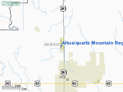
Altus/quartz Mountain Rgnl Airport |
Location & QuickFacts
| FAA Information Effective: | 2008-09-25 |
| Airport Identifier: | AXS |
| Airport Status: | Operational |
| Longitude/Latitude: | 099-20-18.5000W/34-41-55.7000N
-99.338472/34.698806 (Estimated) |
| Elevation: | 1433 ft / 436.78 m (Surveyed) |
| Land: | 434 acres |
| From nearest city: | 3 nautical miles N of Altus, OK |
| Location: | Jackson County, OK |
| Magnetic Variation: | 08E (1985) |
Owner & Manager
| Ownership: | Publicly owned |
| Owner: | City Of Altus |
| Address: | 300 E. Commerce
Altus, OK 73521 |
| Phone number: | 580-477-1950 |
| Manager: | Greg Camp |
| Address: | 300 E. Commerce
Altus, OK 73521 |
| Phone number: | 580-482-8833
ARPT TERMINAL BLDG. |
Airport Operations and Facilities
| Airport Use: | Open to public |
| Wind indicator: | Yes |
| Segmented Circle: | Yes |
| Control Tower: | No |
| Lighting Schedule: | DUSK-DAWN
MIRL RY 17/35 PRESET MED INTST; TO INCR INTST ACTVT- CTAF. |
| Beacon Color: | Clear-Green (lighted land airport) |
| Landing fee charge: | No |
| Sectional chart: | Dallas-ft Worth |
| Region: | ASW - Southwest |
| Traffic Pattern Alt: | 1000 ft |
| Boundary ARTCC: | ZFW - Fort Worth |
| Tie-in FSS: | MLC - Mc Alester |
| FSS on Airport: | No |
| FSS Toll Free: | 1-800-WX-BRIEF |
| NOTAMs Facility: | AXS (NOTAM-d service avaliable) |
| Federal Agreements: | NGY |
Airport Communications
| CTAF: | 122.800 |
| Unicom: | 122.800 |
Airport Services
| Fuel available: | 100LLA |
| Airframe Repair: | MAJOR |
| Power Plant Repair: | MAJOR |
| Bottled Oxygen: | NONE |
| Bulk Oxygen: | NONE |
Runway Information
Runway 17/35
| Dimension: | 5501 x 75 ft / 1676.7 x 22.9 m |
| Surface: | CONC, Good Condition |
| Pavement Class: | 4 /R/B/X/T |
| Weight Limit: | Single wheel: 30000 lbs.
Dual wheel: 48000 lbs.
Dual tandem wheel: 90000 lbs. |
| Edge Lights: | Medium |
| |
Runway 17 |
Runway 35 |
| Longitude: | 099-20-18.5833W | 099-20-18.4105W |
| Latitude: | 34-42-22.8830N | 34-41-28.4709N |
| Elevation: | 1433.00 ft | 1413.00 ft |
| Alignment: | 127 | 127 |
| Traffic Pattern: | Left | Left |
| Markings: | Non-precision instrument, Good Condition | Non-precision instrument, Good Condition |
| Crossing Height: | 52.00 ft | 26.00 ft |
| VASI: | 4-box on left side | 4-box on left side |
| Visual Glide Angle: | 3.00° | 3.00° |
|
Radio Navigation Aids
| ID |
Type |
Name |
Ch |
Freq |
Var |
Dist |
| FSI | FAN MARKER | Trail | | | 09E | 46.5 nm |
| VRT | NDB | Wilbarger | | 230.00 | 08E | 28.6 nm |
| EZY | NDB | Elk City | | 241.00 | 08E | 43.8 nm |
| BZ | NDB | Fossi | | 393.00 | 08E | 45.7 nm |
| OFZ | NDB | Trail | | 388.00 | 09E | 46.5 nm |
| PFL | NDB | Post | | 308.00 | 08E | 46.5 nm |
| LAW | VOR/DME | Lawton | 031X | 109.40 | 09E | 47.4 nm |
| LTS | VORTAC | Altus | 035X | 109.80 | 08E | 4.0 nm |
| HBR | VORTAC | Hobart | 055X | 111.80 | 10E | 16.9 nm |
| BFV | VORTAC | Burns Flat | 037X | 110.00 | 08E | 33.0 nm |
| SYO | VORTAC | Sayre | 099X | 115.20 | 10E | 41.5 nm |
Remarks
- DO NOT MISTAKE ALTUS AFB 4 MI SE OF ARPT.
- NUMEROUS HVY MILITARY JET ACFT OPNS INVOF ARPT.
- NUMEROUS AGRICULTURAL ACFT OPNS INVOF ARPT.
- 320 FT TOWER 2.6 MI SOUTH OF ARPT.
- ULTRALIGHT ACTIVITY ON AND INVOF AIRPORT.
Images and information placed above are from
http://www.airport-data.com/airport/AXS/
We thank them for the data!
| General Info
|
| Country |
United States
|
| State |
OKLAHOMA
|
| FAA ID |
AXS
|
| Latitude |
34-41-55.615N
|
| Longitude |
099-20-17.160W
|
| Elevation |
1433 feet
|
| Near City |
ALTUS
|
We don't guarantee the information is fresh and accurate. The data may
be wrong or outdated.
For more up-to-date information please refer to other sources.
|
|


