 |
|
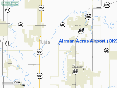
Location & QuickFacts
| FAA Information Effective: | 2008-09-25 |
| Airport Identifier: | OK93 |
| Airport Status: | Operational |
| Longitude/Latitude: | 095-53-00.9650W/36-20-00.3360N
-95.883601/36.333427 (Estimated) |
| Elevation: | 695 ft / 211.84 m (Estimated) |
| Land: | 35 acres |
| From nearest city: | 3 nautical miles SW of Collinsville, OK |
| Location: | Tulsa County, OK |
| Magnetic Variation: | 06E (1985) |
Owner & Manager
| Ownership: | Privately owned |
| Owner: | Airman Acres Inc |
| Address: | 12407 N 73 E Ave
Collinsville, OK 74021 |
| Phone number: | 918-371-4498 |
| Manager: | Donald R. Siemens
IF DONALD SIEMENS IS UNAVAILABLE CALL AUBREY POLLOCK: 12300 N 73 EAST AVE, 918-371-4498 |
| Address: | 12407 N 73 E. Ave.
Collinsville, OK 74021 |
| Phone number: | 918-371-2014 |
Airport Operations and Facilities
| Airport Use: | Private |
| Wind indicator: | Yes |
| Segmented Circle: | No |
| Control Tower: | No |
| Lighting Schedule: | DUSK-DAWN |
| Landing fee charge: | No |
| Sectional chart: | Kansas City |
| Region: | ASW - Southwest |
| Boundary ARTCC: | ZKC - Kansas City |
| Tie-in FSS: | MLC - Mc Alester |
| FSS on Airport: | No |
| FSS Toll Free: | 1-800-WX-BRIEF |
Airport Services
| Airframe Repair: | MAJOR |
| Power Plant Repair: | MAJOR |
Runway Information
Runway N/S
| Dimension: | 2650 x 230 ft / 807.7 x 70.1 m |
| Surface: | TURF, |
| Edge Lights: | Low
RWY LGTS ON WEST SIDE OF N/S RWY ONLY. |
| |
Runway N |
Runway S |
| Traffic Pattern: | Left | Left |
|
Radio Navigation Aids
| ID |
Type |
Name |
Ch |
Freq |
Var |
Dist |
| DW | NDB | Owaso | | 375.00 | 06E | 1.6 nm |
| OWP | NDB | William Pogue | | 362.00 | 06E | 16.3 nm |
| TZO | NDB | Bristow | | 251.00 | 05E | 42.9 nm |
| CFV | NDB | Coffeyville | | 212.00 | 05E | 48.1 nm |
| TQH | NDB | Tahlequah | | 215.00 | 05E | 49.1 nm |
| MEE | VOR | Davis | | 108.60 | 06E | 47.5 nm |
| GNP | VOR/DME | Glenpool | 043X | 110.60 | 06E | 25.1 nm |
| BVO | VOR/DME | Bartlesville | 126X | 117.90 | 08E | 30.8 nm |
| OKM | VOR/DME | Okmulgee | 096X | 114.90 | 08E | 38.5 nm |
| TUL | VORTAC | Tulsa | 091X | 114.40 | 08E | 9.5 nm |
| TUL | VOT | Tulsa Intl | | 109.00 | | 9.5 nm |
Remarks
- HOMES ON BOTH SIDES OF RWY.
- EXISTED PRIOR TO OCT 1959.
Images and information placed above are from
http://www.airport-data.com/airport/OK93/
We thank them for the data!
| General Info
|
| Country |
United States
|
| State |
OKLAHOMA
|
| FAA ID |
OK93
|
| Latitude |
36-20-00.336N
|
| Longitude |
095-53-00.965W
|
| Elevation |
695 feet
|
| Near City |
COLLINSVILLE
|
We don't guarantee the information is fresh and accurate. The data may
be wrong or outdated.
For more up-to-date information please refer to other sources.
|
|


