 |
|
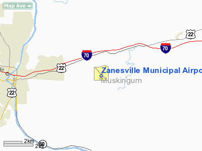
| Zanesville Municipal Airport |
| IATA: ZZV – ICAO: KZZV |
| Summary |
| Airport type |
Public |
| Location |
Zanesville, Ohio |
| Elevation AMSL |
900 ft / 274 m |
| Coordinates |
39°56′40″N 81°53′32″W / 39.94444°N 81.89222°W / 39.94444; -81.89222Coordinates: 39°56′40″N 81°53′32″W / 39.94444°N 81.89222°W / 39.94444; -81.89222 |
| Runways |
| Direction |
Length |
Surface |
| ft |
m |
| 4/22 |
5,000 |
1,524 |
Concrete/Asphalt |
| 16/34 |
4,999 |
1,524 |
Concrete/Asphalt |
Zanesville Municipal Airport (IATA: ZZV, ICAO: KZZV) is an airport near Zanesville, Ohio.
The above content comes from Wikipedia and is published under free licenses – click here to read more.
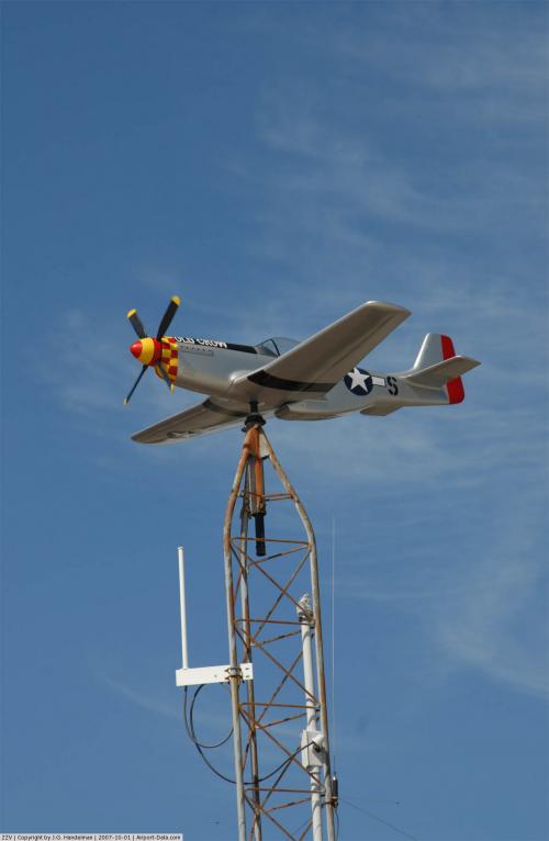 |
(Click on the photo to enlarge) |
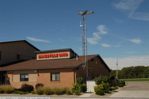 |
(Click on the photo to enlarge) |
Location & QuickFacts
| FAA Information Effective: | 2008-09-25 |
| Airport Identifier: | ZZV |
| Airport Status: | Operational |
| Longitude/Latitude: | 081-53-31.5385W/39-56-40.0099N
-81.892094/39.944447 (Estimated) |
| Elevation: | 900 ft / 274.32 m (Surveyed) |
| Land: | 534 acres |
| From nearest city: | 5 nautical miles E of Zanesville, OH |
| Location: | Muskingum County, OH |
| Magnetic Variation: | 06W (1990) |
Owner & Manager
| Ownership: | Publicly owned |
| Owner: | City Of Zanesville |
| Address: | 401 Market Street
Zanesville, OH 43701 |
| Phone number: | 740-455-0663 |
| Manager: | James Witte |
| Address: | 850 Airport Road
Zanesville, OH 43701-0663 |
| Phone number: | 740-452-3625 |
Airport Operations and Facilities
| Airport Use: | Open to public |
| Wind indicator: | Yes |
| Segmented Circle: | No |
| Control Tower: | No |
| Lighting Schedule: | DUSK-DAWN
HIRL RY 04/22, MIRL RY 16/34, REIL RYS 04, 22, 16 & 34 NSTD PCL, ACTVT- CTAF, 5 CLICKS ON, SEVEN CLICKS OFF.. |
| Beacon Color: | Clear-Green (lighted land airport)
ROTG BCN OTS INDEFLY. |
| Landing fee charge: | No |
| Sectional chart: | Cincinnati |
| Region: | AGL - Great Lakes |
| Traffic Pattern Alt: | 1000 ft |
| Boundary ARTCC: | ZID - Indianapolis |
| Tie-in FSS: | CLE - Cleveland |
| FSS on Airport: | No |
| FSS Toll Free: | 1-800-WX-BRIEF |
| NOTAMs Facility: | ZZV (NOTAM-d service avaliable) |
| Federal Agreements: | NGY3 |
Airport Communications
| CTAF: | 123.000 |
| Unicom: | 123.000 |
Airport Services
| Fuel available: | 100LL80 A1+ |
| Airframe Repair: | MAJOR |
| Power Plant Repair: | MAJOR |
| Bulk Oxygen: | LOW |
Runway Information
Runway 04/22
| Dimension: | 5000 x 150 ft / 1524.0 x 45.7 m |
| Surface: | ASPH-CONC, Fair Condition
& RY 16/34 ARE CONCRETE WITH ASPHALT OVERLAY.
75 FT NEW OVERLAY IN CENTER SIDES ARE POOR. |
| Weight Limit: | Single wheel: 38000 lbs.
Dual wheel: 50000 lbs.
Dual tandem wheel: 75000 lbs. |
| Edge Lights: | High |
| |
Runway 04 |
Runway 22 |
| Longitude: | 081-53-45.0705W | 081-53-09.3216W |
| Latitude: | 39-56-20.5829N | 39-57-01.6260N |
| Elevation: | 896.00 ft | 869.00 ft |
| Alignment: | 34 | 127 |
| ILS Type: | | ILS/DME
|
| Traffic Pattern: | Left | Left |
| Markings: | Non-precision instrument, Fair Condition | Non-precision instrument, Fair Condition |
| Crossing Height: | 35.00 ft | 0.00 ft |
| VASI: | 4-light PAPI on right side | 4-light PAPI on left side |
| Visual Glide Angle: | 3.00° | 0.00° |
| Runway End Identifier: | Yes | Yes |
| Centerline Lights: | No | No |
| Touchdown Lights: | No | No |
| Obstruction: | 65 ft trees, 434.0 ft from runway, 280 ft right of centerline, 3:1 slope to clear | , 50:1 slope to clear |
|
Runway 16/34
| Dimension: | 4999 x 150 ft / 1523.7 x 45.7 m |
| Surface: | ASPH-CONC, Good Condition
& RY 16/34 ARE CONCRETE WITH ASPHALT OVERLAY.
75 FT NEW OVERLAY IN CENTER SIDES ARE POOR. |
| Weight Limit: | Single wheel: 38000 lbs.
Dual wheel: 50000 lbs.
Dual tandem wheel: 75000 lbs. |
| Edge Lights: | Medium |
| |
Runway 16 |
Runway 34 |
| Longitude: | 081-53-50.7064W | 081-53-21.0573W |
| Latitude: | 39-57-00.8220N | 39-56-17.0071N |
| Elevation: | 867.00 ft | 895.00 ft |
| Alignment: | 127 | 127 |
| Traffic Pattern: | Left | Left |
| Markings: | Basic, Good Condition | Basic, Good Condition |
| VASI: | | 4-light PAPI on left side |
| Runway End Identifier: | Yes | Yes |
| Centerline Lights: | No | No |
| Touchdown Lights: | No | No |
| Obstruction: | 56 ft trees, 1430.0 ft from runway, 70 ft right of centerline, 22:1 slope to clear | 44 ft trees, 1419.0 ft from runway, 78 ft left of centerline, 27:1 slope to clear |
|
Radio Navigation Aids
| ID |
Type |
Name |
Ch |
Freq |
Var |
Dist |
| PKB | FAN MARKER | Marietta Ohio | | | 03W | 40.2 nm |
| HRA | NDB | Zanesville | | 204.00 | 06W | 2.6 nm |
| HEH | NDB | Newark | | 524.00 | 06W | 26.8 nm |
| MLR | NDB | Millersburg/dcmsnd | | 382.00 | 06W | 35.9 nm |
| CM | NDB | Sumie | | 391.00 | 05W | 39.8 nm |
| UGS | NDB | University | | 250.00 | 06W | 42.7 nm |
| CFX | NDB | Cadiz | | 239.00 | 07W | 44.1 nm |
| LCK | TACAN | Rickenbacker | 069X | | 05W | 48.5 nm |
| ZZV | VOR/DME | Zanesville | 051X | 111.40 | 06W | 0.2 nm |
| CTW | VOR/DME | Newcomerstown | 055X | 111.80 | 07W | 25.7 nm |
| TVT | VOR/DME | Tiverton | 112X | 116.50 | 03W | 32.7 nm |
| AIR | VOR/DME | Bellaire | 118X | 117.10 | 07W | 49.7 nm |
| APE | VORTAC | Appleton | 114X | 116.70 | 06W | 34.4 nm |
| JPU | VORTAC | Parkersburg | 023X | 108.60 | 03W | 38.6 nm |
| CMH | VOT | Port Columbus | | 111.00 | | 45.9 nm |
Remarks
- DEER & BIRD ON & INVOF ARPT.
- ACFT NOT VISIBLE FM END TO END.
- TWWY A LGTS OTS INDEFLY.
Images and information placed above are from
http://www.airport-data.com/airport/ZZV/
We thank them for the data!
| General Info
|
| Country |
United States
|
| State |
OHIO
|
| FAA ID |
ZZV
|
| Latitude |
39-56-40.050N
|
| Longitude |
081-53-31.579W
|
| Elevation |
900 feet
|
| Near City |
ZANESVILLE
|
We don't guarantee the information is fresh and accurate. The data may
be wrong or outdated.
For more up-to-date information please refer to other sources.
|
|


