 |
|
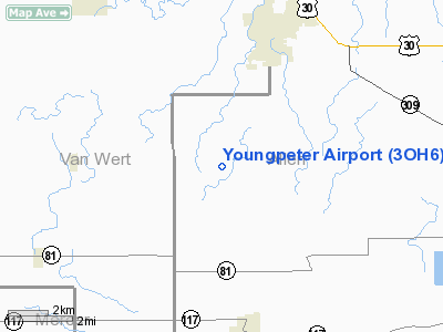
Location & QuickFacts
| FAA Information Effective: | 2008-09-25 |
| Airport Identifier: | 3OH6 |
| Airport Status: | Operational |
| Longitude/Latitude: | 084-22-04.0000W/40-47-00.0000N
-84.367778/40.783333 (Estimated) |
| Elevation: | 815 ft / 248.41 m (Estimated) |
| Land: | 4 acres |
| From nearest city: | 5 nautical miles NE of Delphos, OH |
| Location: | Allen County, OH |
| Magnetic Variation: | 04W (1990) |
Owner & Manager
| Ownership: | Privately owned |
| Owner: | David L Youngpeter |
| Address: | 13820 Bloomlock Rd
Spencerville, OH 45887 |
| Phone number: | 419-695-7509 |
| Address: |
|
Airport Operations and Facilities
| Airport Use: | Private |
| Wind indicator: | Yes |
| Segmented Circle: | No |
| Control Tower: | No |
| Sectional chart: | Detroit |
| Region: | AGL - Great Lakes |
| Boundary ARTCC: | ZID - Indianapolis |
| Tie-in FSS: | DAY - Dayton |
| FSS Toll Free: | 1-800-WX-BRIEF |
Runway Information
Runway 18/36
| Dimension: | 2460 x 60 ft / 749.8 x 18.3 m |
| Surface: | TURF, |
| |
Runway 18 |
Runway 36 |
| Traffic Pattern: | Left | Left |
| Obstruction: | | 20 ft pline, 0.0 ft from runway |
|
Radio Navigation Aids
| ID |
Type |
Name |
Ch |
Freq |
Var |
Dist |
| VFU | NDB | Stanley | | 411.00 | 05W | 12.2 nm |
| LYL | NDB | Lima | | 362.00 | 04W | 16.4 nm |
| CQA | NDB | Lakefield | | 205.00 | 04W | 20.2 nm |
| PDR | NDB | Ottawa | | 233.00 | 05W | 23.2 nm |
| DFI | NDB | Defiance | | 246.00 | 05W | 33.2 nm |
| PLD | NDB | Portland | | 257.00 | 03W | 34.4 nm |
| BNR | NDB | Benton Ridge | | 334.00 | 05W | 34.8 nm |
| VES | NDB | Versailles | | 356.00 | 04W | 35.4 nm |
| EDJ | NDB | Bellefontaine | | 242.00 | 05W | 35.4 nm |
| RUV | NDB | Rushsylvania | | 326.00 | 05W | 37.4 nm |
| BYN | NDB | Bryan | | 260.00 | 04W | 42.1 nm |
| AOH | VOR | Allen County | | 108.40 | 04W | 18.8 nm |
| MAH | VOR | Marathon | | 114.90 | 05W | 34.9 nm |
| DQN | VOR/DME | Dayton | 092X | 114.50 | 01W | 46.1 nm |
| FDY | VORTAC | Findlay | 019X | 108.20 | 02W | 29.7 nm |
| ROD | VORTAC | Rosewood | 122X | 117.50 | 05W | 33.3 nm |
| FWA | VORTAC | Fort Wayne | 125X | 117.80 | 00E | 39.1 nm |
| FWA | VOT | Fort Wayne Baer | | 111.00 | | 39.2 nm |
Remarks
- OBS REMOVED/LOWERED OR THR DSPLCD TO PRVD 20:1 SLOPE; CLEAR 125' EITHER SIDE OF CNTRLN & 200' END OF RY.
Images and information placed above are from
http://www.airport-data.com/airport/3OH6/
We thank them for the data!
| General Info
|
| Country |
United States
|
| State |
OHIO
|
| FAA ID |
3OH6
|
| Latitude |
40-47-00.000N
|
| Longitude |
084-22-04.000W
|
| Elevation |
815 feet
|
| Near City |
DELPHOS
|
We don't guarantee the information is fresh and accurate. The data may
be wrong or outdated.
For more up-to-date information please refer to other sources.
|
|


