 |
|
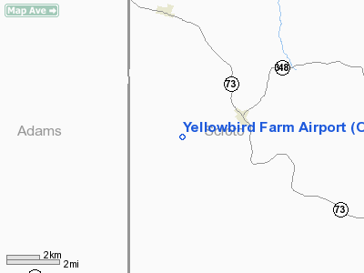
Location & QuickFacts
| FAA Information Effective: | 2008-09-25 |
| Airport Identifier: | OI29 |
| Airport Status: | Operational |
| Longitude/Latitude: | 083-13-49.6590W/38-51-15.2630N
-83.230461/38.854240 (Estimated) |
| Elevation: | 610 ft / 185.93 m (Estimated) |
| Land: | 0 acres |
| From nearest city: | 2 nautical miles SW of Otway, OH |
| Location: | Scioto County, OH |
| Magnetic Variation: | 04W (1985) |
Owner & Manager
| Ownership: | Privately owned |
| Owner: | John E. Vastine |
| Address: | 2570 S R 348
Otway, OH 45657 |
| Phone number: | 614-372-5195 |
| Manager: | John E. Vastine |
| Address: | 2570 S R 348
Otway, OH 45657 |
| Phone number: | 614-372-5195 |
Airport Operations and Facilities
| Airport Use: | Private |
| Wind indicator: | Yes |
| Segmented Circle: | No |
| Control Tower: | No |
| Landing fee charge: | No |
| Sectional chart: | Cincinnati |
| Region: | AGL - Great Lakes |
| Boundary ARTCC: | ZID - Indianapolis |
| Tie-in FSS: | DAY - Dayton |
| FSS on Airport: | No |
| FSS Toll Free: | 1-800-WX-BRIEF |
Runway Information
Runway 12/30
| Dimension: | 1500 x 75 ft / 457.2 x 22.9 m |
| Surface: | TURF, |
| |
Runway 12 |
Runway 30 |
| Traffic Pattern: | Left | Left |
| Obstruction: | 25 ft pline, 600.0 ft from runway | |
|
Radio Navigation Aids
| ID |
Type |
Name |
Ch |
Freq |
Var |
Dist |
| AJY | FAN MARKER | Ashland | | | 03W | 27.1 nm |
| PZO | NDB | Peebles | | 329.00 | 02W | 6.0 nm |
| AMT | NDB | West Union | | 359.00 | 04W | 15.6 nm |
| PMH | NDB | Portsmouth | | 373.00 | 04W | 18.6 nm |
| EOP | NDB | Waverly | | 385.00 | 06W | 23.4 nm |
| HOC | NDB | Hillsboro | | 278.00 | 05W | 24.6 nm |
| XW | NDB | Flmng | | 400.00 | 05W | 25.8 nm |
| RZT | NDB | Ross County | | 236.00 | 05W | 36.3 nm |
| CYO | NDB | Circleville | | 366.00 | 05W | 41.9 nm |
| HW | NDB | Cubla | | 299.00 | 04W | 42.5 nm |
| IL | NDB | Airbo | | 407.00 | 04W | 45.0 nm |
| CSS | NDB | Court House | | 414.00 | 05W | 45.5 nm |
| PWF | NDB | Sportys | | 245.00 | 04W | 47.9 nm |
| XUB | VOR | Yellow Bud | | 112.50 | 05W | 42.1 nm |
| MXQ | VOR/DME | Midwest | 076X | 112.90 | 04W | 43.6 nm |
| YRK | VORTAC | York | 075X | 112.80 | 05W | 17.3 nm |
| ECB | VORTAC | Newcombe | 041X | 110.40 | 02W | 44.5 nm |
Remarks
- DUE TO CLOSE AND SHARPLY RISING TERRAIN TO THE EAST, SOUTH AND NORTH COVERED WITH HIGH TREES; TREES & BARN WITHIN PRIMARY SURFACE. DRIVEWAY CROSSING RUNWAY AND PRIMARY SURFACE.
Images and information placed above are from
http://www.airport-data.com/airport/OI29/
We thank them for the data!
| General Info
|
| Country |
United States
|
| State |
OHIO
|
| FAA ID |
OI29
|
| Latitude |
38-51-15.263N
|
| Longitude |
083-13-49.659W
|
| Elevation |
610 feet
|
| Near City |
OTWAY
|
We don't guarantee the information is fresh and accurate. The data may
be wrong or outdated.
For more up-to-date information please refer to other sources.
|
|


