 |
|
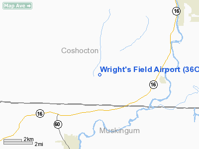
Location & QuickFacts
| FAA Information Effective: | 2008-09-25 |
| Airport Identifier: | 36OH |
| Airport Status: | Operational |
| Longitude/Latitude: | 081-58-26.4860W/40-11-25.2530N
-81.974024/40.190348 (Estimated) |
| Elevation: | 770 ft / 234.70 m (Estimated) |
| Land: | 4 acres |
| From nearest city: | 5 nautical miles W of Conesville, OH |
| Location: | Coshocton County, OH |
| Magnetic Variation: | 06W (1990) |
Owner & Manager
| Ownership: | Privately owned |
| Owner: | Carl Wright |
| Address: | 16139 Cr6
Conesville, OH 43811 |
| Phone number: | 614-829-2409 |
| Manager: | Carl Wright |
| Address: | 16139 Cr6
Conesville, OH 43811 |
| Phone number: | 614-829-2409 |
Airport Operations and Facilities
| Airport Use: | Private |
| Wind indicator: | Yes |
| Segmented Circle: | No |
| Control Tower: | No |
| Sectional chart: | Detroit |
| Region: | AGL - Great Lakes |
| Boundary ARTCC: | ZID - Indianapolis |
| Tie-in FSS: | CLE - Cleveland |
| FSS Toll Free: | 1-800-WX-BRIEF |
Runway Information
Runway 06/24
| Dimension: | 1800 x 80 ft / 548.6 x 24.4 m |
| Surface: | TURF, |
| |
Runway 06 |
Runway 24 |
| Traffic Pattern: | Left | Right |
| Obstruction: | 115 ft pline, 1800.0 ft from runway | 10 ft tank, 30.0 ft from runway |
|
Radio Navigation Aids
| ID |
Type |
Name |
Ch |
Freq |
Var |
Dist |
| HRA | NDB | Zanesville | | 204.00 | 06W | 17.3 nm |
| MLR | NDB | Millersburg/dcmsnd | | 382.00 | 06W | 21.6 nm |
| HEH | NDB | Newark | | 524.00 | 06W | 24.6 nm |
| CM | NDB | Sumie | | 391.00 | 05W | 37.9 nm |
| MF | NDB | Manns | | 372.00 | 06W | 40.8 nm |
| CFX | NDB | Cadiz | | 239.00 | 07W | 44.2 nm |
| TSO | NDB | Tolson | | 395.00 | 07W | 46.8 nm |
| AAU | NDB | Ashland | | 329.00 | 07W | 48.2 nm |
| CHC | NDB | Grens | | 272.00 | 04W | 49.7 nm |
| LCK | TACAN | Rickenbacker | 069X | | 05W | 49.6 nm |
| ZZV | VOR/DME | Zanesville | 051X | 111.40 | 06W | 15.5 nm |
| TVT | VOR/DME | Tiverton | 112X | 116.50 | 03W | 17.5 nm |
| CTW | VOR/DME | Newcomerstown | 055X | 111.80 | 07W | 23.0 nm |
| BSV | VOR/DME | Briggs | 071X | 112.40 | 04W | 41.3 nm |
| APE | VORTAC | Appleton | 114X | 116.70 | 06W | 28.3 nm |
| MFD | VORTAC | Mansfield | 025X | 108.80 | 03W | 49.6 nm |
| CMH | VOT | Port Columbus | | 111.00 | | 43.5 nm |
| CAK | VOT | Akron/canton Regional | | 110.60 | | 49.9 nm |
Remarks
- OBS REMOVED/LOWERED OR THR DSPLCD TO PRVD 20:1 SLOPE CLEAR 125' EITHER SIDE OF CNTRLN & 200' END OF RY. ELIMINATE PEOPLE & VEHICLES FROM PRIVATE LANE.
Images and information placed above are from
http://www.airport-data.com/airport/36OH/
We thank them for the data!
| General Info
|
| Country |
United States
|
| State |
OHIO
|
| FAA ID |
36OH
|
| Latitude |
40-11-25.253N
|
| Longitude |
081-58-26.486W
|
| Elevation |
770 feet
|
| Near City |
CONESVILLE
|
We don't guarantee the information is fresh and accurate. The data may
be wrong or outdated.
For more up-to-date information please refer to other sources.
|
|


