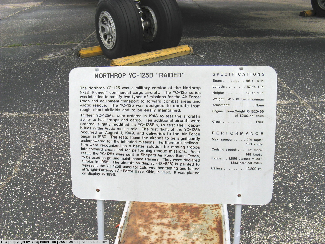
|
 |
|
||||
|
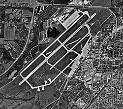
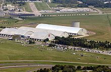
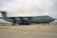
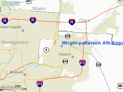
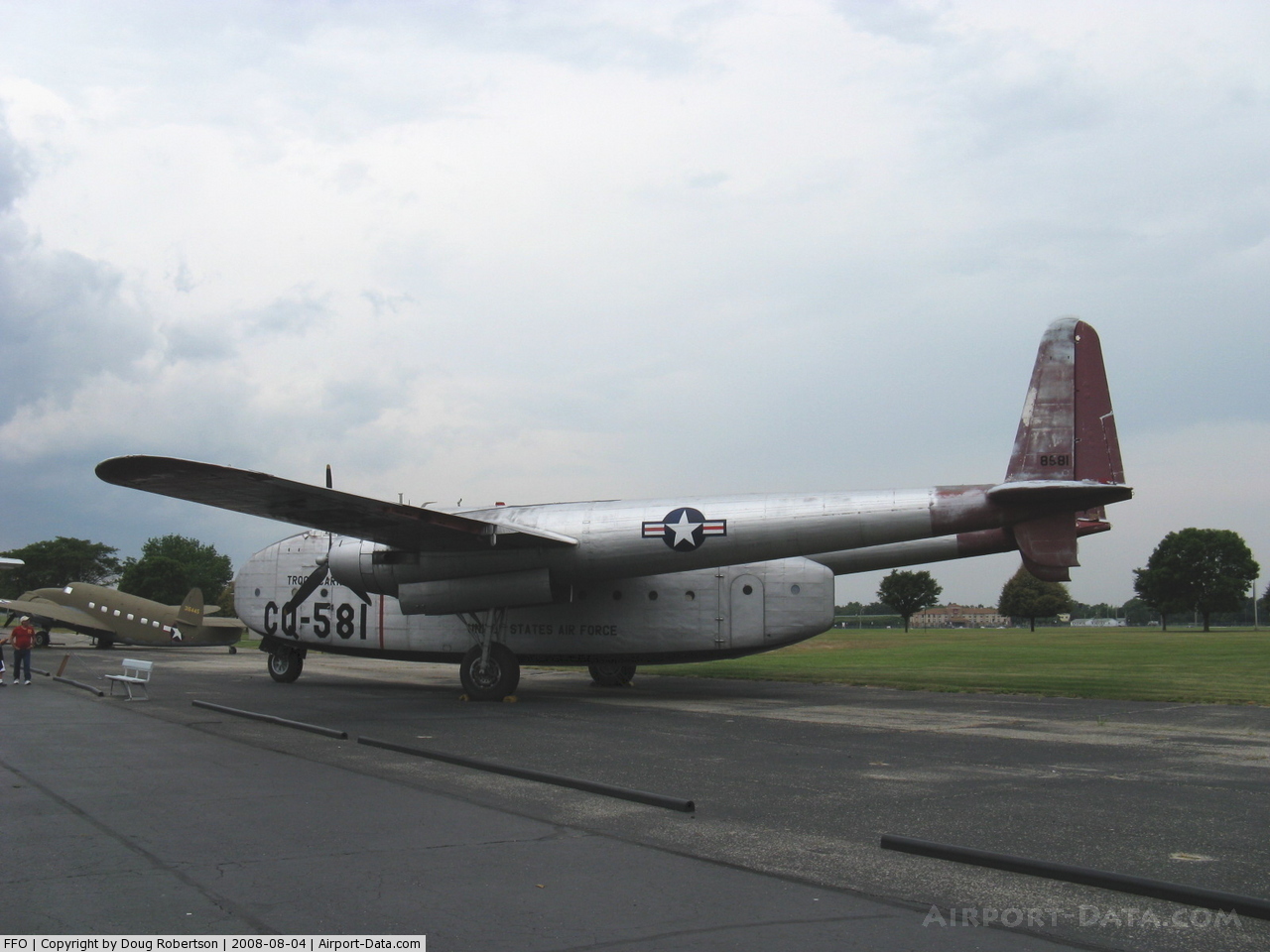
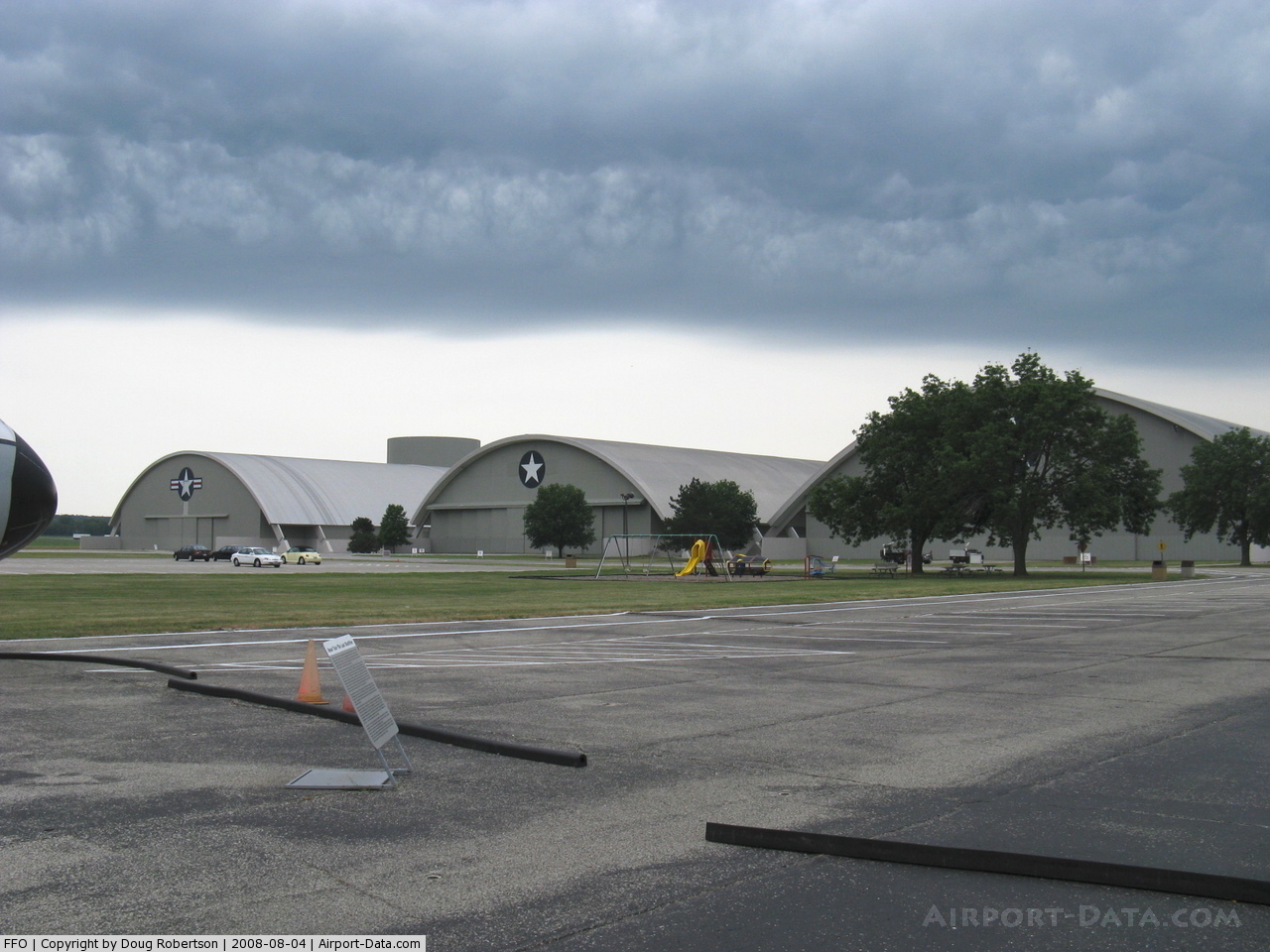
Wright-Patterson Air Force Base (AFB) (IATA: FFO, ICAO: KFFO, FAA LID: FFO) is a United States Air Force base in Greene and Montgomery counties in the U.S. state of Ohio. It includes both Wright and Patterson Fields, which were originally Wilbur Wright Field and Fairfield Aviation General Supply Depot. Patterson Field is located approximately 10 miles (16 km) northeast of Dayton; Wright Field is located approximately 5 miles (8.0 km) northeast of Dayton. The host unit at Wright-Patterson AFB is the 88th Air Base Wing (88 ABW), assigned to the Air Force Materiel Command Aeronautical Systems Center. The 88 ABW operates the airfield, maintains all infrastructure and provides security, communications, medical, legal, personnel, contracting, finance, transportation, air traffic control, weather forecasting, public affairs, recreation and chaplain services for more than 60 associate units. The base's origins begin with the establishment of Wilbur Wright Field on 22 May and McCook Field in November 1917, both established by the Army Air Service as World War I installations. McCook was used as a testing field and for aviation experiments. Wright was used as a flying field (renamed Patterson Field in 1931); Fairfield Aviation General Supply Depot; armorers’ school, and a temporary storage depot. McCook's functions were transferred to Wright Field when it was closed in October 1927. Wright-Patterson AFB was established in 1948 as a merger of Patterson and Wright Fields. The 88th Air Base Wing is commanded by Col. Amanda W. Gladney. Its Command Chief Master Sergeant is Chief Master Sergeant John L. Hoffman, Jr.. The Base had a total of 27,406 military, civilian and contract employees that work for the base in 2010. OverviewWright-Patterson AFB is "one of the largest, most diverse, and organizationally complex bases in the Air Force" with a long history of flight test spanning from the Wright Brothers into the Space Age. It is the headquarters of the Air Force Materiel Command, one of the major commands of the Air Force. "Wright-Patt" (as the base is colloquially called) is also the location of a major USAF Medical Center (hospital), the Air Force Institute of Technology, and the National Museum of the United States Air Force, formerly known as the U.S. Air Force Museum. It is also the home base of the 445th Airlift Wing of the Air Force Reserve Command, an Air Mobility Command-gained unit which flies the C-5 Galaxy heavy airlifter. Wright-Patterson is also the headquarters of the Aeronautical Systems Center and the Air Force Research Laboratory. Wright-Patterson is the host of the annual United States Air Force Marathon which occurs the weekend closest to the Air Force's anniversary. Major units
HistoryThe base is named after the Wright brothers, who used the Huffman Prairie portion of what became Wright-Patterson as their testing ground, and Frank Stuart Patterson, son and nephew of the co-founders of National Cash Register, who was killed on June 19, 1918, in the crash of his Airco DH.4 at Wilbur Wright Field. Wishing to recognize the contributions of the Patterson family (owners of National Cash Register) the area of Wright Field east of Huffman Dam (including Wilbur Wright Field, Fairfield Air Depot, and the Huffman Prairie) was renamed Patterson Field on July 6, 1931, in honor of Lt. Frank Stuart Patterson, who was killed in 1918 during a flight test of a new mechanism for synchronizing machine gun and propeller, when a tie rod broke during a dive from 15,000 feet (4,600 m), causing the wings to separate from the aircraft. In 1948, the nearby Wright Field and Patterson Field were merged under the name Wright-Patterson AFB. The former Wright Field became Area B of the combined installation, and the former Patterson Field became Area C. In 1951, the Air Force created a separate command for research and development called the Air Research and Development Command. The Wright Air Development Center was responsible for principal elements of flight testing, engineering and laboratories. Some of the test pilots working at the base, such as Neil Armstrong and Ed White, went on to become NASA astronauts. Previous names
* The Fairfield depot changed on this date from an installation to a subsidiary organization located at the newly named Patterson Field. Major commands to which assigned
Major units assignedOperational historyOriginsWright-Patterson's history as a military installation dates from World War I. Its aviation history, however, began in 1904-1905 when Wilbur and Orville Wright used an 84-acre plot of land, known as the Huffman Prairie Flying Field, for their experimental test flights. Here the Wright Brothers solved the final secrets of aerodynamics, learned to fly, and developed the first truly practical airplane-their 1905 Flyer. They returned to the Huffman Prairie Flying Field in 1910 to operate a pilot training school-The Wright Company School of Aviation- and a flight exhibition company. When their operations ended in 1916, aviation had become a reality and a rich tradition of invention, operations, and education had been established on this sacred soil. The Huffman Prairie Flying Field was officially designated a National Historic Landmark in 1990 and became part of the newly created Dayton Aviation Heritage National Historical Park two years later. World War IWhen the United States entered World War I in 1917, three military installations were established in the Dayton area. Two of these would become part of Wright-Patterson Air Force Base. The third was located near downtown Dayton. Their original missions-logistics, research and development, and military education-are the same missions that have been performed at Wright-Patterson to this day. Wilbur Wright Field and the Fairfield Aviation General Supply Depot were adjacent installations located at what is today Area C of the base. Wilbur Wright Field was situated on a 2,075-acre tract of land adjacent to the Mad River that was leased to the Army by the Miami Conservancy District. The lease included the Huffman Prairie Flying Field. A Signal Corps Aviation School was established at the new airfield and began operations in June 1917 as a training school for pilots. The field also housed an aviation mechanic's school and a school for armorers. The Fairfield Aviation General Supply Depot was constructed on forty acres of land purchased by the Army from the Miami Conservancy District. The land bordered Wilbur Wright Field. The depot provided logistics support to Wilbur Wright Field and three other Signal Corps aviation schools located in the Midwest. Each day the depot received, stored, and issued equipment and supplies to Signal Corps aviation schools in the region. The third World War I military installation was McCook Field. This 254-acre complex located just north of downtown Dayton between Keowee Street and the Great Miami River. It was named for the Fighting McCook family of Civil War fame who once owned part of the land. McCook Field was the temporary home of the U.S. Army Signal Corps' Airplane Engineering Division. As an engineering and research facility, McCook Field has been described as "the single most influential agency in the early years of American air power." McCook's engineers and technicians researched, developed, manufactured, tested, and evaluated military aircraft and all of their associated components and equipment. Cooperation between the two geographically separated flying fields began in 1918 when Wilbur Wright Field agreed to let McCook Field use hangar and shop space as well as its enlisted mechanics to assemble and maintain airplanes and engines. Wilbur Wright Field's expansive and relatively isolated open flying field also proved ideal for testing the Air Service's experimental aircraft and the larger, more powerful models developed during the 1920s. Between the warsFollowing World War I, the training school at Wilbur Wright Field was discontinued. Wilbur Wright Field and the depot soon merged to form the Fairfield Air Depot. The depot remained active until 1946. McCook Field remained in operation until 1927. The field's limited size could not accommodate the larger, more sophisticated aircraft that quickly emerged after World War I. The warning-"This Field is Small, Use It All!"-was painted atop the airfield's hangars. When the Air Corps announced its intention to close McCook Field, local businessmen and citizens protested. The field offered a stable and expanding economic base for the community, and was also a great source of pride to the city that considered itself the birthplace of aviation. Under the leadership of the Patterson family (who had founded The National Cash Register Company), prominent citizens formed the Dayton Air Service Committee, Inc. This organization mounted a massive public campaign that raised $425,000 in two days. It used the money to purchase 4,520.47 acres of land northeast of Dayton, including Wilbur Wright Field and the Huffman Prairie Flying Field. In 1924, the Committee presented the deeds to President Calvin Coolidge for the construction of a new aviation engineering center. The entire acreage (including the Fairfield Air Depot) was designated Wright Field in honor of both Wright brothers. Between 1925 and 1927, modern new facilities were built on the portion of Wright Field west of Huffman Dam to house all of the functions being relocated from old McCook Field. Orville Wright raised the flag over the new engineering center at the official dedication ceremony on October 12, 1927. The name "Wright Field" soon became synonymous with developments in the field of aeronautical engineering, a reputation that Wright-Patterson retains to the present day. This new portion of Wright Field became the headquarters of the Materiel Division, the main branch of the Army Air Corps responsible for developing advanced aircraft, equipment, and accessories. The Division also procured and provided maintenance for all of these systems and was charged with managing the extensive Air Corps depot system. Wright Field incorporated the entire installation. Many citizens in the local community, however, believed that part of the field should honor the Patterson family in some way as recognition for their leadership in keeping the engineering center in Dayton. This happened on July 1, 1931, when the portion of Wright Field east of Huffman Dam was redesignated "Patterson Field" in honor of Lieutenant Frank Stuart Patterson. Patterson Field consisted of the land known today as Areas A and C of Wright-Patterson Air Force Base. It included the Fairfield Air Depot and the Huffman Prairie Flying Field. Patterson Field soon became the Army's center for aviation logistics, maintenance, and supply. Although Wright Field and Patterson Field were now two separate installations, their missions continued to be closely intertwined. World War IIBoth fields experienced dramatic expansion during World War II, in terms of real estate as well as structures. Employment at the fields jumped from approximately 3,700 in December 1939 to over 50,000 at the war's peak.. Wright Field grew from a modest installation with approximately 30 buildings to a 2,064-acre facility with some 300 buildings and the Air Corps' first modern paved runways. The original part of the field became saturated with office and laboratory buildings and test facilities. The Hilltop area was acquired from private landowners in 1943-1944 to provide housing and services for the thousands of troops assigned to Wright Field. The outbreak of World War II provided a crucial test for the Materiel Division. Since 1926 the Division had managed its experimental, engineering, and procurement functions with limited peacetime appropriations. Changes were required within the Division to accommodate the massive wartime Air Corps expansion program. The functions of the Division were ultimately broken into two separate commands, the Materiel Command and the Air Service Command. The Materiel Command, headquartered at Wright Field, was responsible for the procurement of airplanes and equipment in production quantities and for sustaining an accelerated program of testing and development. The Air Service Command, located on Patterson Field, assumed responsibility for all logistics functions, including maintenance and supply. The separation of these functions soon proved cumbersome and confusing. The Army Air Forces addressed this problem in August 1944 when it inactivated the two commands and reunited their functions in the newly established Air Technical Service Command. This action made Wright Field subordinate to the new headquarters at Patterson Field and had a psychologically divisive effect on the installation. To solve the problem, the portion of Patterson Field from Huffman Dam through the Brick Quarters (including the command headquarters in Building 10262) was reassigned from Patterson Field to Wright Field. To avoid confusing the two areas of Wright Field, the former Patterson Field portion was designated "Area A" of Wright Field and the original Wright Field became "Area B". Patterson Field likewise saw the growth of hundreds of barracks and their supporting mess halls, chapels, hospital facilities, clubs, and recreational facilities. Two densely populated housing and service areas across Highway 444, Wood City and Skyway Park, were geographically separated from the central core of Patterson Field and developed almost self-sufficient community status. (Wood City was acquired in 1924 as part of the original donation of land to the government but was used primarily as just a radio range until World War II. Skyway Park was acquired in 1943.) They supported the vast numbers of recruits who enlisted and were trained at the two fields as well as thousands of civilian laborers, especially single women recruited to work at the depot. Skyway Park was demolished after the war. Wood City was eventually transformed into Kittyhawk Center, the base's modern commercial and recreation center. Technical IntelligenceTechnical intelligence had been a part of the mission of McCook Field beginning in 1918. Following the end of World War I, the armistice with Germany brought 347 aircraft to the United States for technical study and as war relics. Some of these aircraft eventually were incorporated into Army Aeronautical Museum (The forerunner of the National Museum of the Air Force), with its establishment in 1931. With the onset of World War II in 1940, the AAC established the Technical Data Branch in February 1940. This became the Technical Data Section in a July 1941 reorganization. In 1942, the TDS became the Technical Data Laboratory (TDL). As front line troops captured German, Japanese and Italian equipment, they sent the materiel back to Wright Field for assessment. The first German and Japanese aircraft arrived in 1943, and captured equipment soon filled six buildings, a large outdoor storage area, and part of a flight-line hangar. To allow its engineers to study this equipment, TDL closed its Army Aeronautical Museum. In the fall of 1942, the first twelve "Air Force" officers to receive ATI field collection training were assigned to Wright Field for training in the technical aspects of "crash" intelligence. This course utilized laboratory directors and Squadron Leader Colley, from the British Royal Air Force, who identified the types of information that could be obtained from equipment marking plates, such as temperature or pressure ranges. The students also learned to gather air order of battle information from squadron markings. One officer who attended this training, William D. McGarey, went to the Air Ministry in London and worked on German ball bearing markings. This lead to the intensive bombing efforts against ball bearing plants in 1943. Major McGarey later served in the Southwest Pacific. During his tour, he personally inspected and removed the nameplates from some 1,000 Japanese aircraft. These plates provided one of the best sources of target data for manufacturing plants on the home islands of Japan. The most famous World War II (and immediate post-war period) technical intelligence missions in Europe were Operation Lusty and Operation Paperclip. Operation Lusty gathered German aircraft from the battlefield and sent them back to Wright Field for study. The best known of these aircraft was the Messerschmitt 262 jet fighter. Operation Paperclip brought over 200 German scientists and technicians to Wright Field for collaboration with their American counterparts. Initially assigned to the intelligence branch, most of the scientists eventually went to work in the various Wright Field labs. Project Blue BookThrough the end of the decade of the 1940s, intelligence efforts turned increasingly toward the emerging technological threat posed by the Russians. T-2 also opened an office in July 1947 for the study of unidentified flying objects (UFO), popularly known as "flying saucers." Initially called Project Sign (and redesignated Project Grudge in 1949), the UFO program brought T-2's successors their greatest public visibility. Wright-Patterson AFB is known among those involved with UFO conspiracy theories as the home of Project Blue Book and because of its connection with the Roswell UFO incident of July 1947. Some believe that Hangar 18, assigned to the Air Force's Foreign Technology Division at Wright-Patterson, along with the Area 51 installation in Nevada, contains, or once contained, wreckage of a crashed UFO. In March 1952, ATIC established an Aerial Phenomena Group to study the reported sightings, and a new name was assigned to the program—Project Blue Book. Probably the most highly publicized events during the ATIC years was a series of sightings in Washington, DC, in 1952. From 1947 through 1969, FTD and its predecessor organizations studied 12,618 reported sightings. Of these, 701 remained unexplained when Project Blue Book closed when, as a result of the build up in Vietnam, the Air Force closed its UFO investigations. A 1968 report concluded that "there seems to be no reason to attribute [the unexplained sightings] to an extraterrestrial source without much more convincing evidence." When the program ended, FTD sent all of its case files to the USAF Historical Research Center, Maxwell AFB, Alabama. In 1976 the National Archives and Records Service in Washington, DC, became the permanent repository of the Project Sign/Grudge/Blue Book records. The April 25, 1988 issue of The New Yorker carried an interview where Senator Barry Goldwater, who had a deep interest in UFOs, said he repeatedly asked his friend, Gen. Curtis LeMay, if there was any truth to the rumors that UFO evidence was stored in a secret room at Wright-Patterson Air Force Base. He also asked if he (Goldwater) might have access to the room. According to Goldwater, an angry LeMay gave him "holy hell" and said, "Not only can't you get into it but don't you ever mention it to me again." Foreign Technology DivisionOn 21 May 1951, the United States Air Force established the Air Technical Intelligence Center (ATIC) as a field activity of the Assistant Chief of Staff for Intelligence. After ten years, on 1 July 1961, ATIC was inactivated and the Foreign Technology Division (FTD) established. The 1950s, then, provided the backdrop against which ATIC performed its mission. Early in 1951, ATIC analysts obtained engine parts and the tail section of a crashed MiG-15 from the Korean theater. Later, in July, the center received a complete, though crashed, MiG-15. The center had also obtained IL-10 and Yak-9 aircraft in operational condition. In September 1953, shortly following the conclusion of the war, a North Korean defector delivered a MiG-15 to Kimpo Air Base near Seoul. A team of ATIC analysts monitored the MiG-15 flight test program at Kadena Air Force Base, Okinawa, which included flights by one Major Charles E. "Chuck" Yeager from the Air Force Flight Test Center at Edwards AFB. Because of the large amount of materiel (and documents) gathered during the war, ATIC awarded a contract to Battelle Memorial Institute of Columbus, Ohio, for analytical work and document translation. This was the start of a relationship that has lasted over 40 years. The evaluation of these captured aircraft support allowed FEAF to more effectively develop engagement tactics for its F-86 fighters. For the next 30 years FTD personnel became known throughout the Air Force and the intelligence community as the experts in Soviet aircraft, missile, and related equipment performance. In 1961, with the formation of the Defense Intelligence Agency and reorganization within the Air Force, ATIC was reassigned to Air Force Systems Command at Andrews AFB, Maryland and redesignated the Foreign Technology Division (FTD). The "official" history of HQ NAIC starts with the formation of FTD in 1961. From 1961 to 1991, the Foreign Technology Division was the Air Force's S&TI center of excellence for foreign air and space system Cold War and current eraPatterson Field and Wright Field remained separate installations throughout World War II. As the war drew to a close, base leaders quickly recognized the need to make the most efficient use of their facilities. In 1945 they integrated the master plans for both fields and increasingly administrated the functions and services of the two fields as a single installation. This practice was formalized in December 1945 with the establishment of the Army Air Forces Technical Base, Dayton, Ohio, which provided base operational support to the combined bases. On January 13, 1948, the newly created U.S. Air Force officially merged Wright and Patterson Fields to create Wright-Patterson Air Force Base. To facilitate daily management, Patterson Field became "Area C" and Skyway Park became "Area D" of the installation. Area D was donated to the State of Ohio in 1963 for the creation of Wright State University. Today Wright-Patterson Air Force Base is arguably the most important base in the Air Force. From its beginnings as the Wright brothers' testing field, it has evolved into the headquarters for the Air Force's worldwide logistics system and all Air Force systems development and procurement, the aeronautical engineering center, a major research laboratory complex, the heart of Air Force graduate education, location of the second largest Air Force medical center, and home of the National Museum of the U.S. Air Force. Wright-Patterson's age and history coupled with its vital air power missions, and significant functional architecture make it one of the Air Force's most historic bases. Dayton AgreementThe base is also notable for being the site of the Dayton Agreement, also known as the Dayton Accords, the peace agreement that put an end to the three and a half years of Bosnian war, one of the armed conflicts in the former Socialist Federative Republic of Yugoslavia. GeographyAccording to the United States Census Bureau, the U.S. Air Force base has a total area of 30.5 km² (11.8 sq mi). 30.3 km² (11.7 sq mi) of it is land and 0.2 km² (0.1 sq mi) of it (0.76%) is water. The entire base was a census-designated place at the 2000 census, although statistical data have since included the portion in totals for Montgomery County for the city of Riverside. As of the 2000 census, the base had a resident population of 6,656. The permanent party work force at WPAFB as of September 30, 2005, numbered 5,517 military and 8,102 civilian. DemographicsAs of the census of 2000, there were 6,656 people, 1,754 households, and 1,704 families residing on the base. The population density was 219.8/km² (569.2/sq mi). There are 2,096 housing units at an average density of 69.2/km² (179.2/sq mi). The racial makeup of the base was 76.11% White, 15.25% Black or African American, 0.45% Native American, 2.30% Asian, 0.12% Pacific Islander, 2.09% from other races, and 3.68% from two or more races. Hispanic or Latino of any race were 4.45% of the population. There were 1,754 households out of which 78.1% had children under the age of 18 living with them, 89.0% were married couples living together, 6.1% had a female householder with no husband present, and 2.8% were non-families. 2.6% of all households were made up of individuals and none had someone living alone who was 65 years of age or older. The average household size was 3.60 and the average family size was 3.64. On the base the population was spread out with 42.5% under the age of 18, 11.6% from 18 to 24, 41.5% from 25 to 44, 4.2% from 45 to 64, and 0.2% who were 65 years of age or older. The median age was 23 years. For every 100 females there were 105.2 males. For every 100 females age 18 and over, there were 104.1 males. The median income for a household on the base was $43,342, and the median income for a family was $43,092. Males had a median income of $30,888 versus $21,044 for females. The per capita income for the base was $15,341. About 1.6% of families and 1.8% of the population were below the poverty line, including 2.4% of those under age 18 and none of those age 65 or over. As of September 30, 2005, Wright-Patterson had base housing amounting to 2,012 single-family units, 300 units for unaccompanied enlisted personnel, and 455 visitor or temporary living units. The above content comes from Wikipedia and is published under free licenses – click here to read more.
Location & QuickFacts
Owner & Manager
Airport Operations and Facilities
Airport Services
Runway InformationRunway 05L/23R
Runway 05R/23L
Radio Navigation Aids
Remarks
Images and information placed above are from We thank them for the data!
We don't guarantee the information is fresh and accurate. The data may
be wrong or outdated.
|
|||||||||||||||||||||||||||||||||||||||||||||||||||||||||||||||||||||||||||||||||||||||||||||||||||||||||||||||||||||||||||||||||||||||||||||||||||||||||||||||||||||||||||||||||||||||||||||||||||||||||||||||||||||||||||||||||||||||||||||||||||||||||||||||||||||||||||||||||||||||||||||||||||||||||||||||||||||||||||||||||||||||||||||||||||||||||||||||||||||||||||||||||||||||||||||||||||||||||||||||||||||||||||||||||||||||||||||||||||||||||||||||||||||||||||||||||||||||||||||||||||||||||||||||||||||||||||||||||||||||||||||||||||||||||||||||||

 |
|
Copyright 2004-2026 © by Airports-Worldwide.com, Vyshenskoho st. 36, Lviv 79010, Ukraine Legal Disclaimer |