 |
|
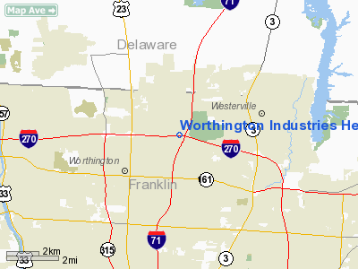
Worthington Industries Heliport |
Location & QuickFacts
| FAA Information Effective: | 2008-09-25 |
| Airport Identifier: | 2OI7 |
| Airport Status: | Operational |
| Longitude/Latitude: | 082-58-53.6580W/40-06-43.2280N
-82.981572/40.112008 (Estimated) |
| Elevation: | 920 ft / 280.42 m (Estimated) |
| Land: | 0 acres |
| From nearest city: | 13 nautical miles N of Columbus, OH |
| Location: | Franklin County, OH |
| Magnetic Variation: | 05W (1985) |
Owner & Manager
| Ownership: | Privately owned |
| Owner: | Worthington Industries |
| Address: | 1205 Dearborn Dr
Worthington, OH 43085 |
| Phone number: | 614-438-3113 |
| Manager: | Bryce Kater |
| Address: | 2170 W Case Rd
Columbus, OH 43235 |
| Phone number: | 614-438-3113 |
Airport Operations and Facilities
| Airport Use: | Private |
| Wind indicator: | Yes |
| Segmented Circle: | No |
| Control Tower: | No |
| Landing fee charge: | No |
| Sectional chart: | Detroit |
| Region: | AGL - Great Lakes |
| Boundary ARTCC: | ZID - Indianapolis |
| Tie-in FSS: | DAY - Dayton |
| FSS on Airport: | No |
| FSS Toll Free: | 1-800-WX-BRIEF |
Runway Information
Helipad H1
| Dimension: | 75 x 75 ft / 22.9 x 22.9 m |
| Surface: | CONC, |
| |
Runway H1 |
Runway |
| Traffic Pattern: | Left | Left |
|
Radio Navigation Aids
| ID |
Type |
Name |
Ch |
Freq |
Var |
Dist |
| DKG | NDB | Don Scott | | 348.00 | 05W | 4.9 nm |
| CHC | NDB | Grens | | 272.00 | 04W | 6.5 nm |
| OS | NDB | Fuler | | 515.00 | 05W | 10.2 nm |
| DLZ | NDB | Delaware | | 215.00 | 06W | 11.4 nm |
| CM | NDB | Sumie | | 391.00 | 05W | 12.9 nm |
| MRT | NDB | Marysville | | 403.00 | 05W | 18.3 nm |
| BU | NDB | Boutn | | 230.00 | 05W | 20.4 nm |
| HEH | NDB | Newark | | 524.00 | 06W | 24.4 nm |
| UYF | NDB | London | | 263.00 | 06W | 24.7 nm |
| MNN | NDB | Marion | | 201.00 | 05W | 30.6 nm |
| CYO | NDB | Circleville | | 366.00 | 05W | 35.4 nm |
| CSS | NDB | Court House | | 414.00 | 05W | 36.1 nm |
| RUV | NDB | Rushsylvania | | 326.00 | 05W | 37.8 nm |
| CCJ | NDB | Clark County | | 341.00 | 04W | 39.4 nm |
| RZT | NDB | Ross County | | 236.00 | 05W | 40.6 nm |
| EDJ | NDB | Bellefontaine | | 242.00 | 05W | 41.2 nm |
| MF | NDB | Manns | | 372.00 | 06W | 46.3 nm |
| XEN | NDB | Xenia | | 395.00 | 03W | 49.8 nm |
| LCK | TACAN | Rickenbacker | 069X | | 05W | 18.4 nm |
| XSF | TACAN | Springfield | 065X | | 04W | 42.9 nm |
| BUD | VOR | Buckeye | | 109.80 | 05W | 30.6 nm |
| XUB | VOR | Yellow Bud | | 112.50 | 05W | 35.2 nm |
| SGH | VOR/DME | Springfield | 079X | 113.20 | 04W | 43.1 nm |
| TVT | VOR/DME | Tiverton | 112X | 116.50 | 03W | 44.4 nm |
| APE | VORTAC | Appleton | 114X | 116.70 | 06W | 18.2 nm |
| MFD | VORTAC | Mansfield | 025X | 108.80 | 03W | 48.9 nm |
| ROD | VORTAC | Rosewood | 122X | 117.50 | 05W | 49.9 nm |
| CMH | VOT | Port Columbus | | 111.00 | | 8.3 nm |
Remarks
- PVDD TKOF/LNDG AREA IS APROPLY MKD; A NON-OBSTG WIND INDCR IS MAINTD ADJ TO TKOF/LNDG AREA.
Images and information placed above are from
http://www.airport-data.com/airport/2OI7/
We thank them for the data!
| General Info
|
| Country |
United States
|
| State |
OHIO
|
| FAA ID |
2OI7
|
| Latitude |
40-06-43.228N
|
| Longitude |
082-58-53.658W
|
| Elevation |
920 feet
|
| Near City |
COLUMBUS
|
We don't guarantee the information is fresh and accurate. The data may
be wrong or outdated.
For more up-to-date information please refer to other sources.
|
|


