 |
|
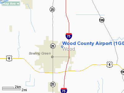
Location & QuickFacts
| FAA Information Effective: | 2008-09-25 |
| Airport Identifier: | 1G0 |
| Airport Status: | Operational |
| Longitude/Latitude: | 083-37-48.5000W/41-23-27.6000N
-83.630139/41.391000 (Estimated) |
| Elevation: | 673 ft / 205.13 m (Surveyed) |
| Land: | 118 acres |
| From nearest city: | 1 nautical miles NE of Bowling Green, OH |
| Location: | Wood County, OH |
| Magnetic Variation: | 05W (1985) |
Owner & Manager
| Ownership: | Publicly owned |
| Owner: | Wood Co. Arpt.auth. |
| Address: | 1255 E Poe Rd
Bowling Green, OH 43402 |
| Phone number: | 419-354-2908 |
| Manager: | Mike Hodges |
| Address: | 1255 E Poe Rd
Bowling Green, OH 43402 |
| Phone number: | 419-354-2908 |
Airport Operations and Facilities
| Airport Use: | Open to public |
| Wind indicator: | Yes |
| Segmented Circle: | Yes |
| Control Tower: | No |
| Lighting Schedule: | DUSK-DAWN
ACTVT MIRL RYS10/28 & 18/36; REIL RYS 10 & 28 & PAPI RY 18 - CTAF. |
| Beacon Color: | Clear-Green (lighted land airport) |
| Landing fee charge: | No |
| Sectional chart: | Detroit |
| Region: | AGL - Great Lakes |
| Traffic Pattern Alt: | 1027 ft |
| Boundary ARTCC: | ZOB - Cleveland |
| Tie-in FSS: | CLE - Cleveland |
| FSS on Airport: | No |
| FSS Toll Free: | 1-800-WX-BRIEF |
| NOTAMs Facility: | CLE (NOTAM-d service avaliable) |
| Federal Agreements: | NGY |
Airport Communications
| CTAF: | 122.800 |
| Unicom: | 122.800 |
Airport Services
| Fuel available: | 100LLA |
| Bottled Oxygen: | NONE |
Runway Information
Runway 10/28
| Dimension: | 4199 x 75 ft / 1279.9 x 22.9 m |
| Surface: | ASPH, Fair Condition |
| Edge Lights: | Medium |
| |
Runway 10 |
Runway 28 |
| Longitude: | 083-38-06.8008W | 083-37-11.7125W |
| Latitude: | 41-23-30.4493N | 41-23-29.8502N |
| Elevation: | 671.00 ft | 671.00 ft |
| Alignment: | 91 | 127 |
| Traffic Pattern: | Left | Right |
| Markings: | Non-precision instrument, Fair Condition | Non-precision instrument, Fair Condition |
| VASI: | 4-light PAPI on left side
OTS INDEFLY. | 4-light PAPI on left side |
| Runway End Identifier: | Yes
OTS INDEFLY. | Yes |
|
Runway 18/36
| Dimension: | 2628 x 50 ft / 801.0 x 15.2 m |
| Surface: | ASPH, Good Condition |
| Edge Lights: | Medium |
| |
Runway 18 |
Runway 36 |
| Longitude: | 083-38-03.4737W | 083-38-03.1340W |
| Latitude: | 41-23-36.3680N | 41-23-10.4088N |
| Elevation: | 671.00 ft | 671.00 ft |
| Alignment: | 127 | 127 |
| Traffic Pattern: | Left | Right |
| Markings: | Non-precision instrument, Good Condition | Non-precision instrument, Good Condition |
| Displaced threshold: | 0.00 ft | 57.00 ft |
| VASI: | 4-light PAPI on left side | |
| Runway End Identifier: | No | No |
| Centerline Lights: | No | No |
| Touchdown Lights: | No | No |
| Obstruction: | , 50:1 slope to clear | 16 ft road, 268.0 ft from runway, 260 ft left of centerline, 4:1 slope to clear
APCH RATIO 21:1 AT DSPLCD THR. |
|
Radio Navigation Aids
| ID |
Type |
Name |
Ch |
Freq |
Var |
Dist |
| FZI | NDB | Fostoria | | 379.00 | 05W | 16.1 nm |
| BNR | NDB | Benton Ridge | | 334.00 | 05W | 22.3 nm |
| TII | NDB | Tiffin | | 269.00 | 05W | 26.0 nm |
| USE | NDB | Fulton | | 375.00 | 05W | 26.2 nm |
| PDR | NDB | Ottawa | | 233.00 | 05W | 26.7 nm |
| ADG | NDB | Adrian | | 278.00 | 06W | 35.1 nm |
| PCW | NDB | Port Clinton | | 423.00 | 06W | 35.1 nm |
| DFI | NDB | Defiance | | 246.00 | 05W | 36.1 nm |
| BYN | NDB | Bryan | | 260.00 | 04W | 38.0 nm |
| TCU | NDB | Tecumseh | | 239.00 | 04W | 40.4 nm |
| LYL | NDB | Lima | | 362.00 | 04W | 44.9 nm |
| RYS | NDB | Grosse Ile | | 419.00 | 06W | 47.7 nm |
| PT | NDB | Pelee Island | | 283.00 | 05W | 49.1 nm |
| TOL | TACAN | Toledo | 072X | | 05W | 14.4 nm |
| MAH | VOR | Marathon | | 114.90 | 05W | 22.7 nm |
| AOH | VOR | Allen County | | 108.40 | 04W | 43.9 nm |
| VWV | VOR/DME | Waterville | 078X | 113.10 | 02W | 3.7 nm |
| SKY | VOR/DME | Sandusky | 029X | 109.20 | 04W | 44.0 nm |
| FDY | VORTAC | Findlay | 019X | 108.20 | 02W | 26.8 nm |
| CRL | VORTAC | Carleton | 104X | 115.70 | 03W | 40.2 nm |
Remarks
- FLOCKS OF GEESE ON & INVOF ARPT DURG FALL & WINTER.
- 160 FT AGL STADIUM LGTS .6 NM SE OF ARPT.
- RY 28 IS THE CALM WIND RY.
Images and information placed above are from
http://www.airport-data.com/airport/1G0/
We thank them for the data!
| General Info
|
| Country |
United States
|
| State |
OHIO
|
| FAA ID |
1G0
|
| Latitude |
41-23-27.600N
|
| Longitude |
083-37-48.500W
|
| Elevation |
673 feet
|
| Near City |
BOWLING GREEN
|
We don't guarantee the information is fresh and accurate. The data may
be wrong or outdated.
For more up-to-date information please refer to other sources.
|
|


