 |
|
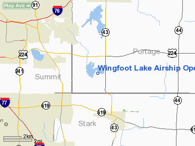
Wingfoot Lake Airship Operations Balloonport Airport |
Location & QuickFacts
| FAA Information Effective: | 2008-09-25 |
| Airport Identifier: | 4OH6 |
| Airport Status: | Operational |
| Longitude/Latitude: | 081-21-28.3920W/41-00-34.2040N
-81.357887/41.009501 (Estimated) |
| Elevation: | 1164 ft / 354.79 m (Estimated) |
| Land: | 95 acres |
| From nearest city: | 6 nautical miles SE of Akron Suffield, OH |
| Location: | Portage County, OH |
| Magnetic Variation: | 08W (1985) |
Owner & Manager
| Ownership: | Privately owned |
| Owner: | Goodyear Tire & Rubber Company |
| Address: | 1144 East Market Street
Akron, OH 44316 |
| Phone number: | 330-796-7972 |
| Manager: | Jim Maloney |
| Address: | 841 Wingfoot Lake Road
Mogadore, OH 44260 |
| Phone number: | 330-796-5272 |
Airport Operations and Facilities
| Airport Use: | Private |
| Wind indicator: | Yes |
| Segmented Circle: | No |
| Control Tower: | No |
| Landing fee charge: | No |
| Sectional chart: | Detroit |
| Region: | AGL - Great Lakes |
| Boundary ARTCC: | ZOB - Cleveland |
| Tie-in FSS: | CLE - Cleveland |
| FSS on Airport: | No |
| FSS Toll Free: | 1-800-WX-BRIEF |
Airport Services
| Airframe Repair: | NONE |
| Power Plant Repair: | NONE |
Runway Information
Balloonport B1
| Dimension: | 1000 x 1000 ft / 304.8 x 304.8 m
1000' CIRCULAR PAD. |
| Surface: | TURF, |
| |
Runway B1 |
Runway |
| Traffic Pattern: | Left | Left |
|
Radio Navigation Aids
| ID |
Type |
Name |
Ch |
Freq |
Var |
Dist |
| AK | NDB | Akron | | 362.00 | 07W | 3.9 nm |
| TSO | NDB | Tolson | | 395.00 | 07W | 29.7 nm |
| EZE | NDB | Engel | | 226.00 | 07W | 33.2 nm |
| CL | NDB | Harri | | 344.00 | 07W | 33.8 nm |
| BKL | NDB | Burke Lakefront | | 416.00 | 07W | 34.1 nm |
| MLR | NDB | Millersburg/dcmsnd | | 382.00 | 06W | 36.6 nm |
| HBD | NDB | Hubbard | | 408.00 | 08W | 38.4 nm |
| LQL | NDB | Lakeland | | 263.00 | 08W | 40.5 nm |
| AAU | NDB | Ashland | | 329.00 | 07W | 40.7 nm |
| UCP | NDB | Castle | | 272.00 | 09W | 42.7 nm |
| CFX | NDB | Cadiz | | 239.00 | 07W | 49.0 nm |
| ACO | VOR/DME | Akron | 091X | 114.40 | 04W | 9.2 nm |
| BSV | VOR/DME | Briggs | 071X | 112.40 | 04W | 16.5 nm |
| CXR | VOR/DME | Chardon | 074X | 112.70 | 05W | 31.7 nm |
| LNN | VOR/DME | Lost Nation | 039X | 110.20 | 08W | 40.6 nm |
| DJB | VOR/DME | Dryer | 083X | 113.60 | 05W | 42.0 nm |
| CTW | VOR/DME | Newcomerstown | 055X | 111.80 | 07W | 47.2 nm |
| TVT | VOR/DME | Tiverton | 112X | 116.50 | 03W | 48.2 nm |
| YNG | VORTAC | Youngstown | 027X | 109.00 | 05W | 36.5 nm |
| CAK | VOT | Akron/canton Regional | | 110.60 | | 6.8 nm |
| CLE | VOT | Cleveland | | 110.40 | | 32.8 nm |
Remarks
- LIMITED AIRSHIP USE ONLY.
- LARGE AIRSHIP HGR 140' X 800' X 100'.
- VFR ONLY
Images and information placed above are from
http://www.airport-data.com/airport/4OH6/
We thank them for the data!
| General Info
|
| Country |
United States
|
| State |
OHIO
|
| FAA ID |
4OH6
|
| Latitude |
41-00-34.204N
|
| Longitude |
081-21-28.392W
|
| Elevation |
1164 feet
|
| Near City |
AKRON SUFFIELD
|
We don't guarantee the information is fresh and accurate. The data may
be wrong or outdated.
For more up-to-date information please refer to other sources.
|
|


